Category:Maps made in the 13th century
Jump to navigation
Jump to search
Subcategories
This category has the following 13 subcategories, out of 13 total.
- 1300 maps (1 F)
*
1
E
- 13th-century maps of Estonia (3 F)
M
- Maps by Matthew Paris (13 F)
P
- Psalter world map London (14 F)
Media in category "Maps made in the 13th century"
The following 7 files are in this category, out of 7 total.
-
 1154 Tabula Rogeriana noroeste Peninsula Iberica Al Idrisi copia mas antigua.jpg 4,800 × 3,231; 6.31 MB
-
 Beatusosma-scan.jpg 1,372 × 1,432; 834 KB
-
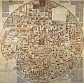 Ebstorfer Weltkarte 2.jpg 7,849 × 7,798; 28.66 MB
-
 Ebstorfer-stich2.jpg 3,571 × 3,566; 4.02 MB
-
 Libro el ekspozicio de Matenadaran 88.jpg 3,454 × 2,592; 2.88 MB
-
 Mapa-mundi do Beato de San Andrés de Arroyo, Palencia (c. 1220).jpg 1,563 × 1,600; 706 KB
-
 PSM V16 D516 Italian itinerary thirteenth century.jpg 1,191 × 870; 217 KB


.jpg)
