Category:Maps indicating sites of discovery
Jump to navigation
Jump to search
Media in category "Maps indicating sites of discovery"
The following 23 files are in this category, out of 23 total.
-
Afarensis east Africa.jpg 4,692 × 4,266; 1.67 MB
-
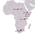
Africa, australopitecines discovery sites.png 341 × 341; 14 KB
-
Antarctica, Bouvet Island, discovery map 1739.jpg 3,836 × 2,916; 2.92 MB
-
Antarctica, Bouvet Island, discovery map 1754.jpg 3,896 × 3,088; 4.16 MB
-
Arte esquematico iberico.png 984 × 844; 412 KB
-
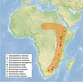
Australopithecines area.jpg 3,195 × 3,167; 933 KB
-
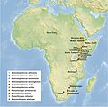
Australopithecines.jpg 3,195 × 3,167; 1,007 KB
-
Berekhat-Ram Map.png 212 × 308; 16 KB
-
Boisei east Africa.jpg 3,300 × 4,322; 15.61 MB
-
Cradle of Humankind plan.jpg 1,730 × 1,291; 235 KB
-
Djourab, Chad ; Sahelanthropus tchadensis 2001 discovery map.png 341 × 341; 7 KB
-
Dmanissi, Georgia ; Homo georgicus 1999 discovery map.png 320 × 240; 6 KB
-
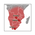
Gwisho culture map.png 326 × 349; 13 KB
-
Herto, Ethiopia ; Homo sapiens idaltu 1997 discovery map.png 341 × 341; 7 KB
-
Paranthropus Africa.jpg 3,195 × 3,167; 999 KB
-
Paranthropus robustus Africa.jpg 2,283 × 2,035; 293 KB
-
Situación del monte Castillo (Cantabria).png 800 × 489; 89 KB
-
Tan-Tan map.png 329 × 352; 10 KB
-
Wilton culture map.png 253 × 253; 5 KB
-
ZAfrica australopitecines discovery sites.png 223 × 115; 3 KB

