Category:Maps in the Michigan State University Map Library
Jump to navigation
Jump to search
Subcategories
This category has the following 2 subcategories, out of 2 total.
Media in category "Maps in the Michigan State University Map Library"
The following 8 files are in this category, out of 8 total.
-
 Africa Corrected from Observtions of Messrs of ye Royal Societies at London and Paris.jpg 11,659 × 8,384; 26.3 MB
-
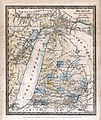 Map of Michigan (1831) DH Burr.jpg 3,511 × 4,158; 4.8 MB
-
 Map of the City of Washington Showing Location of Fatal Cases of Consumption.jpg 8,520 × 8,940; 12.86 MB
-

-
 Map of the State of Michigan and the Surrounding Country.jpg 8,549 × 12,118; 28.95 MB
-
 Map of the surveyed part of the territory of Michigan 1825.jpg 8,298 × 12,772; 27.75 MB
-
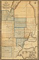
 Map of the town of Michigan 1847.jpg 11,430 × 6,540; 48.27 MB
-
 Plan of the New Town of Halifax in Nova Scotia, 1749.jpg 2,493 × 1,851; 1.45 MB

_DH_Burr.jpg)


