Category:Maps from Africa by Élisée Reclus, Volume 4
Jump to navigation
Jump to search
Media in category "Maps from Africa by Élisée Reclus, Volume 4"
The following 143 files are in this category, out of 143 total.
-
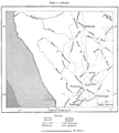
 AFR V4 D017 Routes of the chief explorers in Angola.png 1,716 × 2,722; 587 KB
-
 AFR V4 D026 The Cunene and Etosha lagoon.png 1,729 × 1,994; 601 KB
-
 AFR V4 D029 Vegetable Zones of Angola.jpg 1,249 × 2,022; 461 KB
-
 AFR V4 D029 Vegetable zones of Angola.png 1,232 × 2,006; 811 KB
-
 AFR V4 D035 Ancient kingdom of Congo.png 1,789 × 1,912; 602 KB
-
 AFR V4 D041 Inhabitants of Angola.png 1,783 × 2,728; 1.05 MB
-
 AFR V4 D049 Routes of explorers who have crossed the continent.png 1,779 × 2,466; 721 KB
-
 AFR V4 D053 San Salvador M'banza-Kongo, Africa.png 1,798 × 1,736; 731 KB
-
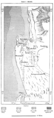
 AFR V4 D057 Ambriz Angola.png 1,238 × 2,422; 723 KB
-
 AFR V4 D058 Southern spit of Loanda Angola.png 1,766 × 2,462; 853 KB
-
 AFR V4 D061 St Paul of Loanda.png 1,755 × 1,786; 854 KB
-
 AFR V4 D063 Dondo Angola.png 1,840 × 1,615; 814 KB
-
 AFR V4 D064 Projected railway to Ambaca.png 1,790 × 1,254; 517 KB
-
 AFR V4 D066 Black stones of Pungo Ndongo.png 1,805 × 1,461; 523 KB
-
 AFR V4 D068 Malange Angola.png 1,794 × 1,624; 795 KB
-
 AFR V4 D078 Tiger Bay and the Cunene.png 1,289 × 2,703; 1.14 MB
-
 AFR V4 D079 Chief zones of useful plants in Angola.png 1,301 × 1,895; 472 KB
-
 AFR V4 D080 Coffee growing region of Angola.png 1,798 × 1,614; 1.65 MB
-
 AFR V4 D085 Chief routes of explorers in Damaraland.png 1,774 × 1,974; 782 KB
-
 AFR V4 D096 Herero Land.png 1,793 × 2,276; 921 KB
-
 AFR V4 D099 Walvisch Bay.png 1,349 × 2,956; 872 KB
-
 AFR V4 D102 Angra Pequena.png 1,798 × 2,427; 811 KB
-
 AFR V4 D108 South West African highlands.png 1,669 × 2,505; 1.89 MB
-
 AFR V4 D110 African territory annexed and claimed by Europeans by 1888.png 4,010 × 2,540; 10.15 MB
-
 AFR V4 D110-111 African territory annexed and claimed by Europeans by 1888.png 4,010 × 5,080; 18.5 MB
-
 AFR V4 D111 African territory annexed and claimed by Europeans by 1888.png 4,010 × 2,540; 8.35 MB
-
 AFR V4 D114 Cape Agulhas.png 1,315 × 2,405; 702 KB
-
 AFR V4 D119 Relief map of South Africa.png 1,791 × 1,465; 1.05 MB
-
 AFR V4 D121 The Orange Falls.png 1,734 × 764; 435 KB
-
 AFR V4 D125 Gate of the St John River.png 1,795 × 2,665; 1.56 MB
-
 AFR V4 D127 Delagoa Bay.png 1,699 × 2,613; 1.12 MB
-
 AFR V4 D132 Agulhas Bank.png 1,861 × 1,552; 596 KB
-
 AFR V4 D134 Isothermals of South Africa.png 1,724 × 998; 723 KB
-
 AFR V4 D136 Rainfall of South Africa.png 1,743 × 1,585; 759 KB
-
 AFR V4 D151 South-African Hottentot Tribes in the middle of the 18th Century.png 1,758 × 1,035; 662 KB
-
 AFR V4 D153 Hottentots Kafirs and Be-Chuanas.png 1,786 × 2,042; 668 KB
-
 AFR V4 D158 Left side of Map of the Cape - South Africa.png 2,323 × 3,656; 9.13 MB
-
 AFR V4 D158-159 Map of the Cape - South Africa.png 4,603 × 3,656; 16.89 MB
-
 AFR V4 D159 Right side of Map of the Cape - South Africa.png 2,304 × 3,694; 7.87 MB
-
 AFR V4 D165 Aboriginies and colonists.png 1,766 × 1,668; 660 KB
-
 AFR V4 D166 Successive British Annexations in South Africa.png 1,739 × 1,479; 1.03 MB
-
 AFR V4 D168 Cape Town South Africa.png 1,734 × 2,174; 1.12 MB
-
 AFR V4 D173 Saldanha Bay.png 1,777 × 2,571; 1.34 MB
-
 AFR V4 D175 Mouth of the Breede - Port Beaufort.png 1,855 × 1,701; 724 KB
-
 AFR V4 D177 Port Elizabeth.png 1,798 × 2,224; 922 KB
-
 AFR V4 D188 South African lines of steam navigation and cables.png 1,799 × 1,578; 698 KB
-
 AFR V4 D193 Administrative divisions of Cape Colony and neighbouring territories.png 1,750 × 1,432; 794 KB
-
 AFR V4 D196 Griqualand West.png 1,772 × 1,619; 338 KB
-
 AFR V4 D198 River diggings in the Vaal basin.png 1,751 × 1,767; 493 KB
-
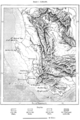
 AFR V4 D206 Chief routes of the explorers north of the South African colonies.png 1,748 × 1,970; 880 KB
-
 AFR V4 D215 Shoshong.png 1,748 × 1,881; 487 KB
-
 AFR V4 D216 Trade Routes in the Bechuanaland.png 1,726 × 1,418; 395 KB
-
 AFR V4 D219 Basutoland.png 1,885 × 2,474; 2.36 MB
-
 AFR V4 D223 Kafirland.png 1,820 × 2,338; 1.85 MB
-
 AFR V4 D230 South Kafirland.png 1,743 × 1,961; 1.69 MB
-
 AFR V4 D233 Cape colony Natal and adjacent territories.png 4,016 × 2,606; 9.21 MB
-
 AFR V4 D236 Natal South Africa.png 1,771 × 2,308; 2.52 MB
-
 AFR V4 D243 The bluff of Natal.png 1,752 × 1,850; 1.17 MB
-
 AFR V4 D244 Port Natal and Durban.png 1,759 × 1,563; 1,015 KB
-
 AFR V4 D252 St Lucia lagoon and backwaters.png 1,214 × 2,623; 1.34 MB
-
 AFR V4 D261 Treks of the Boers.png 1,858 × 1,602; 918 KB
-
 AFR V4 D268 Range of the Tsetse Fly.png 1,758 × 1,918; 497 KB
-
 AFR V4 D270 The Transvaal gold fields.png 1,875 × 1,733; 723 KB
-
 AFR V4 D275 Pretoria South Africa.png 1,793 × 1,430; 1.06 MB
-
 AFR V4 D279 Lorenço Marques.png 1,848 × 1,823; 1.13 MB
-
 AFR V4 D280 The Lorenço Marques-Pretoria railway.png 1,704 × 772; 373 KB
-
 AFR V4 D285 Chief routes of the explorers between Limpopo and Zambese.png 1,824 × 1,514; 608 KB
-
 AFR V4 D296 Manica and Gorongoza highlands.png 1,694 × 1,482; 509 KB
-
 AFR V4 D300 Portuguese Africa from Ocean to Ocean.png 1,838 × 1,734; 716 KB
-
 AFR V4 D302 Region of uncertain waterpartings.png 1,740 × 1,640; 429 KB
-
 AFR V4 D305 Kassai Ku-Bango and Zambese.png 1,803 × 1,959; 614 KB
-
 AFR V4 D310 Victoria Falls.png 1,722 × 1,914; 1.41 MB
-
 AFR V4 D312 The Lupata Gorge.png 1,748 × 1,333; 396 KB
-
 AFR V4 D317 Region between Nyassa and Tanganyika.png 1,764 × 1,104; 456 KB
-
 AFR V4 D319 Zambesi and Shire confluence.png 1,795 × 2,480; 758 KB
-
 AFR V4 D320 Zambese delta.png 1,694 × 2,232; 1.11 MB
-
 AFR V4 D327 Inhabitants of the waterparting between the Congo and Zambese.png 1,754 × 1,028; 293 KB
-
 AFR V4 D333 Barotse uplands.png 1,856 × 1,319; 469 KB
-
 AFR V4 D340 Chief tribes of the Zambese basin.png 1,766 × 1,275; 421 KB
-
 AFR V4 D346 North end of Lake Nyassa.png 1,725 × 1,656; 667 KB
-
 AFR V4 D348 Uplands between the Shire and Nyassa.png 1,741 × 1,301; 479 KB
-
 AFR V4 D351 Quelimane Mozambique.png 1,167 × 2,547; 691 KB
-
 AFR V4 D354 Chief routes of explorers east of Nyassa.png 1,687 × 1,577; 372 KB
-
 AFR V4 D355 Namuli Mountains.png 1,785 × 1,181; 585 KB
-
 AFR V4 D356 Lakes Kilwa Chiuta and Amaramba.png 1,714 × 2,338; 1.04 MB
-
 AFR V4 D361 Mouth of the Rovuma.png 1,758 × 1,505; 624 KB
-
 AFR V4 D362 Ports and reefs of north Mozambique.png 694 × 2,547; 601 KB
-
 AFR V4 D366 Chief nations of Mozambique.png 1,826 × 1,631; 682 KB
-
 AFR V4 D370 Mozambique and its Ports.png 1,701 × 2,382; 1.32 MB
-
 AFR V4 D372 Ports of Ferñao Vellozo Mozambique.png 1,750 × 2,439; 1,009 KB
-
 AFR V4 D376 Chief routes of explorers north of the Rovuma.png 1,704 × 1,522; 402 KB
-
 AFR V4 D380 Zanzibar and Bagamoyo coloured map left side.png 2,247 × 3,769; 6.85 MB
-
 AFR V4 D380-381 Zanzibar and Bagamoyo coloured maps joined.png 4,527 × 3,769; 16.05 MB
-
 AFR V4 D381 Zanzibar and Bagamoyo coloured map right side.png 2,267 × 3,746; 8.56 MB
-
 AFR V4 D384 The Rufiji delta.png 1,435 × 2,509; 675 KB
-
 AFR V4 D391 East African tribes between the Rovuma and Pagani.png 1,730 × 1,525; 476 KB
-
 AFR V4 D397 Ports of Mikindani and Mto-Mtwara.png 1,792 × 1,794; 955 KB
-
 AFR V4 D398 Kiloa-Kisiwani.png 1,743 × 2,012; 899 KB
-
 AFR V4 D402 The two Kiloas.png 1,650 × 2,215; 963 KB
-
 AFR V4 D403 Dar-es-Salaam.png 1,736 × 2,354; 1.23 MB
-
 AFR V4 D405 Bagamoyo.png 1,817 × 2,294; 1.17 MB
-
 AFR V4 D408 Oceanic and landward coasts of Pemba compared.png 1,411 × 2,507; 1.03 MB
-
 AFR V4 D410 Island of Mafia.png 1,640 × 2,287; 1.07 MB
-
 AFR V4 D415 Zanzibar.png 1,768 × 2,435; 1.45 MB
-
 AFR V4 D418 Pemba.png 1,047 × 2,545; 776 KB
-
 AFR V4 D421 Chief routes of explorers in the Kilima-Njaro Region.png 1,863 × 2,329; 788 KB
-
 AFR V4 D422 Line of volcanic fault Masai land.png 839 × 2,295; 416 KB
-
 AFR V4 D424 Region between Zanzibar and Lake Nyanza.png 1,753 × 1,935; 651 KB
-
 AFR V4 D426 Lacustrine region west of Mount Kenia.png 1,862 × 2,129; 1.22 MB
-
 AFR V4 D427 Kilima-Njaro and Nyka uplands.png 1,690 × 1,037; 547 KB
-
 AFR V4 D428 Kilima-Njaro.png 1,728 × 1,770; 1.15 MB
-
 AFR V4 D443 Tribes north of the Pangani.png 1,869 × 2,300; 869 KB
-
 AFR V4 D457 Mombaz.png 1,859 × 1,993; 1.46 MB
-
 AFR V4 D458 Port and hills of Mombaz.png 1,754 × 2,467; 833 KB
-
 AFR V4 D459 Malindi and Vasco de Gama's pillar.png 1,728 × 2,064; 910 KB
-
 AFR V4 D464 Chief routes of explorers in Somali land.png 1,901 × 2,138; 909 KB
-
 AFR V4 D467 Cape Guardafui.png 1,800 × 1,773; 843 KB
-
 AFR V4 D470 Ras Hafun.png 1,818 × 1,821; 1.11 MB
-
 AFR V4 D471 Mouths of the Juba and Bubashi.png 1,706 × 2,266; 1.2 MB
-
 AFR V4 D472 Lower course of the Webi.png 1,816 × 1,666; 893 KB
-
 AFR V4 D478 Somali territory.png 1,858 × 2,429; 867 KB
-
 AFR V4 D493 Vitu land.png 1,817 × 1,652; 703 KB
-
 AFR V4 D495 Double coastline north of Bubashi.png 1,810 × 2,116; 1.06 MB
-
 AFR V4 D498 Kismayu.png 1,693 × 2,577; 1.03 MB
-
 AFR V4 D500 Magdoshu - Mogadishu.png 1,732 × 1,626; 501 KB
-
 AFR V4 D505 Berbera.png 1,762 × 1,793; 742 KB
-
 AFR V4 D509 Sokotra.png 1,806 × 1,251; 928 KB
-
 AFR V4 D515 South east corner of Madagascar.png 1,230 × 2,306; 1.06 MB
-
 AFR V4 D517 Color map of Madagascar 19th century.png 2,696 × 4,114; 10.24 MB
-
 AFR V4 D521 Chief routes of the explorers in Madagascar.png 1,357 × 2,465; 708 KB
-
 AFR V4 D526 Lagoons on the east coast of Madagascar.png 1,167 × 2,442; 1.6 MB
-
 AFR V4 D527 Erosions on the east coast and Anton-Gil bay.png 945 × 2,086; 537 KB
-
 AFR V4 D532 Circular forest zone Madagascar.png 1,235 × 2,390; 1.17 MB
-
 AFR V4 D541 Inhabitants of Madagascar.png 1,396 × 2,422; 2.01 MB
-
 AFR V4 D554 Tananarivo and environs.png 1,733 × 2,328; 1.51 MB
-
 AFR V4 D558 Tamatave.png 1,776 × 2,546; 1.29 MB
-
 AFR V4 D559 Diego Suarez Bay.png 1,923 × 2,087; 946 KB
-
 AFR V4 D563 Nossi Bé.png 1,757 × 2,012; 1.55 MB
-
 AFR V4 D565 North west coast of Madagascar.png 1,733 × 1,882; 1.62 MB
-
 AFR V4 D569 The Comoro Islands.png 1,808 × 1,733; 991 KB
-
 AFR V4 D574 Mayotte.png 1,767 × 2,399; 1.25 MB
-
 AFR V4 D576 Seychelles.png 1,725 × 2,622; 1.53 MB
-
 AFR V4 D577 Submarine banks of Madagascar and the Mascarenhas.png 1,873 × 2,062; 1.22 MB


