Category:Maps digitised by the National Library of Sweden
Jump to navigation
Jump to search
Media in category "Maps digitised by the National Library of Sweden"
The following 57 files are in this category, out of 57 total.
-
 Allegorisk karta över Östersjön i form av färjkarlen Charon.tif 3,113 × 4,657; 82.98 MB
-
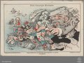
 Angling in troubled waters – a serio-comic map of Europe - Kungliga Biblioteket - 2818247-thumb.png 12,010 × 9,183; 517.45 MB
-
 Angling in troubled waters – a serio-comic map of Europe - Kungliga Biblioteket - 2818247.tif 12,010 × 9,183; 631.1 MB
-

-

-
-
 Carte des états désunis d'Europe - Kungliga Biblioteket - 10348540-thumb.png 10,307 × 7,703; 382.93 MB
-
 Carte des états désunis d'Europe - Kungliga Biblioteket - 10348540.tif 10,307 × 7,703, 2 pages; 454.33 MB
-
 Charta öfwer Swerige med tilgränsande länder - Kungliga Biblioteket - 11692091-thumb.png 11,753 × 9,824; 539.43 MB
-
 Charta öfwer Swerige med tilgränsande länder - Kungliga Biblioteket - 11692091.tif 11,753 × 9,824, 2 pages; 660.71 MB
-
 Charta öfwer södra delen af Swerige - Kungliga Biblioteket - 10294581-thumb.png 9,344 × 11,702; 512.8 MB
-
 Charta öfwer södra delen af Swerige - Kungliga Biblioteket - 10294581.tif 9,344 × 11,702, 2 pages; 625.7 MB
-
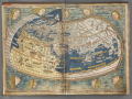 Cosmographia – Ulm 1482 - Kungliga Biblioteket - 3276974-thumb.png 10,880 × 8,160; 439.68 MB
-
 Cosmographia – Ulm 1482 - Kungliga Biblioteket - 3276974.tif 10,880 × 8,160, 2 pages; 508.04 MB
-
 Das heutige Europa.pdf 3,279 × 2,468; 6.77 MB
-
 Den lilla skolkartan öfver Skandinavien, Europa och Globen - Kungliga Biblioteket - 10371878-thumb.png 10,186 × 7,176; 354.11 MB
-
 Den lilla skolkartan öfver Skandinavien, Europa och Globen - Kungliga Biblioteket - 10371878.tif 10,186 × 7,176, 2 pages; 418.28 MB
-
 Exacta totius Africae tabula - Kungliga Biblioteket - 8250653-thumb.png 10,592 × 8,096; 311.31 MB
-
 Exacta totius Africae tabula - Kungliga Biblioteket - 8250653.tif 10,592 × 8,096, 2 pages; 490.74 MB
-
 Exacta totius Americæ tabula - Kungliga Biblioteket - 10398124-thumb.png 10,232 × 7,656; 291.55 MB
-
 Exacta totius Americæ tabula - Kungliga Biblioteket - 10398124.tif 10,232 × 7,656, 2 pages; 448.29 MB
-
 Exacta totius Asiæ tabula - Kungliga Biblioteket - 10397528-thumb.png 10,270 × 7,824; 300.09 MB
-
 Exacta totius Asiæ tabula - Kungliga Biblioteket - 10397528.tif 10,270 × 7,824, 2 pages; 459.82 MB
-
 Exacta totius Eurpæ tabula - Kungliga Biblioteket - 10398206-thumb.png 9,622 × 7,788; 354.11 MB
-
 Exacta totius Eurpæ tabula - Kungliga Biblioteket - 10398206.tif 9,622 × 7,788, 2 pages; 428.82 MB
-

-

-
 Försök til en magnetisk inclinations charta - Kungliga Biblioteket - 10344951.tif 8,088 × 5,568, 2 pages; 257.72 MB
-

-

-
 General passcharta öfwer Öster-siöön och Skager-rack - Kungliga Biblioteket - 10346689-thumb.png 10,674 × 9,070; 461.9 MB
-
 General passcharta öfwer Öster-siöön och Skager-rack - Kungliga Biblioteket - 10346689.tif 10,674 × 9,070, 2 pages; 554 MB
-
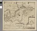
 Karta öfver föreslagna jernvägar norrut från Stockholm. - Kungliga Biblioteket - 10938798-thumb.png 5,892 × 9,435; 260.33 MB
-
 Karta öfver föreslagna jernvägar norrut från Stockholm. - Kungliga Biblioteket - 10938798.tif 5,892 × 9,435, 2 pages; 318.12 MB
-
 Karta öfver Sverige - Kungliga Biblioteket - 10346168-thumb.png 8,385 × 12,265; 497.22 MB
-
 Karta öfver Sverige - Kungliga Biblioteket - 10346168.tif 8,385 × 12,265, 2 pages; 588.5 MB
-
 Karta över Norden - Kungliga Biblioteket - 10397840-thumb.png 9,117 × 7,153; 303.92 MB
-
 Karta över Norden - Kungliga Biblioteket - 10397840.tif 9,117 × 7,153, 2 pages; 373.19 MB
-
 Karta över Skandinavien - Kungliga Biblioteket - 10393902-thumb.png 10,689 × 7,908; 402.93 MB
-
 Karta över Skandinavien - Kungliga Biblioteket - 10393902.tif 10,689 × 7,908, 2 pages; 483.71 MB
-
 Kinesisk världskarta - Kungliga Biblioteket - 10451834-thumb.png 10,234 × 7,908; 358.88 MB
-
 Kinesisk världskarta - Kungliga Biblioteket - 10451834.tif 10,234 × 7,908, 2 pages; 463.13 MB
-
 Nativus, Sueciae adiacenti umque regnorum typus - Kungliga Biblioteket - 11308411-thumb.png 10,361 × 8,249; 407.1 MB
-
 Nativus, Sueciae adiacenti umque regnorum typus - Kungliga Biblioteket - 11308411.tif 10,361 × 8,249, 2 pages; 489.08 MB
-
 Nouveau plan de Paris monumental by L. Guilmin, 1899 - National Library of Sweden.jpg 4,170 × 3,085; 5.26 MB
-
 Nouveau plan itinéraire de Paris by Alexandre, 1845 - National Library of Sweden.jpg 3,668 × 2,840; 4.77 MB
-
 Nova verior et integra totius orbis descriptio – nune primum in lucem edita - Kungliga Biblioteket - 10188630.tif 7,186 × 4,584, 2 pages; 188.52 MB
-
 Portolankarta över Medelhavet - Kungliga Biblioteket - 10189802-thumb.png 12,409 × 7,501; 456.13 MB
-
 Portolankarta över Medelhavet - Kungliga Biblioteket - 10189802.tif 12,409 × 7,501, 2 pages; 532.64 MB
-

-
 Scandinavia complectens Sueciæ, Daniæ et Norvegiæ regna – ex tabulis - Kungliga Biblioteket - 10348309.tif 10,126 × 7,774, 2 pages; 450.47 MB
-
-

-
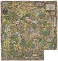
 Stora Kopparbärgz grufva - Kungliga Biblioteket - 10315723-thumb.png 11,513 × 8,479; 476.48 MB
-
 Stora Kopparbärgz grufva - Kungliga Biblioteket - 10315723.tif 11,513 × 8,479, 2 pages; 558.61 MB
-
 Svecia et Norvegia cum confinijs - Kungliga Biblioteket - 10377574-thumb.png 9,793 × 7,542; 354.27 MB
-
 Svecia et Norvegia cum confinijs - Kungliga Biblioteket - 10377574.tif 9,793 × 7,542, 2 pages; 422.65 MB


