Category:Maps by the United States Army Corps of Topographical Engineers
Jump to navigation
Jump to search
Media in category "Maps by the United States Army Corps of Topographical Engineers"
The following 164 files are in this category, out of 164 total.
-
-

-
 (Map of the environs of Resaca, Georgia). LOC 2007626730.jpg 3,600 × 5,750; 2.32 MB
-
 (Map of the environs of Resaca, Georgia). LOC 2007626730.tif 3,600 × 5,750; 59.22 MB
-

-

-
-
 Additions & corrections to the map of Cobb Co., Ga. LOC 2006459205.jpg 2,352 × 2,649; 724 KB
-
 Additions & corrections to the map of Cobb Co., Ga. LOC 2006459205.tif 2,352 × 2,649; 17.83 MB
-
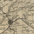
 Atlanta & vicinity - compiled from state map and information LOC 2006458681.jpg 4,956 × 7,003; 4.27 MB
-

-

-
 Central Virginia LOC 2003621224-1.jpg 9,459 × 7,731; 14.57 MB
-
 Central Virginia LOC 2003621224-1.tif 9,459 × 7,731; 209.22 MB
-
 Central Virginia LOC 2003621224-10.jpg 11,470 × 7,949; 9.11 MB
-
 Central Virginia LOC 2003621224-10.tif 11,470 × 7,949; 260.85 MB
-
 Central Virginia LOC 2003621224-11.jpg 11,418 × 7,979; 8.78 MB
-
 Central Virginia LOC 2003621224-11.tif 11,418 × 7,979; 260.65 MB
-
 Central Virginia LOC 2003621224-12.jpg 11,719 × 7,873; 9.77 MB
-
 Central Virginia LOC 2003621224-12.tif 11,719 × 7,873; 263.97 MB
-
 Central Virginia LOC 2003621224-13.jpg 6,578 × 8,492; 5.8 MB
-
 Central Virginia LOC 2003621224-13.tif 6,578 × 8,492; 159.82 MB
-
 Central Virginia LOC 2003621224-14.jpg 11,658 × 7,980; 11.56 MB
-
 Central Virginia LOC 2003621224-14.tif 11,658 × 7,980; 266.16 MB
-
 Central Virginia LOC 2003621224-15.jpg 9,673 × 6,226; 6.83 MB
-
 Central Virginia LOC 2003621224-15.tif 9,673 × 6,226; 172.3 MB
-
 Central Virginia LOC 2003621224-16.jpg 9,796 × 6,638; 6.89 MB
-
 Central Virginia LOC 2003621224-16.tif 9,796 × 6,638; 186.04 MB
-
 Central Virginia LOC 2003621224-17.jpg 10,997 × 8,017; 9.6 MB
-
 Central Virginia LOC 2003621224-17.tif 10,997 × 8,017; 252.24 MB
-
 Central Virginia LOC 2003621224-18.jpg 10,729 × 7,849; 10.19 MB
-
 Central Virginia LOC 2003621224-18.tif 10,729 × 7,849; 240.93 MB
-
 Central Virginia LOC 2003621224-19.jpg 6,035 × 8,197; 5.23 MB
-
 Central Virginia LOC 2003621224-19.tif 6,035 × 8,197; 141.53 MB
-
 Central Virginia LOC 2003621224-2.jpg 9,700 × 6,619; 5.99 MB
-
 Central Virginia LOC 2003621224-2.tif 9,700 × 6,619; 183.69 MB
-
 Central Virginia LOC 2003621224-20.jpg 11,250 × 8,250; 7.3 MB
-
 Central Virginia LOC 2003621224-20.tif 11,250 × 8,250; 265.54 MB
-
 Central Virginia LOC 2003621224-3.jpg 9,699 × 6,676; 5.57 MB
-
 Central Virginia LOC 2003621224-3.tif 9,699 × 6,676; 185.25 MB
-
 Central Virginia LOC 2003621224-4.jpg 10,657 × 7,948; 7.92 MB
-
 Central Virginia LOC 2003621224-4.tif 10,657 × 7,948; 242.33 MB
-
 Central Virginia LOC 2003621224-5.jpg 10,690 × 7,970; 9.7 MB
-
 Central Virginia LOC 2003621224-5.tif 10,690 × 7,970; 243.76 MB
-
 Central Virginia LOC 2003621224-6.jpg 11,737 × 7,982; 7.81 MB
-
 Central Virginia LOC 2003621224-6.tif 11,737 × 7,982; 268.03 MB
-
 Central Virginia LOC 2003621224-7.jpg 11,744 × 7,911; 8.53 MB
-
 Central Virginia LOC 2003621224-7.tif 11,744 × 7,911; 265.81 MB
-
 Central Virginia LOC 2003621224-8.jpg 11,765 × 7,998; 11 MB
-
 Central Virginia LOC 2003621224-8.tif 11,765 × 7,998; 269.21 MB
-
 Central Virginia LOC 2003621224-9.jpg 11,894 × 8,111; 11.77 MB
-
 Central Virginia LOC 2003621224-9.tif 11,894 × 8,111; 276.01 MB
-
 Central Virginia LOC 2006627687.jpg 9,817 × 8,112; 12.97 MB
-
 Central Virginia LOC 2006627687.tif 9,817 × 8,112; 227.84 MB
-
 Central Virginia LOC 2006635254.jpg 9,505 × 7,047; 10.95 MB
-
 Central Virginia LOC 2006635254.tif 9,505 × 7,047; 191.64 MB
-
 Central Virginia LOC 83694333.jpg 10,123 × 8,136; 15.86 MB
-
 Central Virginia LOC 83694333.tif 10,123 × 8,136; 235.64 MB
-
 Central Virginia LOC glva000001-1.jpg 10,978 × 7,998; 9.54 MB
-
 Central Virginia LOC glva000001-10.jpg 10,604 × 7,974; 12.03 MB
-
 Central Virginia LOC glva000001-10.tif 10,604 × 7,974; 241.92 MB
-
 Central Virginia LOC glva000001-11.jpg 12,113 × 8,555; 10.37 MB
-
 Central Virginia LOC glva000001-11.tif 12,113 × 8,555; 296.48 MB
-
 Central Virginia LOC glva000001-12.jpg 6,767 × 9,079; 5.79 MB
-
 Central Virginia LOC glva000001-12.tif 6,767 × 9,079; 175.77 MB
-
 Central Virginia LOC glva000001-13.jpg 6,519 × 8,345; 5.32 MB
-
 Central Virginia LOC glva000001-13.tif 6,519 × 8,345; 155.64 MB
-
 Central Virginia LOC glva000001-14.jpg 11,838 × 8,550; 11.01 MB
-
 Central Virginia LOC glva000001-14.tif 11,838 × 8,550; 289.58 MB
-
 Central Virginia LOC glva000001-15.jpg 11,913 × 8,580; 11.28 MB
-
 Central Virginia LOC glva000001-15.tif 11,913 × 8,580; 292.44 MB
-
 Central Virginia LOC glva000001-16.jpg 11,425 × 7,984; 9.99 MB
-
 Central Virginia LOC glva000001-16.tif 11,425 × 7,984; 260.97 MB
-
 Central Virginia LOC glva000001-17.jpg 11,076 × 7,899; 10.23 MB
-
 Central Virginia LOC glva000001-18.jpg 10,754 × 12,420; 13.39 MB
-
 Central Virginia LOC glva000001-2.jpg 12,155 × 8,153; 8.75 MB
-
 Central Virginia LOC glva000001-2.tif 12,155 × 8,153; 283.53 MB
-
 Central Virginia LOC glva000001-3.jpg 12,066 × 8,490; 15.99 MB
-
 Central Virginia LOC glva000001-4.jpg 12,268 × 8,904; 13.85 MB
-
 Central Virginia LOC glva000001-4.tif 12,268 × 8,904; 312.52 MB
-
 Central Virginia LOC glva000001-5.jpg 11,939 × 8,436; 17.33 MB
-
 Central Virginia LOC glva000001-6.jpg 11,215 × 8,034; 8.46 MB
-
 Central Virginia LOC glva000001-7.jpg 6,608 × 8,256; 5.56 MB
-
 Central Virginia LOC glva000001-8.jpg 12,010 × 8,411; 12.43 MB
-
 Central Virginia LOC glva000001-8.tif 12,010 × 8,411; 289.01 MB
-
 Central Virginia LOC glva000001-9.jpg 10,761 × 7,986; 13.63 MB
-
 Central Virginia LOC glva000001-9.tif 10,761 × 7,986; 245.87 MB
-
 Central Virignia LOC 99448507.jpg 10,138 × 8,284; 16.19 MB
-
 Central Virignia LOC 99448507.tif 10,138 × 8,284; 240.28 MB
-

-

-
 Chart of the Potomac River from Georgetown to Alexandria LOC 87695742.jpg 11,601 × 8,566; 12.13 MB
-
 Chart of the Potomac River from Georgetown to Alexandria LOC 87695742.tif 11,601 × 8,566; 284.31 MB
-
 Civil War map with Flat Rock listed.png 338 × 337; 227 KB
-

-

-
 Culpeper County with parts of Madison, Rappahannock, and Fauquier counties, Virginia. LOC 2006629171.tif 11,853 × 9,029; 306.19 MB
-

-

-
-
 Head of navigation of the Potomac River LOC 87695757.jpg 15,202 × 9,015; 17.53 MB
-
 Head of navigation of the Potomac River LOC 87695757.tif 15,202 × 9,015; 392.09 MB
-
 Indian Territory, with part of the adjoining state of Kansas, etc. LOC 2011590003.jpg 10,770 × 8,148; 9.29 MB
-
 Indian Territory, with part of the adjoining state of Kansas, etc. LOC 2011590003.tif 10,770 × 8,148; 251.07 MB
-
 Information map of part of Georgia. LOC 2007626700.jpg 4,893 × 3,792; 1.6 MB
-
 Information map of part of Georgia. LOC 2007626700.tif 4,893 × 3,792; 53.08 MB
-
 Lake Erie LOC 2017588900.jpg 12,001 × 7,533; 10.6 MB
-
 Lake Erie LOC 2017588900.tif 12,001 × 7,533; 258.65 MB
-
 Map of field of occupation of Army of the Potomac LOC 99446529.jpg 11,165 × 7,648; 10.97 MB
-
 Map of Texas and part of New Mexico (NBY 15547).jpg 3,600 × 3,052; 1.28 MB
-
 Map of Texas and part of New Mexico LOC 2015591074.jpg 11,274 × 10,673; 14.84 MB
-
 Map of Texas and part of New Mexico LOC 2015591074.tif 11,274 × 10,673; 344.26 MB
-
 Map of the alluvial region of the Mississippi LOC 2007627376.jpg 5,650 × 8,806; 4.98 MB
-
 Map of the alluvial region of the Mississippi LOC 2007627376.tif 5,650 × 8,806; 142.35 MB
-
 Map of the alluvial region of the Mississippi LOC 2015591011.jpg 5,707 × 8,850; 7.08 MB
-
 Map of the alluvial region of the Mississippi LOC 2015591011.tif 5,707 × 8,850; 144.5 MB
-

-
 Map of the seat of war in Florida LOC 2018588050.jpg 6,441 × 10,667; 10.76 MB
-
 Map of the seat of war in Florida LOC 2018588050.tif 6,441 × 10,667; 196.57 MB
-

-

-
 Map of wagon routes in Utah Territory LOC 2012586633.jpg 15,323 × 9,079; 13.99 MB
-
 Map of wagon routes in Utah Territory LOC 2012586633.tif 15,323 × 9,079; 398.02 MB
-

-

-

-

-
 Part of Carroll County, Maryland LOC 2009579480.jpg 11,202 × 12,844; 15.8 MB
-
 Part of Carroll County, Maryland LOC 2009579480.tif 11,202 × 12,844; 411.64 MB
-
 Part of Cobb Co., Ga. LOC 2006459207.jpg 6,144 × 4,476; 2.99 MB
-
 Part of Cobb Co., Ga. LOC 2006459207.tif 6,144 × 4,476; 78.68 MB
-
 Part of Cobb Co., Ga. LOC 2006459208.jpg 7,207 × 3,925; 2.98 MB
-
 Part of Cobb Co., Ga. LOC 2006459208.tif 7,207 × 3,925; 80.93 MB
-
 Part of Cobb County, Georgia LOC 2006458682.jpg 4,835 × 4,908; 2.31 MB
-
 Part of Cobb County, Georgia LOC 2006458682.tif 4,835 × 4,908; 67.89 MB
-
 Part of Cobb County, Georgia LOC 2006458683.jpg 4,382 × 4,593; 1.82 MB
-
 Part of Cobb County, Georgia LOC 2006458683.tif 4,382 × 4,593; 57.58 MB
-

-

-
 Part of northern Georgia - no. 2 LOC 2004629004.jpg 4,276 × 6,425; 5.37 MB
-
 Part of northern Georgia - no. 2 LOC 2004629004.tif 4,276 × 6,425; 78.6 MB
-
 Part of northern Georgia LOC 2004629016.jpg 4,446 × 6,811; 5.64 MB
-
 Part of northern Georgia LOC 2004629016.tif 4,446 × 6,811; 86.64 MB
-
 Part of the map of the military department of S.E. Virginia & Fort Monroe LOC 99448883.jpg 13,360 × 8,744; 17.68 MB
-
 Part of the map of the military department of S.E. Virginia & Fort Monroe LOC 99448883.tif 13,360 × 8,744; 334.22 MB
-
 Report of an expedition down the Zuni and Colorado rivers (NBY 16476).jpg 3,600 × 2,082; 689 KB
-

-

-

-

-
-
-
 Territory and military department of New Mexico LOC 2015591072.jpg 10,441 × 7,478; 9.98 MB
-
 Territory and military department of Utah LOC 2015591071.jpg 12,806 × 8,733; 15.9 MB
-
 Territory and military department of Utah LOC 2015591071.tif 12,806 × 8,733; 319.96 MB
-

-

-
 View looking north west from Promontory Point Great Salt Lake LCCN2014649004.jpg 3,850 × 2,471; 1.73 MB
-
 View looking north west from Promontory Point Great Salt Lake LCCN2014649004.tif 3,850 × 2,471; 27.28 MB
-
 West end of Lake Erie and Detroit River LOC 2017588902.jpg 8,721 × 11,099; 10.77 MB
-
 West end of Lake Erie and Detroit River LOC 2017588902.tif 8,721 × 11,099; 276.93 MB
-
 York River and Mobajack (sic) Bay, Va. LOC 2003630521.jpg 6,677 × 6,333; 4.86 MB
-
 York River and Mobajack (sic) Bay, Va. LOC 2003630521.tif 6,677 × 6,333; 120.98 MB
-

_LOC_99439135.jpg)
._LOC_2007626730.jpg)


.jpg)


.jpg)
.jpg)
_under_the_direction_of_Brig._Genl._A.A._Humphreys,_Comdg._Topl._Engr%27s._LOC_2006626065.jpg)
.jpg)


_Bay,_Va._LOC_2003630521.jpg)
_of_Routes_from_San_Antonio_de_Bexar_to_El_Paso_del_Norte_1849_(1850)_UTA.jpg)