Category:Maps by User:Waldyrious
Jump to navigation
Jump to search
Media in category "Maps by User:Waldyrious"
The following 63 files are in this category, out of 63 total.
-
 All (grey).png 3,768 × 1,896; 144 KB
-
 Baixo rocha.png 3,768 × 1,896; 126 KB
-
 Boa Vista - Cape Verde.svg 512 × 458; 88 KB
-
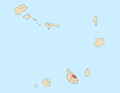
 Boa Vista county, Cape Verde.png 1,317 × 1,017; 31 KB
-
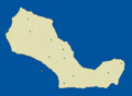
 Brava - Cape Verde.svg 512 × 602; 153 KB
-
 Brava county, Cape Verde.png 1,317 × 1,017; 31 KB
-
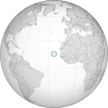 Cape Verde (orthographic projection).svg 553 × 553; 289 KB
-
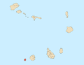
 Cape Verde counties numbered big.png 1,317 × 1,017; 41 KB
-
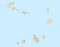 Cape Verde counties numbered.png 1,317 × 1,017; 32 KB
-
 Capitals Sao Nicolau.png 3,768 × 1,896; 122 KB
-
 Cezi.svg 629 × 814; 74 KB
-
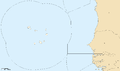 EEZ Cape Verde.png 1,988 × 1,170; 61 KB
-
 Fogo - Cape Verde.svg 512 × 554; 95 KB
-
 Image-Locator map of Maio, Cape Verde.png 1,317 × 1,017; 29 KB
-
 Jintang.svg 629 × 814; 73 KB
-
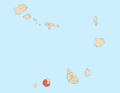
 Locator map of Brava, Cape Verde.png 1,317 × 1,017; 29 KB
-
 Locator map of Fogo, Cape Verde.png 1,317 × 1,017; 29 KB
-
 Locator map of Sal, Cape Verde.png 1,317 × 1,017; 29 KB
-
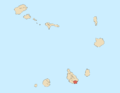
 Locator map of Santa Luzia, Cape Verde.png 1,317 × 1,017; 29 KB
-
 Locator map of Santiago, Cape Verde.png 1,317 × 1,017; 29 KB
-
 Locator map of Santo Antão, Cape Verde.png 1,317 × 1,017; 29 KB
-
 Locator map of São Nicolau, Cape Verde.png 1,317 × 1,017; 29 KB
-
 Locator map of São Vicente, Cape Verde.png 1,317 × 1,017; 29 KB
-
 Maio - Cape Verde.svg 512 × 798; 80 KB
-
 Maio county, Cape Verde.png 1,317 × 1,017; 31 KB
-
 Mosteiros county, Cape Verde.png 1,317 × 1,017; 31 KB
-
 Palop.svg 650 × 650; 152 KB
-
 Paul county, Cape Verde.png 1,317 × 1,017; 31 KB
-
 Porto Novo county, Cape Verde.png 1,317 × 1,017; 31 KB
-
 Praia county, Cape Verde.png 1,317 × 1,017; 31 KB
-
 Ribeira brava (with cities).png 3,768 × 1,896; 132 KB
-
 Ribeira brava (with roads).png 3,768 × 1,896; 178 KB
-
 Ribeira Brava county, Cape Verde.png 1,317 × 1,017; 31 KB
-
 Ribeira Brava.png 3,768 × 1,896; 100 KB
-
 Ribeira Grande county, Cape Verde.png 1,317 × 1,017; 31 KB
-
 Ribeira Grande de Santiago county, Cape Verde.png 1,317 × 1,017; 31 KB
-
 Sal - Cape Verde.svg 512 × 1,117; 79 KB
-
 Sal county, Cape Verde.png 1,317 × 1,017; 31 KB
-
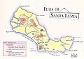 Sana Luzia draw.jpg 2,354 × 1,673; 880 KB
-
 Santa Catarina county, Cape Verde.png 1,317 × 1,017; 31 KB
-
 Santa Catarina do Fogo county, Cape Verde.png 1,317 × 1,017; 31 KB
-
 Santa Cruz county, Cape Verde.png 1,317 × 1,017; 31 KB
-
 Santa Luzia Complete.png 1,976 × 1,448; 1.07 MB
-
 Santa Luzia Mounts.png 1,976 × 1,448; 859 KB
-
 Santa Luzia Streams.png 1,976 × 1,448; 904 KB
-
 Santa Luzia.svg 640 × 460; 468 KB
-
 Santiago - Cape Verde.svg 512 × 649; 369 KB
-
 Santo Antão - Cape Verde.svg 512 × 399; 144 KB
-
 Sao Filipe county, Cape Verde.png 1,317 × 1,017; 31 KB
-
 Sao Nicolau Roads.png 3,768 × 1,896; 183 KB
-
 Sao Vicente county, Cape Verde.png 1,317 × 1,017; 31 KB
-
 São Domingos county, Cape Verde.png 1,317 × 1,017; 31 KB
-
 São Miguel county, Cape Verde.png 1,317 × 1,017; 31 KB
-
 São Nicolau - Cape Verde.svg 512 × 258; 131 KB
-
 São Salvador do Mundo county, Cape Verde.png 1,317 × 1,017; 31 KB
-
 São Vicente - Cape Verde.svg 512 × 343; 123 KB
-
 Tarrafal (with cities).png 3,768 × 1,896; 127 KB
-
 Tarrafal (with roads).png 3,768 × 1,896; 178 KB
-
 Tarrafal county, Cape Verde.png 1,317 × 1,017; 31 KB
-
 Tarrafal de Sao Nicolau.png 3,768 × 1,896; 99 KB
-
 Tarrafal SN county, Cape Verde.png 1,317 × 1,017; 31 KB
-
 Vila da Ribeira brava.png 3,768 × 1,896; 111 KB
-
 Vila do Tarrafal.png 3,768 × 1,896; 118 KB
.png)


.svg)


.png)
.png)


.png)
.png)


