Category:Maps by User:Pomfuttge
Jump to navigation
Jump to search
Deutsch: Diese Kategorie ist für die Karten von Benutzer:Pomfuttge.
English: This category is for the maps by User:Pomfuttge.
Subcategories
This category has only the following subcategory.
Media in category "Maps by User:Pomfuttge"
The following 200 files are in this category, out of 758 total.
(previous page) (next page)-
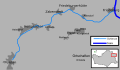
 Verlauf Wipper (Harz).png 1,750 × 948; 263 KB
-
 KarteSchlenze.svg 858 × 494; 130 KB
-
 Thondorf in Siersleben.svg 307 × 445; 10 KB
-
 Zugstrecke Berlin-Halle Verlauf.png 145 × 138; 3 KB
-
 Griftbäche.svg 867 × 330; 91 KB
-
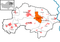
 Districts of Allstedt.svg 435 × 730; 174 KB
-
 Beyernaumburg in Allstedt.svg 435 × 730; 174 KB
-
 Emseloh in Allstedt.svg 435 × 730; 174 KB
-
 Holdenstedt in Allstedt.svg 435 × 730; 174 KB
-
 Katharinenrieth in Allstedt.svg 435 × 730; 175 KB
-
 Liedersdorf in Allstedt.svg 435 × 730; 175 KB
-
 Mittelhausen in Allstedt.svg 435 × 730; 175 KB
-
 Niederröblingen in Allstedt.svg 435 × 730; 175 KB
-
 Nienstedt in Allstedt.svg 435 × 730; 174 KB
-
 Pölsfeld in Allstedt.svg 435 × 730; 174 KB
-
 Sotterhausen in Allstedt.svg 435 × 730; 174 KB
-
 Winkel in Allstedt.svg 435 × 730; 174 KB
-
 Wolferstedt in Allstedt.svg 435 × 730; 174 KB
-
 Alterode in Arnstein (Mansfelder Land).svg 502 × 310; 162 KB
-
 Arnstedt in Arnstein (Mansfelder Land).svg 502 × 310; 162 KB
-
 Bräunrode in Arnstein (Mansfelder Land).svg 502 × 310; 162 KB
-
 Districts of Arnstein (Mansfelder Land).svg 502 × 310; 162 KB
-
 Greifenhagen in Arnstein (Mansfelder Land).svg 502 × 310; 162 KB
-
 Harkerode in Arnstein (Mansfelder Land).svg 502 × 310; 162 KB
-
 Quenstedt in Arnstein (Mansfelder Land).svg 502 × 310; 162 KB
-
 Sandersleben in Arnstein (Mansfelder Land).svg 502 × 310; 162 KB
-
 Stangerode in Arnstein (Mansfelder Land).svg 502 × 310; 162 KB
-
 Sylda in Arnstein (Mansfelder Land).svg 502 × 310; 162 KB
-
 Ulzigerode in Arnstein (Mansfelder Land).svg 502 × 310; 162 KB
-
 Welbsleben in Arnstein (Mansfelder Land).svg 502 × 310; 162 KB
-
 Wiederstedt in Arnstein (Mansfelder Land).svg 502 × 310; 162 KB
-
 Aschersleben in Aschersleben.svg 1,396 × 1,432; 146 KB
-
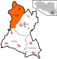
 Districts of Aschersleben.svg 1,396 × 1,432; 146 KB
-
 Drohndorf in Aschersleben.svg 1,396 × 1,432; 154 KB
-
 Freckleben in Aschersleben.svg 1,396 × 1,432; 154 KB
-
 Groß Schierstedt in Aschersleben.svg 1,396 × 1,432; 146 KB
-
 Klein Schierstedt in Aschersleben.svg 1,396 × 1,432; 146 KB
-
 Mehringen in Aschersleben.svg 1,396 × 1,432; 154 KB
-
 Neu Königsaue in Aschersleben.svg 1,396 × 1,432; 146 KB
-
 Schackenthal in Aschersleben.svg 1,396 × 1,432; 146 KB
-
 Schackstedt in Aschersleben.svg 1,396 × 1,432; 154 KB
-
 Westdorf in Aschersleben.svg 1,396 × 1,432; 154 KB
-
 Wilsleben in Aschersleben.svg 1,396 × 1,432; 154 KB
-
 Winningen in Aschersleben.svg 1,396 × 1,432; 146 KB
-
 Altenroda in Bad Bibra.svg 850 × 905; 77 KB
-
 Bad Bibra in Bad Bibra.svg 850 × 905; 77 KB
-
 Districts of Bad Bibra.svg 850 × 905; 77 KB
-
 Golzen in Bad Bibra.svg 850 × 905; 77 KB
-
 Krawinkel in Bad Bibra.svg 850 × 905; 77 KB
-
 Thalwinkel in Bad Bibra.svg 850 × 905; 77 KB
-
 Bad Dürrenberg in Bad Dürrenberg.svg 1,027 × 882; 74 KB
-
 Districts of Bad Dürrenberg.svg 1,027 × 882; 74 KB
-
 Nempitz in Bad Dürrenberg.svg 1,027 × 882; 74 KB
-
 Oebles-Schlechtewitz in Bad Dürrenberg.svg 1,027 × 882; 74 KB
-
 Tollwitz in Bad Dürrenberg.svg 1,027 × 882; 74 KB
-
 Breitenhagen in Barby.svg 383 × 446; 116 KB
-
 Districts of Barby.svg 383 × 446; 116 KB
-
 Glinde in Barby.svg 383 × 446; 116 KB
-
 Gnadau in Barby.svg 383 × 446; 116 KB
-
 Groß Rosenburg in Barby.svg 383 × 446; 116 KB
-
 Lödderitz in Barby.svg 383 × 446; 116 KB
-
 Pömmelte in Barby.svg 383 × 446; 116 KB
-
 Sachsendorf in Barby.svg 383 × 446; 116 KB
-
 Tornitz in Barby.svg 383 × 446; 116 KB
-
 Wespen in Barby.svg 383 × 446; 116 KB
-
 Zuchau in Barby.svg 383 × 446; 116 KB
-
 Aderstedt in Bernburg.svg 1,157 × 946; 112 KB
-
 Baalberge in Bernburg.svg 1,157 × 946; 112 KB
-
 Bernburg in Bernburg.svg 1,157 × 946; 112 KB
-
 Biendorf in Bernburg.svg 1,157 × 946; 112 KB
-
 Districts of Bernburg.svg 1,157 × 946; 118 KB
-
 Gröna in Bernburg.svg 1,157 × 946; 112 KB
-
 Peißen in Bernburg.svg 1,157 × 946; 112 KB
-
 Poley in Bernburg.svg 1,157 × 946; 112 KB
-
 Preußlitz in Bernburg.svg 1,157 × 946; 112 KB
-
 Wohlsdorf in Bernburg.svg 1,157 × 946; 112 KB
-
 Bitterfeld in Bitterfeld-Wolfen.svg 674 × 585; 112 KB
-
 Bobbau in Bitterfeld-Wolfen.svg 674 × 585; 112 KB
-
 Districts of Bitterfeld-Wolfen.svg 674 × 585; 112 KB
-
 Greppin in Bitterfeld-Wolfen.svg 674 × 585; 112 KB
-
 Holzweißig in Bitterfeld-Wolfen.svg 674 × 585; 112 KB
-
 Reuden in Bitterfeld-Wolfen.svg 674 × 585; 112 KB
-
 Rödgen in Bitterfeld-Wolfen.svg 674 × 585; 112 KB
-
 Thalheim in Bitterfeld-Wolfen.svg 674 × 585; 112 KB
-
 Wolfen in Bitterfeld-Wolfen.svg 674 × 585; 112 KB
-
 Braunsbedra in Braunsbedra.svg 395 × 415; 75 KB
-
 Districts of Braunsbedra.svg 395 × 415; 74 KB
-
 Frankleben in Braunsbedra.svg 395 × 415; 74 KB
-
 Großkayna in Braunsbedra.svg 395 × 415; 74 KB
-
 Krumpa in Braunsbedra.svg 395 × 415; 74 KB
-
 Roßbach in Braunsbedra.svg 395 × 415; 74 KB
-
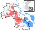
 Brücken in Brücken-Hackpfüffel.svg 331 × 336; 61 KB
-
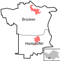 Districts of Brücken-Hackpfüffel.svg 331 × 336; 61 KB
-
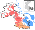
 Hackpfüffel in Brücken-Hackpfüffel.svg 331 × 336; 61 KB
-
 Bundesstraße 250 HE Verlauf.svg 592 × 801; 449 KB
-
 Bundesstraße 250 SA Verlauf.svg 592 × 801; 450 KB
-
 Bundesautobahn 535 Verlauf.png 655 × 642; 16 KB
-
 Bundesstraße 249 Verlauf.PNG 323 × 404; 10 KB
-
 Bundesstraße 252 Verlauf.PNG 320 × 400; 10 KB
-
 Bundesstraße 256 Verlauf.PNG 323 × 404; 10 KB
-
 Bundesstraße 273 Verlauf.PNG 320 × 400; 10 KB
-
 Verlauf B 250 ST.PNG 323 × 404; 10 KB
-
 Biere in Bördeland.svg 443 × 444; 77 KB
-
 Districts of Bördeland.svg 443 × 444; 77 KB
-
 Eggersdorf in Bördeland.svg 443 × 444; 77 KB
-
 Eickendorf in Bördeland.svg 443 × 444; 77 KB
-
 Großmühlingen in Bördeland.svg 443 × 444; 77 KB
-
 Kleinmühlingen in Bördeland.svg 443 × 444; 77 KB
-
 Welsleben in Bördeland.svg 443 × 444; 77 KB
-
 Zens in Bördeland.svg 443 × 444; 77 KB
-
 Calbe in Calbe.svg 611 × 525; 32 KB
-
 Districts of Calbe.svg 611 × 525; 32 KB
-
 Schwarz in Calbe.svg 611 × 525; 32 KB
-
 Trabitz in Calbe.svg 611 × 525; 32 KB
-
 Alten in Dessau-Roßlau.svg 587 × 629; 2.13 MB
-
 Brambach in Dessau-Roßlau.svg 587 × 629; 2.13 MB
-
 Großkühnau in Dessau-Roßlau.svg 587 × 629; 2.13 MB
-
 Haideburg in Dessau-Roßlau.svg 587 × 629; 2.13 MB
-
 IB Mitte in Dessau-Roßlau.svg 587 × 629; 2.13 MB
-
 IB Nord in Dessau-Roßlau.svg 587 × 629; 2.13 MB
-
 IB Süd in Dessau-Roßlau.svg 587 × 629; 2.13 MB
-
 Kleinkühnau in Dessau-Roßlau.svg 587 × 629; 2.13 MB
-
 Kleutsch in Dessau-Roßlau.svg 587 × 629; 2.13 MB
-
 Kochstedt in Dessau-Roßlau.svg 587 × 629; 2.13 MB
-
 Meinsdorf in Dessau-Roßlau.svg 587 × 629; 2.13 MB
-
 Mildensee in Dessau-Roßlau.svg 587 × 629; 2.13 MB
-
 Mosigkau in Dessau-Roßlau.svg 587 × 629; 2.13 MB
-
 Mühlstedt in Dessau-Roßlau.svg 587 × 629; 2.13 MB
-
 Rodleben in Dessau-Roßlau.svg 587 × 629; 2.13 MB
-
 Roßlau (Elbe) in Dessau-Roßlau.svg 587 × 629; 2.13 MB
-
 Siedlung in Dessau-Roßlau.svg 587 × 629; 2.13 MB
-
 Sollnitz in Dessau-Roßlau.svg 587 × 629; 2.13 MB
-
 Streetz-Natho in Dessau-Roßlau.svg 587 × 629; 2.13 MB
-
 Süd in Dessau-Roßlau.svg 587 × 629; 2.13 MB
-
 Törten in Dessau-Roßlau.svg 587 × 629; 2.13 MB
-
 Waldersee in Dessau-Roßlau.svg 587 × 629; 2.13 MB
-
 West in Dessau-Roßlau.svg 587 × 629; 2.13 MB
-
 Ziebigk in Dessau-Roßlau.svg 587 × 629; 2.13 MB
-
 Zoberberg in Dessau-Roßlau.svg 587 × 629; 2.13 MB
-
 Bischofrode in Eisleben.svg 744 × 1,052; 190 KB
-
 Burgsdorf in Eisleben.svg 744 × 1,052; 182 KB
-
 Districts of Eisleben (white version).svg 744 × 1,052; 117 KB
-
 Districts of Eisleben.svg 744 × 1,052; 190 KB
-
 Hedersleben in Eisleben.svg 744 × 1,052; 182 KB
-
 Helfta in Eisleben.svg 744 × 1,052; 182 KB
-
 Oberrißdorf in Eisleben.svg 744 × 1,052; 182 KB
-
 Osterhausen in Eisleben.svg 744 × 1,052; 182 KB
-
 Polleben in Eisleben.svg 744 × 1,052; 182 KB
-
 Rotenschirmbach in Eisleben.svg 744 × 1,052; 182 KB
-
 Schmalzerode in Eisleben.svg 744 × 1,052; 182 KB
-
 Unterrißdorf in Eisleben.svg 744 × 1,052; 182 KB
-
 Volkstedt in Eisleben.svg 744 × 1,052; 182 KB
-
 Wolferode in Eisleben.svg 744 × 1,052; 182 KB
-
 Bornitz in Elsteraue.svg 595 × 616; 143 KB
-
 Districts of Elsteraue.svg 595 × 616; 142 KB
-
 Draschwitz in Elsteraue.svg 595 × 616; 142 KB
-
 Göbitz in Elsteraue.svg 595 × 616; 142 KB
-
 Könderitz in Elsteraue.svg 595 × 616; 142 KB
-
 Langendorf in Elsteraue.svg 595 × 616; 142 KB
-
 Profen in Elsteraue.svg 595 × 616; 142 KB
-
 Rehmsdorf in Elsteraue.svg 595 × 616; 142 KB
-
 Reuden in Elsteraue.svg 595 × 616; 142 KB
-
 Spora in Elsteraue.svg 595 × 616; 142 KB
-
 Tröglitz in Elsteraue.svg 595 × 616; 142 KB
-
 Districts of Falkenstein,Harz.svg 410 × 445; 87 KB
-
 Endorf in Falkenstein,Harz.svg 410 × 445; 87 KB
-
 Ermsleben in Falkenstein,Harz.svg 410 × 445; 87 KB
-
 Meisdorf in Falkenstein,Harz.svg 410 × 445; 87 KB
-
 Neuplatendorf in Falkenstein,Harz.svg 410 × 445; 87 KB
-
 Pansfelde in Falkenstein,Harz.svg 410 × 445; 87 KB
-
 Reinstedt in Falkenstein,Harz.svg 410 × 445; 87 KB
-
 Wieserode in Falkenstein,Harz.svg 410 × 445; 87 KB
-
 Friesenfeld1000.JPG 252 × 197; 25 KB
-
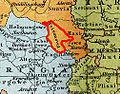
 Gau Daleminzen Lage.JPG 393 × 329; 56 KB
-
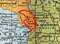 Hassegau1000.JPG 273 × 197; 27 KB
-
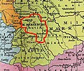 Gau Chutizi Lage.JPG 351 × 299; 47 KB
-
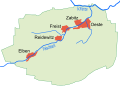 Villages Freist.svg 537 × 386; 34 KB
-
 Augsdorf in Gerbstedt.svg 1,293 × 914; 809 KB
-
 Districts of Gerbstedt.svg 1,293 × 914; 805 KB
-
 Freist in Gerbstedt.svg 1,293 × 914; 805 KB
-
 Friedeburg in Gerbstedt.svg 1,293 × 914; 805 KB
-
 Friedeburgerhütte in Gerbstedt.svg 1,293 × 914; 805 KB
-
 Gerbstedt in Gerbstedt.svg 1,293 × 914; 805 KB
-
 Heiligenthal in Gerbstedt.svg 1,293 × 914; 805 KB
-
 Hübitz in Gerbstedt.svg 1,293 × 914; 805 KB
-
 Ihlewitz in Gerbstedt.svg 1,293 × 914; 805 KB
-
 Rottelsdorf in Gerbstedt.svg 1,293 × 914; 805 KB
-
 Siersleben in Gerbstedt.svg 1,293 × 914; 805 KB
-
 Welfesholz in Gerbstedt.svg 1,293 × 914; 805 KB
-
 Zabenstedt in Gerbstedt.svg 1,293 × 914; 805 KB
-
 GerbstedtAufteilungFläche.svg 1,293 × 914; 668 KB
-
 Bergisdorf in Gutenborn.svg 427 × 442; 80 KB
-
 Districts of Gutenborn.svg 427 × 442; 78 KB
-
 Droßdorf in Gutenborn.svg 427 × 442; 78 KB
-
 Heuckewalde in Gutenborn.svg 427 × 442; 78 KB
-
 Schellbach in Gutenborn.svg 427 × 442; 78 KB
-
 Halle (Saale), nördl. Innenstadt.svg 626 × 655; 27 KB
-
 HAltstadt.svg 626 × 655; 26 KB
-
 HAm WasserturmTviertel.svg 626 × 655; 26 KB
-
 HBeesenAmmendorf.svg 626 × 655; 27 KB
.png)


.svg)
.svg)
.svg)
.svg)
.svg)
.svg)
.svg)
.svg)
.svg)
.svg)
.svg)
.svg)
.svg)


_in_Dessau-Ro%C3%9Flau.svg)


.svg)


,_n%C3%B6rdl._Innenstadt.svg)


