Category:Maps by User:Nyttend
Jump to navigation
Jump to search

|
All locator map images in this category could be re-created using vector graphics as SVG files. This has several advantages; see Commons:Media for cleanup for more information. If an SVG form of this image is available, please upload it and afterwards replace this template with
{{vector version available|new image name}}. |
This is a user-specific subcategory for maps created by User:Nyttend. No image uploaded by other users should be added to this category.
Media in category "Maps by User:Nyttend"
The following 200 files are in this category, out of 3,199 total.
(previous page) (next page)-
 Aberdeen Micropolitan Area.png 568 × 366; 21 KB
-
 Adair counties in the USA.png 1,513 × 983; 171 KB
-
 Adams counties in the USA.png 1,513 × 983; 171 KB
-
 African use of the shilling.png 600 × 600; 44 KB
-
 Akron Metropolitan Area.png 400 × 450; 23 KB
-
 Alaska boroughs and census areas in color.png 356 × 262; 8 KB
-
 Albany-Corvallis-Lebanon CSA.png 567 × 434; 25 KB
-
 Albany-Schenectady-Amsterdam CSA.png 571 × 431; 29 KB
-
 Albany-Schenectady-Amsterdam CSA.svg 6,599 × 5,030; 125 KB
-
 Albuquerque Metropolitan Area.png 404 × 447; 15 KB
-
 Allen counties in the USA.png 1,513 × 983; 171 KB
-
 Americus Micropolitan Area.png 424 × 503; 39 KB
-
 Ames-Boone CSA.png 576 × 395; 21 KB
-
 Anchorage Metropolitan Area.png 955 × 541; 43 KB
-
 Anderson counties in the USA.png 1,513 × 983; 171 KB
-
 Androscoggin County Maine Incorporated Areas Auburn Highlighted.png 450 × 386; 31 KB
-
 Androscoggin County Maine Incorporated Areas Durham Highlighted.png 450 × 386; 31 KB
-
 Androscoggin County Maine Incorporated Areas Greene Highlighted.png 450 × 386; 31 KB
-
 Androscoggin County Maine Incorporated Areas Leeds Highlighted.png 450 × 386; 31 KB
-

-

-

-

-

-
 Androscoggin County Maine Incorporated Areas Minot Highlighted.png 450 × 386; 31 KB
-
 Androscoggin County Maine Incorporated Areas Poland Highlighted.png 450 × 386; 31 KB
-

-
 Androscoggin County Maine Incorporated Areas Turner Highlighted.png 450 × 386; 31 KB
-
 Androscoggin County Maine Incorporated Areas Wales Highlighted.png 450 × 386; 31 KB
-
 Appalachian Ohio Counties.png 274 × 300; 12 KB
-
 Appleton-Oshkosh-Neenah CSA.png 434 × 459; 23 KB
-
 Ardmore Micropolitan Area.png 574 × 293; 20 KB
-
 Asheville-Brevard CSA.png 654 × 266; 29 KB
-
 Baltimore-Towson Metropolitan Area.png 566 × 311; 22 KB
-
 Baton Rouge-Pierre Part CSA.png 542 × 490; 36 KB
-
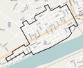 Beaver Historic District map.png 720 × 588; 261 KB
-
 Beckley-Oak Hill CSA.png 524 × 471; 29 KB
-
 Bend-Prineville CSA.png 567 × 434; 25 KB
-
 Benton counties in the USA.png 1,513 × 983; 171 KB
-
 Billings Metropolitan Area.png 539 × 313; 24 KB
-
 Binghamton Metropolitan Area.png 571 × 431; 28 KB
-
 Birmingham-Hoover Metropolitan Area.png 245 × 385; 18 KB
-
 Bismarck Metropolitan Area.png 566 × 346; 19 KB
-
 Blacksburg-Christiansburg-Radford Metropolitan Area.png 638 × 293; 33 KB
-
 Blaine counties in the USA.png 1,513 × 983; 171 KB
-
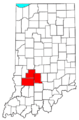 Bloomington Metropolitan Area.png 301 × 456; 18 KB
-
 Bloomsburg-Berwick Micropolitan Area.png 565 × 361; 27 KB
-
 Boise City-Nampa Metropolitan Area.png 335 × 503; 19 KB
-
 Boone counties in the USA.png 1,513 × 983; 171 KB
-
 Brainerd Micropolitan Area.png 440 × 498; 24 KB
-
 Branson micropolitan area.png 533 × 473; 29 KB
-
 Bridgewater Historic District map (Pennsylvania).png 385 × 481; 151 KB
-
 Brown counties in the USA.png 1,513 × 983; 171 KB
-
 Burley Micropolitan Area.png 335 × 503; 19 KB
-
 Burlington-South Burlington Metropolitan Area.png 285 × 460; 15 KB
-
 Butler counties in the USA.png 1,513 × 983; 171 KB
-
 Caldwell counties in the USA.png 1,513 × 983; 171 KB
-
 Calhoun counties in the USA.png 1,513 × 983; 171 KB
-
 Camden counties in the USA.png 1,513 × 983; 171 KB
-
 Camden Micropolitan Area.png 545 × 475; 33 KB
-
 Campbell counties in the USA.png 1,513 × 983; 171 KB
-
 Canton-Massillon Metropolitan Area.png 400 × 450; 23 KB
-
 Carbon counties in the USA.png 1,513 × 983; 171 KB
-
 Carroll counties in the USA.png 1,513 × 983; 171 KB
-
 Champaign-Urbana Metropolitan Area.png 298 × 494; 20 KB
-
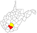
 Charleston, WV Metropolitan Area.png 524 × 471; 29 KB
-
 Charleston-Mattoon Micropolitan Area.png 298 × 494; 20 KB
-
 Charleston-North Charleston Metropolitan Area.png 541 × 437; 29 KB
-
 Charlottesville Metropolitan Area.png 638 × 293; 33 KB
-
 Clarksburg Micropolitan Area and Fairmont-Clarksburg CSA.png 524 × 471; 29 KB
-
 Cleveland, Tennessee Metropolitan Area.png 625 × 173; 22 KB
-
 Clovis-Portales CSA.png 404 × 447; 15 KB
-
 Columbia-Newberry CSA.png 541 × 437; 30 KB
-
 Cookeville Micropolitan Area.png 625 × 173; 22 KB
-
 Corbin-London CSA.png 651 × 291; 34 KB
-
 Dalton Metropolitan Area.png 424 × 503; 39 KB
-
 Danville Metropolitan Area.png 638 × 293; 32 KB
-
 Danville Micropolitan Area.png 651 × 291; 34 KB
-
 Dayton Metropolitan Area.png 400 × 450; 23 KB
-
 Denver-Aurora Metropolitan Area.png 569 × 414; 25 KB
-
 Des Moines-Newton-Pella CSA.png 576 × 395; 21 KB
-
 Dickinson Micropolitan Area.png 566 × 346; 19 KB
-
 Dothan Metropolitan Area.png 245 × 385; 18 KB
-
 Dothan-Enterprise-Ozark CSA.png 245 × 385; 25 KB
-
 Douglas Micropolitan Area.png 424 × 503; 39 KB
-
 Dublin Micropolitan Area.png 424 × 503; 39 KB
-
 Elizabeth City Micropolitan Area.png 654 × 266; 29 KB
-
 Elko Micropolitan Area.png 321 × 465; 12 KB
-
 Emporia Micropolitan Area.png 567 × 308; 19 KB
-
 Enterprise-Ozark Micropolitan Area.png 245 × 385; 18 KB
-
 Fitzgerald Micropolitan Area.png 424 × 503; 39 KB
-
 Florence Metropolitan Area.png 541 × 437; 29 KB
-
 Fond du Lac-Beaver Dam CSA.png 434 × 459; 23 KB
-
 Fort Polk South-De Ridder CSA.png 542 × 490; 36 KB
-
 Fort Wayne-Huntington-Auburn CSA.png 301 × 456; 10 KB
-
 Fresno-Madera CSA.png 421 × 489; 24 KB
-
 Gainesville Metropolitan Area.png 2,560 × 2,552; 684 KB
-
 Glasgow Micropolitan Area.png 651 × 291; 34 KB
-
 Green Bay Metropolitan Area.png 434 × 459; 23 KB
-
 Greensboro-Winston-Salem-High Point CSA.png 654 × 266; 40 KB
-
 Greenville-Mauldin-Easley Metropolitan Area.png 541 × 437; 30 KB
-
 Hannibal Micropolitan Area.png 533 × 473; 29 KB
-

-
 Harrison Micropolitan Area.png 545 × 475; 33 KB
-
 Harrisonburg Metropolitan Area.png 638 × 293; 32 KB
-

-
 Helena Micropolitan Area.png 539 × 313; 24 KB
-
 Hilton Head Island-Beaufort Micropolitan Area.png 541 × 437; 29 KB
-
 Hope Micropolitan Area.png 545 × 475; 33 KB
-
 Houston-Baytown-Huntsville CSA.png 579 × 550; 57 KB
-
 Huntsville-Decatur CSA.png 245 × 385; 18 KB
-
 Idaho Falls Metropolitan Area and Idaho Falls-Blackfoot CSA.png 335 × 503; 19 KB
-
 Illinois flooding disaster areas, April 2013.png 298 × 494; 27 KB
-
 Ithaca-Cortland CSA.png 571 × 431; 28 KB
-
 Jackson-Humboldt CSA.png 625 × 173; 22 KB
-
 Jacksonville Micropolitan Area.png 298 × 494; 20 KB
-
 Jasper Micropolitan Area.png 301 × 456; 18 KB
-
 Johnson City Metropolitan Area.png 625 × 173; 22 KB
-
 Joplin Metropolitan Area.png 533 × 473; 29 KB
-
 Kennewick-Richland-Pasco Metropolitan Area.png 581 × 385; 29 KB
-
 Kirksville micropolitan area.png 533 × 473; 29 KB
-
 Knoxville-Sevierville-La Follette CSA.png 625 × 173; 23 KB
-
 Kokomo-Peru CSA.png 301 × 456; 10 KB
-
 Lafayette-Frankfort CSA.png 301 × 456; 18 KB
-
 Lansing-East Lansing-Owosso CSA.png 435 × 497; 28 KB
-
 Las Vegas-Paradise-Pahrump CSA.png 321 × 465; 12 KB
-
 Lexington-Fayette-Frankfort-Richmond CSA.png 651 × 291; 35 KB
-
 Lumberton-Laurinburg CSA.png 654 × 266; 29 KB
-
 Lynchburg Metropolitan Area.png 638 × 293; 33 KB
-
 Macon-Warner Robins-Fort Valley CSA.png 424 × 503; 39 KB
-
 Madison-Baraboo CSA.png 434 × 459; 23 KB
-
 Manhattan Micropolitan Area.png 567 × 308; 19 KB
-
 Mankato-North Mankato Micropolitan Area.png 440 × 498; 24 KB
-
 Map of Adams County Ohio Highlighting Bratton Township.png 494 × 654; 30 KB
-
 Map of Adams County Ohio Highlighting Brush Creek Township.png 494 × 654; 30 KB
-
 Map of Adams County Ohio Highlighting Cherry Fork Village.png 494 × 654; 30 KB
-
 Map of Adams County Ohio Highlighting Franklin Township.png 494 × 654; 30 KB
-
 Map of Adams County Ohio Highlighting Green Township.png 494 × 654; 30 KB
-
 Map of Adams County Ohio Highlighting Jefferson Township.png 494 × 654; 30 KB
-
 Map of Adams County Ohio Highlighting Liberty Township.png 494 × 654; 30 KB
-
 Map of Adams County Ohio Highlighting Manchester Township.png 494 × 654; 30 KB
-
 Map of Adams County Ohio Highlighting Manchester Village.png 494 × 654; 30 KB
-
 Map of Adams County Ohio Highlighting Meigs Township.png 494 × 654; 30 KB
-
 Map of Adams County Ohio Highlighting Monroe Township.png 494 × 654; 30 KB
-
 Map of Adams County Ohio Highlighting Oliver Township.png 494 × 654; 30 KB
-
 Map of Adams County Ohio Highlighting Peebles Village.png 494 × 654; 30 KB
-
 Map of Adams County Ohio Highlighting Rome Village.png 494 × 654; 30 KB
-
 Map of Adams County Ohio Highlighting Scott Township.png 494 × 654; 30 KB
-
 Map of Adams County Ohio Highlighting Seaman Village.png 494 × 654; 30 KB
-
 Map of Adams County Ohio Highlighting Sprigg Township.png 494 × 654; 30 KB
-
 Map of Adams County Ohio Highlighting Tiffin Township.png 494 × 654; 30 KB
-
 Map of Adams County Ohio Highlighting Wayne Township.png 494 × 654; 30 KB
-
 Map of Adams County Ohio Highlighting West Union Village.png 494 × 654; 30 KB
-
 Map of Adams County Ohio Highlighting Winchester Township.png 494 × 654; 30 KB
-
 Map of Adams County Ohio Highlighting Winchester Village.png 494 × 654; 30 KB
-
 Map of Adams County, Ohio No Text, Municipalities Distinct.png 494 × 654; 30 KB
-
 Map of Adams County, Ohio No Text.png 494 × 654; 29 KB
-
 Map of Allen County Ohio Highlighting Amanda Township.png 566 × 399; 20 KB
-
 Map of Allen County Ohio Highlighting American Township.png 566 × 399; 20 KB
-
 Map of Allen County Ohio Highlighting Auglaize Township.png 566 × 399; 20 KB
-
 Map of Allen County Ohio Highlighting Bath Township.png 566 × 399; 20 KB
-
 Map of Allen County Ohio Highlighting Beaverdam Village.png 566 × 399; 20 KB
-
 Map of Allen County Ohio Highlighting Bluffton Village.png 566 × 399; 20 KB
-
 Map of Allen County Ohio Highlighting Cairo Village.png 566 × 399; 20 KB
-
 Map of Allen County Ohio Highlighting Delphos City.png 566 × 399; 20 KB
-
 Map of Allen County Ohio Highlighting Elida Village.png 566 × 399; 20 KB
-
 Map of Allen County Ohio Highlighting Harrod Village.png 566 × 399; 20 KB
-
 Map of Allen County Ohio Highlighting Jackson Township.png 566 × 399; 20 KB
-
 Map of Allen County Ohio Highlighting Lafayette Village.png 566 × 399; 20 KB
-
 Map of Allen County Ohio Highlighting Lima City.png 566 × 399; 20 KB
-
 Map of Allen County Ohio Highlighting Marion Township.png 566 × 399; 20 KB
-
 Map of Allen County Ohio Highlighting Monroe Township.png 566 × 399; 20 KB
-
 Map of Allen County Ohio Highlighting Perry Township.png 566 × 399; 20 KB
-
 Map of Allen County Ohio Highlighting Richland Township.png 566 × 399; 20 KB
-
 Map of Allen County Ohio Highlighting Shawnee Township.png 566 × 399; 20 KB
-
 Map of Allen County Ohio Highlighting Spencer Township.png 566 × 399; 20 KB
-
 Map of Allen County Ohio Highlighting Spencerville Village.png 566 × 399; 20 KB
-
 Map of Allen County Ohio Highlighting Sugar Creek Township.png 566 × 399; 20 KB
-
 Map of Allen County, Ohio No Text, Municipalities Distinct.png 566 × 399; 20 KB
-
 Map of Allen County, Ohio No Text.png 566 × 399; 20 KB
-
 Map of Ashland County Ohio Highlighting Ashland City.png 345 × 782; 22 KB
-
 Map of Ashland County Ohio Highlighting Bailey Lakes Village.png 345 × 782; 22 KB
-
 Map of Ashland County Ohio Highlighting Clear Creek Township.png 345 × 782; 22 KB
-
 Map of Ashland County Ohio Highlighting Green Township.png 345 × 782; 22 KB
-
 Map of Ashland County Ohio Highlighting Hanover Township.png 345 × 782; 22 KB
-
 Map of Ashland County Ohio Highlighting Hayesville Village.png 345 × 782; 22 KB
-
 Map of Ashland County Ohio Highlighting Jackson Township.png 345 × 782; 22 KB
-
 Map of Ashland County Ohio Highlighting Jeromesville Village.png 345 × 782; 22 KB
-
 Map of Ashland County Ohio Highlighting Lake Township.png 345 × 782; 22 KB
-
 Map of Ashland County Ohio Highlighting Loudonville Village.png 345 × 782; 22 KB
-
 Map of Ashland County Ohio Highlighting Mifflin Township.png 345 × 782; 22 KB
-
 Map of Ashland County Ohio Highlighting Mifflin Village.png 345 × 782; 22 KB
-
 Map of Ashland County Ohio Highlighting Milton Township.png 345 × 782; 22 KB
-
 Map of Ashland County Ohio Highlighting Mohican Township.png 345 × 782; 22 KB
-
 Map of Ashland County Ohio Highlighting Montgomery Township.png 345 × 782; 22 KB
-
 Map of Ashland County Ohio Highlighting Orange Township.png 345 × 782; 22 KB
-
 Map of Ashland County Ohio Highlighting Perry Township.png 345 × 782; 22 KB
-
 Map of Ashland County Ohio Highlighting Perrysville Village.png 345 × 782; 22 KB
-
 Map of Ashland County Ohio Highlighting Polk Village.png 345 × 782; 22 KB
-
 Map of Ashland County Ohio Highlighting Ruggles Township.png 345 × 782; 22 KB


.png)


