Category:Maps by Pmau
Jump to navigation
Jump to search
Media in category "Maps by Pmau"
The following 200 files are in this category, out of 404 total.
(previous page) (next page)-
 Périmètre PN Cevennes.png 926 × 775; 969 KB
-
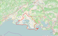
 Périmètre PN des Calanques.png 935 × 777; 298 KB
-
 Périmètre PN Ecrins.png 1,472 × 1,023; 1.16 MB
-
 Périmètre PN Guadeloupe.png 932 × 772; 271 KB
-
 Périmètre PN Guyane.png 1,047 × 804; 303 KB
-
 Périmètre PN Mercantour.png 1,047 × 803; 965 KB
-
 Périmètre PN Port-Cros.png 1,473 × 1,024; 225 KB
-
 Périmètre PN Pyrénées.png 1,473 × 1,021; 1.14 MB
-
 Périmètre PN Réunion.png 1,472 × 956; 622 KB
-
 Périmètre PN Vanoise.png 1,472 × 1,023; 931 KB
-
 Périmètre PNM Bassin d'Arcachon.png 1,091 × 872; 504 KB
-
 Périmètre PNM Cap Corse et Agriate.png 1,091 × 872; 384 KB
-
 Périmètre PNM des Glorieuses.png 1,091 × 872; 149 KB
-
 Périmètre PNM estuaire de la Gironde et mer des Pertuis.png 1,091 × 872; 814 KB
-
 Périmètre PNM estuaires picards et mer d'Opale.png 1,091 × 872; 749 KB
-
 Périmètre PNM Golfe du Lion.png 1,091 × 872; 721 KB
-
 Périmètre PNM Iroise.png 1,091 × 872; 518 KB
-
 Périmètre PNM Martinique.png 1,199 × 799; 108 KB
-
 Périmètre PNM Mayotte.png 1,091 × 872; 98 KB
-
 Périmètre PNR d'Armorique.png 1,297 × 798; 982 KB
-
 Périmètre PNR de Brière.png 1,299 × 797; 810 KB
-
 Périmètre PNR de Camargue.png 1,299 × 799; 1.07 MB
-
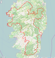 Périmètre PNR de Corse.png 1,000 × 1,049; 813 KB
-
 Périmètre PNR de Guyane.png 1,300 × 1,050; 416 KB
-
 Périmètre PNR de l'Avesnois.png 1,300 × 1,050; 1.16 MB
-
 Périmètre PNR de la Brenne.png 999 × 818; 1.02 MB
-
 Périmètre PNR de la Chartreuse.png 1,000 × 1,050; 1.05 MB
-
 Périmètre PNR de la Forêt d'Orient.png 1,295 × 799; 829 KB
-
 Périmètre PNR de la Haute Vallée de Chevreuse.png 1,297 × 818; 1.19 MB
-
 Périmètre PNR de la Montagne de Reims.png 1,098 × 817; 718 KB
-
 Périmètre PNR de la Narbonnaise en Méditerranée.png 997 × 816; 426 KB
-
 Périmètre PNR de Lorraine.png 1,297 × 817; 1.39 MB
-
 Périmètre PNR de Martinique.png 998 × 818; 289 KB
-
 Périmètre PNR de Millevaches en Limousin.png 998 × 817; 1.3 MB
-
 Périmètre PNR des Alpilles.png 997 × 818; 738 KB
-
 Périmètre PNR des Ardennes.png 1,500 × 1,050; 1.25 MB
-
 Périmètre PNR des Ballons des Vosges.png 1,000 × 1,050; 1.38 MB
-
 Périmètre PNR des Baronnies provençales.png 1,500 × 1,050; 1.63 MB
-
 Périmètre PNR des Boucles de la Seine normande.png 1,296 × 816; 1,014 KB
-
 Périmètre PNR des Caps et Marais d'Opale.png 1,500 × 1,050; 1.16 MB
-
 Périmètre PNR des Causses du Quercy.png 1,000 × 1,050; 1.54 MB
-
 Périmètre PNR des Grands Causses.png 1,000 × 1,050; 1.39 MB
-
 Périmètre PNR des Landes de Gascogne.png 1,000 × 1,050; 1.14 MB
-
 Périmètre PNR des Marais du Cotentin et du Bessin.png 997 × 818; 681 KB
-
 Périmètre PNR des Monts d'Ardèche.png 1,000 × 1,050; 1.49 MB
-
 Périmètre PNR des Préalpes d'Azur.png 1,297 × 817; 829 KB
-
 Périmètre PNR des Pyrénées ariégeoises.png 999 × 817; 969 KB
-
 Périmètre PNR des Pyrénées catalanes.png 1,498 × 818; 966 KB
-
 Périmètre PNR des Volcans d'Auvergne.png 999 × 1,298; 1.99 MB
-
 Périmètre PNR des Vosges du Nord.png 1,298 × 817; 1.46 MB
-
 Périmètre PNR du Golfe du Morbihan (2014).png 1,296 × 818; 919 KB
-
 Périmètre PNR du Gâtinais Français.png 1,000 × 1,050; 958 KB
-
 Périmètre PNR du Haut-Jura.png 998 × 1,050; 1.42 MB
-
 Périmètre PNR du Haut-Languedoc.png 1,295 × 817; 1.34 MB
-
 Périmètre PNR du Luberon.png 1,497 × 817; 1.12 MB
-
 Périmètre PNR du Marais poitevin.png 1,298 × 819; 1.09 MB
-
 Périmètre PNR du Massif des Bauges.png 1,000 × 1,050; 969 KB
-
 Périmètre PNR du Morvan.png 1,000 × 1,050; 1.37 MB
-
 Périmètre PNR du Perche.png 997 × 818; 1.11 MB
-
 Périmètre PNR du Pilat.png 1,297 × 817; 1.13 MB
-
 Périmètre PNR du Queyras.png 998 × 817; 647 KB
-
 Périmètre PNR du Vercors.png 1,297 × 818; 1.35 MB
-
 Périmètre PNR du Verdon.png 1,297 × 817; 1.27 MB
-
 Périmètre PNR du Vexin français.png 1,299 × 818; 1.08 MB
-
 Périmètre PNR Livradois-Forez.png 999 × 1,050; 1.55 MB
-
 Périmètre PNR Loire-Anjou-Touraine.png 1,295 × 817; 1.49 MB
-
 Périmètre PNR Normandie-Maine.png 1,296 × 819; 1.53 MB
-
 Périmètre PNR Oise-Pays de France.png 998 × 816; 694 KB
-
 Périmètre PNR Périgord Limousin.png 996 × 818; 1.28 MB
-
 Périmètre PNR Scarpe-Escaut.png 1,199 × 796; 968 KB
-
 Périmètre RNC Bouches de Bonifacio rnc147.png 1,236 × 823; 292 KB
-
 Périmètre RNC Iles Cerbicale rnc51.png 1,238 × 828; 360 KB
-
 Périmètre RNC Massif du Monte Rotondo rnc317.png 1,300 × 860; 553 KB
-
 Périmètre RNC Scandola rnc24.png 1,240 × 829; 238 KB
-
 Périmètre RNC Tre Padule de Suartone rnc151.png 1,234 × 821; 277 KB
-
 Périmètre RNC Étang de Biguglia rnc120.png 835 × 1,024; 385 KB
-
 Périmètre RNN Aiguilles Rouges rnn18.png 1,137 × 1,024; 1.11 MB
-
 Périmètre RNN Amana rnn138.png 1,236 × 825; 234 KB
-
 Périmètre RNN Bagnas rnn67.png 1,236 × 823; 1.03 MB
-
 Périmètre RNN Baie de Canche rnn87.png 1,237 × 825; 436 KB
-
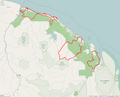
 Périmètre RNN Baie de l'Aiguillon (Charente Maritime) rnn146.png 1,236 × 822; 465 KB
-
 Périmètre RNN Baie de l'Aiguillon (Vendée) rnn130.png 1,237 × 824; 482 KB
-
 Périmètre RNN Baie de Saint-Brieuc rnn140.png 1,234 × 824; 875 KB
-
 Périmètre RNN Baie de Somme rnn118.png 1,236 × 823; 416 KB
-
 Périmètre RNN Bailletaz rnn150.png 1,234 × 822; 341 KB
-
 Périmètre RNN Ballons Comtois rnn153.png 1,237 × 1,055; 925 KB
-
 Périmètre RNN Banc d'Arguin rnn5.png 998 × 797; 236 KB
-
 Périmètre RNN Bois du Parc rnn39.png 1,240 × 826; 357 KB
-
 Périmètre RNN Bout du lac d'Annecy rnn21.png 1,240 × 827; 427 KB
-
 Périmètre RNN Camargue rnn22.png 1,241 × 826; 370 KB
-
 Périmètre RNN Carlaveyron rnn103.png 1,234 × 824; 652 KB
-
 Périmètre RNN Casse de la Belle Henriette rnn174.png 1,433 × 823; 514 KB
-
 Périmètre RNN Cerbère Banyuls rnn9.png 1,238 × 829; 464 KB
-
 Périmètre RNN Chalmessin rnn114.png 1,236 × 824; 329 KB
-
 Périmètre RNN Chastreix-Sancy rnn165.png 1,233 × 823; 703 KB
-
 Périmètre RNN Chaumes du Verniller rnn179.png 1,300 × 860; 531 KB
-
 Périmètre RNN Chérine rnn78.png 1,237 × 825; 671 KB
-
 Périmètre RNN Cirque du grand lac des Estaris rnn15.png 1,241 × 829; 387 KB
-
 Périmètre RNN Combe Lavaux Jean Roland rnn157.png 1,235 × 822; 627 KB
-
 Périmètre RNN Conat rnn82.png 1,236 × 825; 419 KB
-
 Périmètre RNN Contamines Montjoie rnn38.png 1,240 × 828; 578 KB
-
 Périmètre RNN Coteau de Mesnil Soleil rnn55.png 1,237 × 825; 312 KB
-
 Périmètre RNN Coteaux de la Seine rnn170.png 1,436 × 824; 695 KB
-
 Périmètre RNN Courant d'Huchet rnn57.png 1,237 × 825; 474 KB
-
 Périmètre RNN Coussouls de Crau rnn152.png 1,237 × 1,055; 835 KB
-
 Périmètre RNN Delta de la Dranse rnn43.png 1,239 × 828; 725 KB
-
 Périmètre RNN Delta de la Sauer rnn135.png 1,233 × 825; 652 KB
-
 Périmètre RNN Domaine de Beauguillot rnn42.png 1,238 × 827; 316 KB
-
 Périmètre RNN Dune Marchand rnn19.png 1,239 × 828; 560 KB
-
 Périmètre RNN Dunes et marais d'Hourtin rnn172.png 1,436 × 821; 315 KB
-
 Périmètre RNN Estagnol rnn27.png 1,239 × 827; 727 KB
-
 Périmètre RNN Estuaire de la Seine rnn137.png 1,235 × 827; 861 KB
-
 Périmètre RNN Etang de la Horre rnn149.png 1,236 × 824; 287 KB
-
 Périmètre RNN Etang de Saint-Paul rnn166.png 1,235 × 823; 769 KB
-
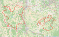
 Périmètre RNN Etang des Landes rnn158.png 1,233 × 824; 308 KB
-
 Périmètre RNN Etang du Grand-Lemps rnn115.png 1,236 × 824; 338 KB
-
 Périmètre RNN Etangs du Romelaëre rnn168.png 1,234 × 823; 376 KB
-
 Périmètre RNN Falaise du Cap Romain rnn69.png 1,236 × 824; 413 KB
-
 Périmètre RNN Forêt d'Erstein rnn98.png 1,237 × 825; 599 KB
-
 Périmètre RNN Forêt d'Offendorf rnn97.png 1,237 × 824; 543 KB
-
 Périmètre RNN Forêt de la Massane rnn6.png 1,350 × 900; 1,000 KB
-
 Périmètre RNN Forêt domaniale de Cerisy rnn28.png 1,239 × 829; 567 KB
-
 Périmètre RNN Frankenthal-Missheimle rnn126.png 1,235 × 824; 505 KB
-
 Périmètre RNN François le Bail Ile de Groix rnn63.png 1,236 × 825; 360 KB
-
 Périmètre RNN Frayère d'Alose rnn52.png 1,238 × 826; 1.31 MB
-
 Périmètre RNN Gorges de l'Ardèche rnn41.png 1,240 × 828; 657 KB
-
 Périmètre RNN Grande Sassière rnn7.png 1,348 × 900; 796 KB
-
 Périmètre RNN Grotte de Gravelle rnn110.png 1,234 × 825; 375 KB
-
 Périmètre RNN Grotte de Hautecourt rnn47.png 1,239 × 828; 408 KB
-
 Périmètre RNN Grotte du Carroussel rnn99.png 1,237 × 823; 155 KB
-
 Périmètre RNN Grotte du T.M.71 rnn88.png 1,236 × 825; 253 KB
-
 Périmètre RNN Grotte et pelouses d'Acquin rnn167.png 1,237 × 1,055; 628 KB
-
 Périmètre RNN Géologique de Saucats et La Brède rnn62.png 1,237 × 825; 525 KB
-
 Périmètre RNN Haute vallée de la Séveraisse rnn11.png 1,239 × 828; 264 KB
-
 Périmètre RNN Haute vallée de Saint-Pierre rnn12.png 1,238 × 827; 638 KB
-
 Périmètre RNN Haute vallée du Béranger rnn14.png 1,239 × 828; 432 KB
-
 Périmètre RNN Haute vallée du Vénéon rnn13.png 1,238 × 826; 262 KB
-
 Périmètre RNN Haute-chaîne du Jura rnn112.png 1,038 × 1,483; 1.74 MB
-
 Périmètre RNN Hauts de Chartreuse rnn136.png 1,234 × 823; 829 KB
-
 Périmètre RNN Hauts de Villaroger rnn101.png 1,236 × 826; 862 KB
-
 Périmètre RNN Hauts plateaux du Vercors rnn74.png 1,116 × 1,424; 1.09 MB
-
 Périmètre RNN Hettange-Grande rnn75.png 1,236 × 824; 657 KB
-
 Périmètre RNN Ile de la Platière rnn79.png 1,237 × 825; 950 KB
-
 Périmètre RNN Ile de Rhinau rnn106.png 800 × 1,058; 442 KB
-
 Périmètre RNN Ile du Girard rnn61.png 1,237 × 825; 356 KB
-
 Périmètre RNN Ile du Grand Connetable rnn109.png 1,238 × 826; 166 KB
-
 Périmètre RNN Ile du Rohrschollen rnn133.png 1,238 × 824; 1.25 MB
-
 Périmètre RNN Iles de la Petite-Terre rnn142.png 1,236 × 823; 206 KB
-
 Périmètre RNN Ilets de Sainte-Anne rnn125.png 1,237 × 825; 172 KB
-
 Périmètre RNN Ilot Mbouzi rnn162.png 1,235 × 822; 476 KB
-
 Périmètre RNN Iroise rnn108.png 1,234 × 822; 219 KB
-
 Périmètre RNN Jujols rnn83.png 1,237 × 825; 361 KB
-
 Périmètre RNN La Bassée rnn155.png 1,236 × 825; 453 KB
-
 Périmètre RNN La Désirade rnn173.png 1,434 × 824; 142 KB
-
 Périmètre RNN la Trinité rnn129.png 1,236 × 822; 301 KB
-
 Périmètre RNN La Truchère-Ratenelle rnn49.png 1,242 × 828; 380 KB
-
 Périmètre RNN Lac de Grand-Lieu rnn48.png 1,241 × 827; 763 KB
-
 Périmètre RNN Lac de Remoray rnn46.png 1,243 × 828; 470 KB
-
 Périmètre RNN Landes de Versigny rnn124.png 1,236 × 824; 279 KB
-
 Périmètre RNN Lilleau des Niges rnn45.png 1,239 × 827; 392 KB
-
 Périmètre RNN Mantet rnn72.png 1,237 × 825; 579 KB
-
 Périmètre RNN Marais d'Isle rnn58.png 1,235 × 825; 1.26 MB
-
 Périmètre RNN Marais d'Orx rnn123.png 1,233 × 823; 472 KB
-
 Périmètre RNN Marais d'Yves rnn53.png 1,239 × 825; 563 KB
-
 Périmètre RNN Marais de Bruges rnn64.png 1,237 × 824; 957 KB
-
 Périmètre RNN Marais de Kaw-Roura rnn139.png 1,235 × 824; 322 KB
-
 Périmètre RNN Marais de la Sangsuriere et Adriennerie rnn102.png 1,236 × 825; 440 KB
-
 Périmètre RNN Marais de Lavours rnn68.png 1,237 × 825; 632 KB
-
 Périmètre RNN Marais de Mullembourg rnn121.png 1,235 × 826; 672 KB
-
 Périmètre RNN Marais de Vesles et Caumont rnn134.png 1,235 × 822; 461 KB
-
 Périmètre RNN Marais Vernier rnn177.png 1,297 × 819; 363 KB
-
 Périmètre RNN Mare de Vauville rnn30.png 1,239 × 827; 247 KB
-
 Périmètre RNN Marine de la Réunion 2 rnn164.png 837 × 1,025; 575 KB
-
 Périmètre RNN Marine de la Réunion rnn164.png 1,234 × 824; 609 KB
-
 Périmètre RNN Mas Larrieu rnn70.png 1,237 × 825; 679 KB
-
 Périmètre RNN Massif du Ventron rnn95.png 1,237 × 825; 781 KB
-
 Périmètre RNN Michel Brosselin Saint-Denis du Payré rnn33.png 1,239 × 830; 423 KB
-
 Périmètre RNN Mont Grand Matoury rnn160.png 1,234 × 824; 519 KB
-
 Périmètre RNN Montenach rnn116.png 1,235 × 825; 390 KB
-
 Périmètre RNN Moëze-Oléron rnn77.png 1,237 × 825; 753 KB
-
 Périmètre RNN Nohèdes rnn84.png 1,237 × 825; 547 KB
-
 Périmètre RNN Nouragues rnn128.png 1,236 × 828; 316 KB
-
 Périmètre RNN Néouvielle rnn4.png 1,350 × 900; 1.05 MB
-
 Périmètre RNN Passy rnn50.png 1,241 × 828; 1.03 MB
-
 Périmètre RNN Patis d'Oger et du Mesnil sur Oger rnn159.png 1,233 × 823; 513 KB
-
 Périmètre RNN Petite Camargue alsacienne rnn60.png 1,237 × 825; 1.1 MB
-
 Périmètre RNN Pics du Combeynot rnn16.png 1,241 × 830; 901 KB
-
 Périmètre RNN Pinail rnn44.png 1,240 × 827; 384 KB
-
 Périmètre RNN Plaine des Maures rnn171.png 1,435 × 823; 789 KB
-
 Périmètre RNN Plan de Tuéda rnn100.png 1,237 × 824; 625 KB
-
 Périmètre RNN Platier d'Oye rnn86.png 1,237 × 825; 493 KB
-
 Périmètre RNN Pointe de Givet rnn145.png 1,436 × 1,055; 768 KB
-
 Périmètre RNN Prats de Mollo la Preste rnn81.png 1,236 × 825; 570 KB
-
 Périmètre RNN Presqu'ile de la Caravelle rnn29.png 1,240 × 828; 220 KB
-
 Périmètre RNN Prés salés d'Arès et de Lège Cap Ferret rnn65.png 1,237 × 825; 505 KB
-
 Périmètre RNN Py rnn71.png 1,237 × 825; 568 KB
-
 Périmètre RNN Ramières du Val de Drôme rnn89.png 1,437 × 1,055; 733 KB
-
 Périmètre RNN Ravin de Valbois rnn66.png 1,237 × 825; 520 KB
-
 Périmètre RNN Ristolas Mont-Viso rnn163.png 1,234 × 821; 670 KB
-
 Périmètre RNN Roc de Chère rnn36.png 1,238 × 827; 497 KB


.png)


_rnn146.png)
_rnn130.png)


