Category:Maps by Philipp Apian
Jump to navigation
Jump to search
Subcategories
This category has the following 2 subcategories, out of 2 total.
B
C
- Chorographia Bavariae (2 F)
Media in category "Maps by Philipp Apian"
The following 8 files are in this category, out of 8 total.
-
 1568 Schloss Ortenburg map Ortenburger Land 445.jpg 2,048 × 1,536; 2.11 MB
-
 Atlas Ortelius KB PPN369376781-053av-053br.jpg 3,000 × 2,194; 5.05 MB
-
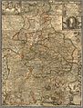
 Circulus Bavaricus-1688 (Rumsey).jpg 4,716 × 4,070; 7.31 MB
-
 Circulus Bavaricus-1688.jpg 5,500 × 4,782; 5.42 MB
-
 GrafschaftOrtenburg1568.JPG 761 × 936; 74 KB
-
 Gronsdf Karte von 1568.jpg 1,119 × 1,023; 320 KB
-
 Sacri Romani imperii circuli et electoratus Bavariæ tabula chorographica (1663).jpg 10,736 × 14,081; 68.46 MB
-
 Weinerus Bayern 1577.jpg 2,000 × 1,716; 1.51 MB


.jpg)


.jpg)
