Category:Maps by Noirlab
Jump to navigation
Jump to search
Media in category "Maps by Noirlab"
The following 50 files are in this category, out of 50 total.
-
 AURA astronomy centers and sites (aura-map).jpg 4,000 × 2,251; 1.15 MB
-
 AURA astronomy centers and sites (aura-map).tiff 4,000 × 2,251; 1,009 KB
-
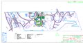
 AURA Recinto map (AURA-Recinto).jpg 943 × 492; 188 KB
-
 AURA Recinto map (AURA-Recinto).tiff 943 × 492; 467 KB
-
 Ernest B De Silva Elementary Map (EB-deSilva-Map).jpg 502 × 433; 42 KB
-
 Ernest B De Silva Elementary Map (EB-deSilva-Map).tiff 502 × 433; 253 KB
-
 Ha‘aheo Elementary Map (Haaheo-Elementary-Map).jpg 3,300 × 2,549; 435 KB
-
 Ha‘aheo Elementary Map (Haaheo-Elementary-Map).tiff 3,300 × 2,549; 1.78 MB
-
 Highlight012a graphic (highlight012a).jpg 750 × 750; 82 KB
-
 Highlight012a graphic (highlight012a).tiff 750 × 750; 129 KB
-
 Hilo High School Map (Hilo-High-Map).jpg 612 × 792; 96 KB
-
 Hilo High School Map (Hilo-High-Map).tiff 612 × 792; 295 KB
-
 Hilo Intermediate School Map (Hilo-Intermediate-Map).jpg 1,004 × 609; 125 KB
-
 Hilo Intermediate School Map (Hilo-Intermediate-Map).tiff 1,004 × 609; 353 KB
-
 Hilo Union Elementary School Map (Hilo-Union-Map).jpg 3,299 × 2,550; 834 KB
-
 Hilo Union Elementary School Map (Hilo-Union-Map).tiff 3,299 × 2,550; 3.82 MB
-
 Kalanianaole Elementary & Intermediate Map (Kalanianaole-Elementary-Map).jpg 3,300 × 2,549; 700 KB
-
 Kalanianaole Elementary & Intermediate Map (Kalanianaole-Elementary-Map).tiff 3,300 × 2,549; 3.01 MB
-
 Kapi‘olani Elementary Map (Kapiolani-Map).jpg 612 × 612; 60 KB
-
 Kapi‘olani Elementary Map (Kapiolani-Map).tiff 612 × 612; 378 KB
-
 Kaumana Elementary Map (Kaumana-Elem-Map).jpg 3,300 × 2,549; 800 KB
-
 Kaumana Elementary Map (Kaumana-Elem-Map).tiff 3,300 × 2,549; 3.64 MB
-
 Keaukaha Elementary Map (Keaukaha-Elem-Map).jpg 3,300 × 2,549; 582 KB
-
 Keaukaha Elementary Map (Keaukaha-Elem-Map).tiff 3,300 × 2,549; 2.59 MB
-
 La Serena Chile (ls-gral-mar).jpg 850 × 1,100; 246 KB
-
 La Serena Chile (ls-gral-mar).tiff 850 × 1,100; 1.16 MB
-
 La Serena Dowtown (ls-down-mar).jpg 950 × 734; 292 KB
-
 La Serena Dowtown (ls-down-mar).tiff 950 × 734; 1.04 MB
-
 Noaoann07009a.jpg 350 × 231; 55 KB
-
 Noaoann07009a.tiff 350 × 231; 158 KB
-
 NOIRLab & AURA Sites (NOIRLab-AURA-Sites).jpg 5,120 × 2,880; 761 KB
-
 NOIRLab & AURA Sites (NOIRLab-AURA-Sites).tiff 5,120 × 2,880; 911 KB
-
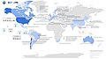 NOIRLab International Partners & Tenants (NOIRLab-International-Partners-Tenants).jpg 5,120 × 2,880; 1.32 MB
-
 NOIRLab International Partners & Tenants (NOIRLab-International-Partners-Tenants).png 5,120 × 2,880; 1.62 MB
-
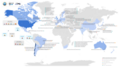
 NOIRLab US Partners & Tenants (NOIRLab-US-Partners-Tenants).jpg 5,120 × 2,880; 1.16 MB
-
 NOIRLab US Partners & Tenants (NOIRLab-US-Partners-Tenants).tiff 5,120 × 2,880; 4.58 MB
-
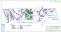
 Plano Recinto (Plano-Recinto-2).jpg 2,437 × 775; 405 KB
-
 Plano Recinto (Plano-Recinto-2).tiff 2,437 × 775; 1.96 MB
-
 Rubin Observatory Operations (rubin-Sites and Data Flows Map).jpg 3,000 × 1,821; 441 KB
-
 Rubin Observatory Operations (rubin-Sites and Data Flows Map).tiff 3,000 × 1,821; 1.53 MB
-
 Titan Occultation Maps (occultation-maps).jpg 2,400 × 1,350; 403 KB
-
 Titan Occultation Maps (occultation-maps).tiff 2,400 × 1,350; 3.1 MB
-
 Waiakeawaena Elementary School Map (Waiakeawaena-Map).jpg 2,550 × 3,299; 649 KB
-
 Waiakeawaena Elementary School Map (Waiakeawaena-Map).tiff 2,550 × 3,299; 2.99 MB
-
 Waiākea Elementary Map (Waiakea-Elementary-Map).jpg 3,300 × 2,549; 545 KB
-
 Waiākea Elementary Map (Waiakea-Elementary-Map).tiff 3,300 × 2,549; 2.24 MB
-
 Waiākea High School Map (Waiakea-High-Map).jpg 3,120 × 2,480; 1.18 MB
-
 Waiākea High School Map (Waiakea-High-Map).tiff 3,120 × 2,480; 2.31 MB
-
 Waiākea Intermediate Map (Waiakea-Intermediate-Map).jpg 3,300 × 2,549; 620 KB
-
 Waiākea Intermediate Map (Waiakea-Intermediate-Map).tiff 3,300 × 2,549; 2.76 MB
.jpg)
.jpg)
.jpg)
.jpg)
.jpg)
.jpg)
.jpg)
.jpg)
.jpg)
.jpg)
.jpg)
.jpg)
.jpg)
.jpg)

.jpg)
.jpg)
.png)
.jpg)
.jpg)
.jpg)
.jpg)
.jpg)
.jpg)
.jpg)
.jpg)