Category:Maps by Leonhard Euler
Jump to navigation
Jump to search
Media in category "Maps by Leonhard Euler"
The following 8 files are in this category, out of 8 total.
-
 Euler Tab. Geogr. Africae 1753 UTA.jpg 4,755 × 3,938; 8.48 MB
-

-
 LASB K Hellwig 0513.jpg 5,415 × 4,200; 5.69 MB
-
 Leonhard Euler World Map AD1760.jpg 2,615 × 2,252; 2.79 MB
-
 Map of the Duchy of Samogitia (Žemaitija), 1753.jpg 1,187 × 903; 678 KB
-
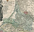 Map of the Lithuania Minor (Mažoji Lietuva), 1753.jpg 1,093 × 1,030; 775 KB
-
 Tabula Geographica Hemisphaerii Borealis ad emenatiora quae adhuc prodierunt exampla jusqu.jpg 10,302 × 8,666; 16.36 MB
-
 Tabula Geographica Imperii Turcici by Nicolas Friedrich Sauerbrey 1753.jpg 2,953 × 2,537; 4.3 MB

_by_Leonhard_Euler,_1753.png)


,_1753.jpg)
,_1753.jpg)

