Category:Maps by John Disturnell
Jump to navigation
Jump to search
Subcategories
This category has only the following subcategory.
M
Media in category "Maps by John Disturnell"
The following 30 files are in this category, out of 30 total.
-
1858 Smith - Disturnell Pocket Map of New York - Geographicus - NewYork-smith-1858.jpg 5,000 × 3,917; 4.22 MB
-
Disturnell's New Map of the United States and Canada - NARA - 78117081.jpg 12,198 × 9,332; 21.43 MB
-
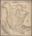
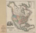
Map of North America (8346467841).jpg 698 × 800; 138 KB
-
New map of California, Oregon, Washington, Utah and New Mexico LOC 2012593338.jpg 7,701 × 8,715; 9.22 MB
-
New map of California, Oregon, Washington, Utah and New Mexico LOC 2012593338.tif 7,701 × 8,715; 192.02 MB
-
Routes between New-York & Washington (NYPL b14951935-434652).jpg 1,776 × 6,300; 2.31 MB
-
Map of the Lake Region, St. Lawrence Valley and surrounding country (NYPL b15112862-434065).tiff 6,147 × 3,992; 70.21 MB
-
Map of North America (NYPL b20731631-5404011).jpg 7,280 × 8,457; 65.55 MB
-
Map of North America (NYPL b20731631-5404011).tiff 7,760 × 10,328, 2 pages; 229.57 MB
-
Political map of the United States. LOC 2012586606.jpg 6,170 × 4,970; 3.73 MB
-
Political map of the United States. LOC 2012586606.tif 6,170 × 4,970; 87.73 MB
-
Uw-archives map columbia river 1855.jpg 640 × 480; 93 KB


