Category:Maps by John Bartholomew
Jump to navigation
Jump to search
Subcategories
This category has the following 3 subcategories, out of 3 total.
Media in category "Maps by John Bartholomew"
The following 12 files are in this category, out of 12 total.
-
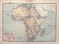 Bartholomew Africa 1875 UTA.jpg 3,669 × 2,784; 2.97 MB
-

-

-
 Bartholomew's Map of North-Eastern France, Belgium and the Rhine - btv1b53121363d.jpg 9,550 × 7,294; 11.99 MB
-
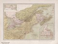 Dominion of Canada & northern United States, by John Bartholomew. (IA bp 32618).pdf 2,733 × 2,043; 2.39 MB
-
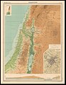 Edinburgh Geographical Institute, Palestine (FL36012252 3896582).jpg 10,860 × 14,060; 211.27 MB
-

-
 Karachi map 1911.jpg 1,811 × 1,376; 260 KB
-
 Map from Isle of Wight (1908) John Bartholomew & Co..jpg 7,544 × 5,134; 10.7 MB
-

-
 The Slave Coast on a John Bartholomew & Co. map published c. 1914 (part).jpg 1,541 × 946; 780 KB
-
 West Africa in a John Bartholomew & Co. map published c. 1914.jpg 1,864 × 1,193; 958 KB

.jpg)
.jpg)

.jpg)
.jpg)

_John_Bartholomew_%26_Co..jpg)

.jpg)
