Category:Maps by John Arrowsmith
Jump to navigation
Jump to search
Subcategories
This category has the following 2 subcategories, out of 2 total.
Media in category "Maps by John Arrowsmith"
The following 32 files are in this category, out of 32 total.
-
 Arrowsmith Mexico 1832 UTA.jpg 9,448 × 7,506; 18.76 MB
-
 1832 map of India by John Arrowsmith.jpg 12,842 × 15,518; 34.74 MB
-
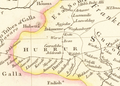 1832 Map of Nubia and Abyssinia.png 840 × 599; 935 KB
-
 1832 жылғы ағылшын картасындағы қырғыздардың (bourouts) қоныстануы.jpg 2,620 × 1,476; 1.13 MB
-
 WELLSTED(1838) p1.027 MAP OF OMAN (retouched).jpg 4,592 × 4,768; 10.68 MB
-
 WELLSTED(1838) p1.027 MAP OF OMAN.jpg 4,649 × 4,823; 9.09 MB
-
 1838 map of Siberia and Chinese Tartary.jpg 4,880 × 4,108; 3.64 MB
-
 1840 map of Turkey in Asia by John Arrowsmith.jpg 15,175 × 12,467; 28.91 MB
-
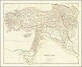 1840 map of Turkey in Asia.jpg 15,460 × 12,655; 38.66 MB
-
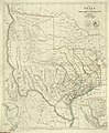 Arrowsmith Map of Texas 1841 UTA.jpg 12,300 × 14,963; 83.62 MB
-

-
 1842 map of Central Asia by John Arrowsmith.jpg 17,686 × 12,299; 26.82 MB
-
 1842 map of North Western Africa by John Arrowsmith.jpg 14,930 × 11,970; 18.02 MB
-
 1842 map of Northeast Africa by John Arrowsmith.jpg 14,857 × 12,501; 16.98 MB
-
 1842 map of the Caspian Sea, Khivah and the surrounding country by John Arrowsmith.jpg 4,286 × 5,192; 3.78 MB
-
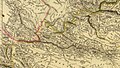
 1858 map of the Austrian Empire by John Arrowsmith.jpg 14,652 × 11,966; 39.73 MB
-
 Ambracian Gulf, Arrowsmith John, 1844.jpg 2,162 × 1,303; 470 KB
-
 Arrowsmith Mexico 1832 UTA (Detail Sonora Sinaloa).jpg 2,715 × 2,713; 1.94 MB
-
 Arrowsmith Oregon Country.jpg 2,552 × 2,926; 1.65 MB
-
 Arrowsmith's Map of Persia, 1819.jpg 1,600 × 1,301; 479 KB
-

-

-
 Dease and Simpson - Arctic expedition 1837.png 2,395 × 1,414; 288 KB
-
 Map Desert East of the Hauran Graham.webp 4,783 × 2,836; 10.95 MB
-
 Map of Circassia Wellcome L0040021.jpg 3,763 × 1,789; 1.73 MB
-
 Map of Part of the Valley of Red River North of the 49th Parallel (1858).jpg 7,500 × 3,443; 5.5 MB
-
 Map of the Maltese Islands from actual survey, John Arrowsmith, 1844.jpg 4,339 × 4,295; 2.87 MB
-
 Schomburgk Map of Guiana.jpg 5,041 × 3,891; 2.87 MB
-

-
 The Inland Navigation, Rail Roads, Geology and Minerals of England & Wales.jpg 12,790 × 15,412; 34.3 MB
-
 The Ionian Islands and Malta, Arrowsmith John, 1844.jpg 8,528 × 11,847; 15.64 MB
-
 Upper Canada by J. Arrowsmith. 1837. CTASC.jpg 600 × 718; 516 KB


_%D2%9B%D0%BE%D0%BD%D1%8B%D1%81%D1%82%D0%B0%D0%BD%D1%83%D1%8B.jpg)
_p1.027_MAP_OF_OMAN_(retouched).jpg)
_p1.027_MAP_OF_OMAN.jpg)


.jpg)


.jpg)


