Category:Maps by Johannes Mejer
Jump to navigation
Jump to search
| NO WIKIDATA ID FOUND! Search for Maps by Johannes Mejer on Wikidata | |
| Upload media |
Subcategories
This category has the following 5 subcategories, out of 5 total.
Media in category "Maps by Johannes Mejer"
The following 58 files are in this category, out of 58 total.
-
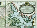
 "Accuratissima Sliae fluminis descriptio - ... Iohannes Mejer" (22241002332).jpg 4,203 × 3,018; 2.56 MB
-
 "Aroe Insulae delineatio geometrica - author Iohannes Mejer" (22263616981).jpg 1,976 × 1,344; 458 KB
-
 "Comitatus Pinnen Berg - Iohannes Mejer...; Andres Lorensen sculps." (22070021140).jpg 3,689 × 2,947; 2.38 MB
-

-

-
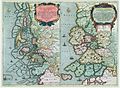
 "Ducatus Sleswici pars borealis. - Author Iohannes Mejerus " (22234101276).jpg 4,442 × 3,099; 2.99 MB
-
 "Ducatus Sleswici pars meridionalis - Author Iohannes Mejerus " (22067658640).jpg 4,416 × 3,071; 2.8 MB
-
-
-

-

-
 "Praefectura Apenrade et Luntost herde - Iohannes Mejer..." (22241656782).jpg 4,037 × 3,097; 2.25 MB
-

-
-

-
-

-
-
 Alt Nordstrand 1634.jpg 11,329 × 10,200; 14.31 MB
-
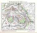
 Alt Nordstrand um 1240.jpg 5,274 × 4,163; 7.8 MB
-
 Am Hauptbahnhof KIel (02) (53188462536).jpg 5,184 × 3,456; 12.07 MB
-
 Am Hauptbahnhof KIel (03) (53190773685).jpg 5,184 × 3,456; 19.9 MB
-
 CCI21062015 0000x.jpg 1,200 × 1,683; 993 KB
-
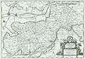
 WP Dithmarschen.jpg 1,276 × 899; 808 KB
-
 Eidersedt DAdD 042.JPG 8,761 × 6,109; 12.08 MB
-
 Elbinseln Joh Mejer 1650 (cropped).jpg 1,251 × 994; 350 KB
-
 Elbinseln Joh Mejer 1650.jpg 2,232 × 1,242; 789 KB
-
 Flensburger Förde 1650.jpg 1,248 × 852; 528 KB
-
 Glückstadt 1652.jpg 614 × 468; 98 KB
-
 Grundtriß der edlen weitberumbte Statt Hamburg Anno 1651.jpg 2,399 × 1,796; 1.22 MB
-
 Hamburg Trittow Mejer AD1652.jpg 2,511 × 1,930; 1.41 MB
-
 Amt Tremsbüttel (1652).jpg 600 × 450; 117 KB
-
 JBAM 068.JPG 2,687 × 1,968; 3.2 MB
-
 JBAM 078a.JPG 3,278 × 2,512; 5.68 MB
-
 JBAM 078b.JPG 3,278 × 2,512; 5.65 MB
-
 JBAM 079a.JPG 3,328 × 2,514; 5.57 MB
-
 JBAM 079b.JPG 3,328 × 2,526; 5.63 MB
-
 JBAM 080-081.png 5,648 × 4,204; 60.98 MB
-
 JBAM 080a.JPG 3,342 × 2,512; 5.26 MB
-
 JBAM 080b.JPG 3,342 × 2,512; 5.47 MB
-
 JBAM 081a.JPG 3,328 × 2,526; 5.15 MB
-
 JBAM 081b.JPG 3,328 × 2,526; 5.25 MB
-
 JBAM 082.JPG 4,223 × 2,848; 6.79 MB
-
 JBAM 141-142.png 5,951 × 4,523; 54.84 MB
-
 JBAM 141a.JPG 3,498 × 2,528; 4.9 MB
-
 JBAM 141b-N.jpg 2,631 × 2,095; 3.52 MB
-
 JBAM 141b.JPG 3,498 × 2,528; 4.7 MB
-
 JBAM 142a.JPG 3,488 × 2,538; 4.55 MB
-
 JBAM 142b.JPG 3,488 × 2,538; 4.75 MB
-
 Joh Mejer Stormarn 1650.jpg 5,216 × 3,762; 19.05 MB
-
 Johs. Mejer 1650.JPG 2,962 × 2,303; 5.04 MB
-
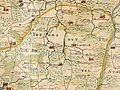
 Landtcarte von den Ambtern Rendsborg, Kiel und Bordesholm Anno 1649.jpg 1,859 × 1,069; 668 KB
-
 Nordfriesland um 1240.jpg 3,944 × 5,176; 8.33 MB
-
 Reichsstadt Giengen Territorium - Mejer-Homann 1710.png 1,920 × 1,079; 3.47 MB
-
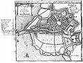
 Stadtplan Kiel (Mejer, 1651).jpg 5,129 × 3,977; 7.57 MB
-
 Wald westlich Wrohm 1651.jpg 1,881 × 1,051; 708 KB
-
 Winbergener Niederung 1559.jpg 1,886 × 1,072; 948 KB
-
 Winbergener Niederung 1651.jpg 1,883 × 1,067; 796 KB
.jpg)
.jpg)
.jpg)
.jpg)
.jpg)
.jpg)
.jpg)
.jpg)
.jpg)
.jpg)
.jpg)
.jpg)
.jpg)
.jpg)
.jpg)
.jpg)
.jpg)
.jpg)


_(53188462536).jpg)
_(53190773685).jpg)


.jpg)


.jpg)


.jpg)


