Category:Maps by Jacques-Nicolas Bellin
Jump to navigation
Jump to search
Subcategories
This category has the following 5 subcategories, out of 5 total.
Media in category "Maps by Jacques-Nicolas Bellin"
The following 200 files are in this category, out of 261 total.
(previous page) (next page)-

-

-
 Map of Japan 1.jpg 800 × 600; 117 KB
-
 1744 bellin map Carte des lacs du Canada.jpg 5,827 × 3,642; 7.82 MB
-
 Map Japan 1746.JPG 409 × 295; 20 KB
-
 Schley-Bellin Verfolg van de Kust van Guinee... 1747 UTA.jpg 5,310 × 2,987; 5.12 MB
-
 Histoire des deux Indes-Atlas-d26-C08-Chine.png 3,147 × 2,329; 2.47 MB
-

-
 L'Empire de la Chine pour servir a L'histoire générale des voyages LOC 2006629393.jpg 6,810 × 5,064; 6.37 MB
-
 L'Empire de la Chine pour servir a L'histoire générale des voyages LOC 2006629393.tif 6,810 × 5,064; 98.67 MB
-
-
 Bellin Plan de L'Isle de Goré 1749 UTA.jpg 3,428 × 2,546; 2.72 MB
-

-

-

-
 1750 Bellin Map of Cape Town, South Africa - Geographicus - Gundriss-bellin-1750.jpg 3,375 × 2,722; 1.45 MB
-
 1750 Bellin Map of the Kuril Islands - Geographicus - Kouriles-bellin-1750.jpg 3,000 × 2,737; 2.35 MB
-
 1750 Bellin Map of the Senegal - Geographicus - Senegal-bellin-1750.jpg 1,985 × 2,784; 1.13 MB
-
 1750 Schley Map of Ormus, Persian Gulf - Geographicus - Ormus-schley-1750.jpg 2,500 × 2,015; 1.78 MB
-
 1752 Schely Plan or Map of Edo or Tokyo, Japan - Geographicus - EdoTokyo-schley-1752.jpg 2,500 × 2,461; 1.96 MB
-
 1754 Bellin Map of Mexico City ^ Environs - Geographicus - MexicoCity2-bellin-1754.jpg 2,095 × 2,508; 1.03 MB
-
 1754 Bellin Map of Veracruz, Mexico - Geographicus - Veracruz-bellin-1754.jpg 1,844 × 2,500; 1.34 MB
-
 1755 Bellin Map of the Great Lakes - Geographicus - GreatLakes-bellin-1755.jpg 4,000 × 3,215; 3.49 MB
-
 1756 Bellin Map of Boston, Massachusetts - Geographicus - Boston-bellin-1756.jpg 3,334 × 2,100; 2.07 MB
-
 1756 Bellin Map of Boston, Massachusetts - Geographicus - Boston2-bellin-1756.jpg 2,500 × 1,554; 1.12 MB
-
 1756 Bellin Map of Kollam Fort, Kerala, India - Geographicus - Coylan-bellin-1756.jpg 3,000 × 2,109; 2.09 MB
-

-
 1756 Map of Formosa (Taiwan) by French 法國人所繪福爾摩沙島圖 L' Isle Formose.png 1,991 × 1,675; 7.43 MB
-
-

-

-
 1760 Bellin Map of Bali, Indonesia - Geographicus - Bali-bellin-1760.jpg 2,668 × 2,097; 932 KB
-

-
 1764 Bellin Map of Acapulco, Mexico - Geographicus - Acapulco-bellin-1764.jpg 2,193 × 2,724; 999 KB
-
 1764 Bellin Map of Bombay (Mumbai) India - Geographicus - Bombay-bellin-1750.jpg 2,099 × 2,705; 1.39 MB
-
 1764 Bellin Map of Cape Town (Cape of Good Hope) - Geographicus - GoodHope3-bellin-1763.jpg 2,100 × 2,576; 1,012 KB
-
 1764 Bellin Map of Macao China.jpg 2,103 × 2,628; 832 KB
-

-
 1764 map of Charleston, South Carolina.jpeg 861 × 1,208; 255 KB
-
-

-

-

-
 Map - Special Collections University of Amsterdam - OTM- HB-KZL I 2 A 9 (31a).jpg 10,656 × 7,992; 27.07 MB
-

-
 1778 Bellin Nautical Chart or Map of the World - Geographicus - World-bellin-1778.jpg 4,000 × 2,902; 3.67 MB
-
 1852 Bellin Map of Sumatra, Malaca, and Singapore - Geographicus - Sumatra-bellin-1750.jpg 3,000 × 2,566; 1.61 MB
-
-
-
 2e. feuille Suite de la province de Quito auPerou - (par J.N. Bellin) - btv1b85965093.jpg 6,144 × 4,209; 4.98 MB
-
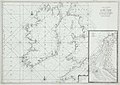 A Chart of Northern Ireland and Scotland.jpg 2,000 × 1,413; 428 KB
-

-
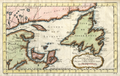
 Acadie 1757.gif 1,831 × 1,176; 97 KB
-
 Acadie1744 IPE.jpg 722 × 461; 54 KB
-
 AMH-7421-NA Map of west Africa.jpg 2,400 × 1,655; 679 KB
-
 AMH-7998-KB Map of Ceylon.jpg 2,176 × 2,400; 1 MB
-
 AMH-8039-KB Map of the Gulf of Mexico.jpg 2,400 × 1,968; 920 KB
-
 AMH-8040-KB Map of Haiti and surrounding islands.jpg 2,400 × 1,676; 735 KB
-

-
 Basic cartouche in a Caucasus map by Bellin.tif 898 × 541; 1.41 MB
-
 Bay Islands and coast of Honduras 1754.png 1,587 × 918; 2.23 MB
-
 Baye de Carthagène dans l'Amérique Méridionale - (par J.N. Bellin) - btv1b8596463j.jpg 5,806 × 3,743; 3.63 MB
-
 Bellin - Carte de la Tartarie Occidentale.png 1,987 × 1,500; 4.91 MB
-
 Bellin - Carte reduite de l'ocean septentrional.png 1,971 × 1,300; 5 MB
-
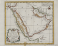
 Bellin - Karte von der Küste von Arabien c.1745 (crop).png 789 × 666; 669 KB
-
 Bellin - Plan de la Ville de Moka.png 1,400 × 1,822; 4.7 MB
-
 Bellin - Ville de Manathe ou Nouvelle-Yorc.jpg 2,152 × 2,825; 806 KB
-
 Bellin 1755.png 1,286 × 635; 1.78 MB
-
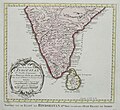 Bellin Indoustan 1770.jpg 623 × 571; 64 KB
-
 Bellin map 1767 Carte reduite de l Islande et des Mers qui en sont voisines.jpg 10,107 × 6,938; 7.49 MB
-

-

-
 Bellin's map of the port itself.jpg 725 × 900; 91 KB
-
 Bellin's plan of Goa, c.1750 VERY LARGE SCAN.jpg 4,432 × 2,656; 1.88 MB
-
 Bellin's plan of Goa, c.1750;.jpg 800 × 479; 81 KB
-
 Bellin, Carte Glénan, 1764.JPG 1,819 × 2,302; 1.11 MB
-

-

-
 Bellin1744.png 938 × 570; 1.2 MB
-
 Carte Baie de Douarnenez.JPEG 1,367 × 892; 717 KB
-
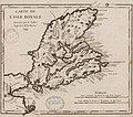
 Carte de l Acadie, Isle Royale, et pais voisins.jpg 3,014 × 2,160; 1.05 MB
-
 Carte de l Amérique Septentrionale pour servir a l Histoire de la Nouvelle France.png 4,468 × 3,507; 23.92 MB
-
 Carte de l' Accadie et Pais Voisins 1757.jpg 3,047 × 1,982; 828 KB
-
 Carte de l'Afrique - (Bellin) - btv1b8595158w.jpg 3,672 × 4,355; 2.45 MB
-
 Carte de l'Arménie, Géorgie et pays voisins.tif 5,164 × 3,774; 55.78 MB
-

-

-

-
 Carte de l'Isle de Brehat Bellin.jpg 736 × 1,001; 653 KB
-
 Carte de L'Isle de France-Nicolas Bellin 1763.jpg 6,227 × 3,954; 5.55 MB
-
 Carte de L'Isle de France-Nicolas Bellin mg 8531.jpg 3,303 × 2,540; 1.72 MB
-
 Carte de L'Isle de France-Nicolas Bellin mg 8532.jpg 4,368 × 2,912; 5.42 MB
-
 Carte de L'Isle de France-Nicolas Bellin mg 8534.jpg 4,368 × 2,912; 5.47 MB
-
 Carte de L'Isle de France-Nicolas Bellin mg 8535.jpg 4,368 × 2,912; 5.83 MB
-
 Carte de l'isle de la Barbade. LOC 73697230.jpg 2,097 × 3,250; 835 KB
-
 Carte de l'état de Gênes - (Bellin) ; Croisey - btv1b53042588x.jpg 5,786 × 3,834; 3.04 MB
-
 Carte de la baie d'Hudson en 1744.jpg 1,238 × 908; 507 KB
-
-
 Carte de la Coste d'Arabie, Mer Rouge, et Golfe de Perse.png 1,347 × 1,024; 2.15 MB
-

-
 Carte de la Crimée - (Bellin) - btv1b53040896w.jpg 2,990 × 3,496; 1.29 MB
-
 Carte de la Guyane françoise et l'isle de Cayenne (Bellin, 1763).jpg 1,267 × 943; 1.08 MB
-
 Carte de la L'isle Grande et coste de Brezil aux environs. LOC 2003627068.tif 2,490 × 3,788; 26.99 MB
-

-
 Carte de la Normandie et de la Bretagne - btv1b85918122.jpg 5,200 × 4,238; 3.65 MB
-
 Carte de la partie orientale de la Nouvelle France ou du Canada.png 4,436 × 3,213; 8.98 MB
-

-

-

-
 Carte des Baleares de la baie de Mahon et du fort Saint Philippe en 1740.jpg 1,616 × 643; 411 KB
-
 Carte des Comores-1747.jpg 526 × 459; 120 KB
-
 Carte des côtes de Bretagne de Plouhan à la baie de La Forêt par Jacques-Nicolas Bellin.jpg 5,216 × 3,532; 3.53 MB
-
 Carte des isles de Comore Johanna ou Anjouan Mohilla ou Moaly et Mayote Bnf40600530t.jpg 1,140 × 1,054; 239 KB
-

-
 Carte des Isles de Saint Pierre et Miquelon levee... 1763.jpg 7,287 × 4,979; 4.61 MB
-
 Carte des isles situées au nord de St. Domingue (2674965842).jpg 3,960 × 2,436; 2.09 MB
-
 Carte du Chili - (par J.N. Bellin) - btv1b8596585g.jpg 3,652 × 4,800; 2.86 MB
-

-
 Carte du cours du fleuve de Saint Laurent depuis Quebec jusqu a la mer - IIe Feuille.png 3,379 × 2,300; 16.06 MB
-
 Carte du cours du fleuve de Saint Laurent depuis Quebec jusqu a la mer - Ire Feuille bas.png 6,775 × 1,895; 28.53 MB
-
 Carte du cours du fleuve de Saint Laurent depuis Quebec jusqu a la mer - Ire Feuille haut.png 6,775 × 2,536; 35.41 MB
-

-

-
 Carte du fond de la baie d'Hudson en 1744.jpg 876 × 1,207; 464 KB
-
 Carte du golfe de Guinée-18e s..jpg 568 × 510; 67 KB
-
 Carte du golphe de l'Especy - (Bellin) - btv1b53042991q.jpg 2,853 × 3,415; 1.23 MB
-
 Carte du Golphe de St-Laurent et Pays Voisins.png 1,375 × 870; 2.51 MB
-
 Carte du golphe de St. Laurent et pays voisins.jpg 3,454 × 2,173; 1.1 MB
-
 Carte Du Golphe Persique (Eliminate background).png 750 × 589; 913 KB
-
 Carte Du Golphe Persique.png 1,398 × 1,024; 2.02 MB
-
 Carte en français de l'Isle Royale en 1744.jpg 987 × 873; 383 KB
-
 Carte Isle de Montreal Bellin 1744.png 1,070 × 862; 1.71 MB
-
 Carte Reduite de la Mer de Marmara et du Canal Des Dardanelles.jpg 21,921 × 14,676; 57.94 MB
-
 Carte reduite de la mer du nord Zusammengezogene Karte des Nordmeeres Bellin 1772.jpg 4,449 × 2,670; 1.48 MB
-

-

-

-

-
-

-
 Carte reduite du golphe de St Laurent.jpg 4,575 × 3,244; 2.24 MB
-

-
 Carte réduite de la Mer de Marmara et du Canal des Dardanelle.tif 7,699 × 5,519; 86.12 MB
-
 Carte réduite de lisle de Cube (7537862886) - Parcel.jpg 451 × 334; 114 KB
-

-

-
 Carte réduite du canal de Mozambique - par le Sr. Bellin - btv1b532657057 (1 of 2).jpg 10,494 × 7,458; 11.18 MB
-
 Carte-des-isles-du-japon-terre-de-jesso-et-pays-voisoins-d-bellin.jpg 1,799 × 1,300; 2.61 MB
-
 Cartes et plans de l'Amerique. LOC 2003623376-22.jpg 10,324 × 6,853; 8.61 MB
-
 Cartes et plans de l'Amerique. LOC 2003623376-22.tif 10,324 × 6,853; 202.42 MB
-
 Cartouche on a map of Tartary by Bellin.jpg 901 × 1,095; 254 KB
-
 Chequamegon1755.jpg 424 × 332; 56 KB
-
 Cochin1.jpg 388 × 311; 23 KB
-
 Cochin2.jpg 403 × 302; 34 KB
-
 Cochin4.jpg 403 × 302; 40 KB
-
 Conception Bay - Bellin, Nicolaus.jpg 1,276 × 811; 545 KB
-
 De la rivière de Sierra Leona au cap dos Palmas - Bellin - btv1b53153518z.jpg 4,236 × 3,090; 1.53 MB
-
 Embouchure du Kongo-1747.jpg 2,048 × 2,555; 2.72 MB
-
 Embouchures du Fleuve St. Louis ou Mississipi.jpg 1,500 × 1,863; 1.55 MB
-
 Essay d'une Carte reduite contenant les parties connuees du Globe Terrestre.jpg 1,798 × 1,195; 484 KB
-
 Falkland Islands map 1771 by Bellin.jpg 6,270 × 3,937; 6.03 MB
-
 Greatbukhara.jpg 800 × 600; 128 KB
-
 Greatbukharane.jpg 800 × 600; 117 KB
-
 Greatbukharanw.jpg 800 × 600; 120 KB
-
 Greatbukharase.jpg 800 × 600; 136 KB
-
 Greatbukharasw.jpg 800 × 600; 116 KB
-
 Grenada 1758-15474-01.jpg 1,276 × 1,690; 1.11 MB
-
 Grenada 1758-15474-02.jpg 1,942 × 1,361; 393 KB
-
 Gulf of Cambay A closer look from a map by Bellin, 1752.jpg 900 × 720; 141 KB
-

-
 IAN 0134 Bellin 1797 Ionian Sea.jpg 2,977 × 3,882; 12.03 MB
-
 IAN 0202 Bellin 1771 Preveza.jpg 5,052 × 3,252; 13.15 MB
-
 Iceland map 1756.png 2,120 × 1,700; 7.66 MB
-
 Idée de la ville d'Amsterdam - (Bellin) - btv1b530425844.jpg 3,036 × 3,510; 1.62 MB
-
 Iere feuille Province de Quito au Pérou - (par J.N. Bellin) - btv1b8596508p.jpg 6,161 × 4,032; 4.17 MB
-
 Ilha Formosa.jpg 420 × 498; 156 KB
-
 Isle de la Guadeloupe, les Saintes et Marie Galante. LOC 74691485.jpg 4,413 × 3,123; 1.81 MB
-
 Isle de la Guadeloupe, les Saintes et Marie Galante. LOC 74691485.tif 4,413 × 3,123; 39.43 MB
-

-
-
 Jacques-Nicolas Bellin, Carte reduite de l'Ocean oriental ou Mers des Indes (FL37816898 3153840).jpg 22,716 × 16,019; 473.75 MB
-
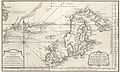
 Jan Mayen map by Jacques-Nicolas Bellin 1760 color.jpg 1,689 × 2,187; 1.38 MB
-
 Jan Mayen map by Jacques-Nicolas Bellin 1760.jpg 1,132 × 1,504; 1.05 MB
-
 JNBellinMap1744MississippiLaBalize.jpg 600 × 403; 106 KB
-
 Kapidag (cropped).tif 956 × 549; 1.17 MB
-
 Karte von dem Laufe des Flusses St. Laurenz.jpg 2,545 × 2,015; 1.03 MB
-
 Kazakhstan. Bellin, Nicolaus. Leipzig, Merkur, 1749.jpg 2,316 × 1,700; 1.91 MB
-
 Kolbeinsey (Rocher des Mouettes) on Bellin map 1767.jpg 249 × 144; 5 KB
-
 Koreane.jpg 800 × 600; 137 KB
-
 Koreanw.jpg 800 × 600; 137 KB
-
 Korease.jpg 800 × 600; 114 KB
-
 Koreasw.jpg 800 × 600; 151 KB
-
 Lake Superior by Bellin 1744.png 2,445 × 1,622; 7.01 MB
-
 Littlebukhara.jpg 800 × 600; 125 KB
-
 Littlebukharane.jpg 800 × 600; 126 KB
-
 Littlebukharanw.jpg 800 × 600; 112 KB
-
 Littlebukharase.jpg 800 × 600; 117 KB
-
 Littlebukharasw.jpg 800 × 600; 118 KB
-
 Locmiquélic Bellin 1764.jpg 1,132 × 1,211; 981 KB
-
 Lopburi Map.jpg 3,286 × 4,397; 1.57 MB


_(14782754404).jpg)


_by_French_%E6%B3%95%E5%9C%8B%E4%BA%BA%E6%89%80%E7%B9%AA%E7%A6%8F%E7%88%BE%E6%91%A9%E6%B2%99%E5%B3%B6%E5%9C%96_L%27_Isle_Formose.png)

,_West_Indies_-_Geographicus_-_SaintLucia-bellin-1758.jpg)
,_in_the_West_Indies_-_Geographicus_-_StLucie-bellin-1758.jpg)

_South_Africa_-_Geographicus_-_GoodHope2-bellin-1763.jpg)

_India_-_Geographicus_-_Bombay-bellin-1750.jpg)
_-_Geographicus_-_GoodHope3-bellin-1763.jpg)


.jpg)


_-_Geographicus_-_WestAfrica2-bellin-1765.jpg)

_-_btv1b85965093.jpg)


_-_btv1b8596463j.jpg)


.png)


_-_btv1b8595158w.jpg)
_-_btv1b8595536p.jpg)


_;_Croisey_-_btv1b53042588x.jpg)


_-_btv1b8595534v.jpg)
_-_btv1b53040896w.jpg)
.jpg)


.jpg)


_-_btv1b53227041w_(1_of_2).jpg)

.jpg)
_-_btv1b8596585g.jpg)


_-_btv1b53042991q.jpg)


.png)


.jpg)
.jpg)
.jpg)
.jpg)


_-_Parcel.jpg)
_et_les_Isles_Canaries,_seconde_feuille_Depuis..._-_btv1b10678512f_(1_of_2).jpg)
_et_les_Isles_Canaries,_seconde_feuille_Depuis..._-_btv1b10678512f_(2_of_2).jpg)
.jpg)


_-_avec_le_journal_historique_d%27un_voyage_fait_par_ordre_du_roi_dans_l%27Am%C3%A9rique_septentrionnale_(1744)_(20626362575).jpg)


_-_btv1b530425844.jpg)
_-_btv1b8596508p.jpg)


.jpg)

.jpg)


_on_Bellin_map_1767.jpg)


