Category:Maps by Henri Dron
Jump to navigation
Jump to search
Subcategories
This category has only the following subcategory.
Media in category "Maps by Henri Dron"
The following 18 files are in this category, out of 18 total.
-
 Henri Dron & Heymann, Plan de la Commune de Paris - Paris Musées.jpg 7,790 × 6,029; 29.14 MB
-
 Henri Dron, Paris en 1889 - Gallica.jpg 6,659 × 5,338; 7.1 MB
-
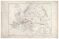 L'Europe au 20ème siècle - par Henri Dron - btv1b8491839g.jpg 8,962 × 5,929; 8.22 MB
-
 L'Europe diplomatique ou des libres alliances - btv1b8492029n.jpg 9,094 × 7,404; 8.57 MB
-
 L'Europe telle qu'elle est aujourd'hui - btv1b84907303.jpg 10,138 × 7,320; 9.37 MB
-
 La France et Paris - btv1b530857610.jpg 7,307 × 9,619; 13.18 MB
-
 La France, la Hollande, la Suisse la Belgique confédérées au XXe siècle - btv1b8441603s.jpg 5,975 × 5,114; 5.11 MB
-

-

-

-

-

-
 Peuples ! Formez une sainte alliance et donnez vous la main... - btv1b84439481.jpg 10,500 × 7,979; 8.06 MB
-

-

-
 Problème ? Le Rhin, les Alpes, le Danube, l'Euphrate, les mers, les détroits.jpg 8,951 × 7,046; 10.57 MB
-

-
 Un grand pas en avant, vers les Etats Unis du monde - btv1b8443480h.jpg 12,078 × 9,018; 10.91 MB


..._L%27Allemagne_sur_la_rive_droite,_la_France_sur_la_rive_gauche..._L%27Europe_au_futur_congr%C3%A8s_avant_la_guerre...%22_-_btv1b530937857.jpg)


_-_btv1b8445003z.jpg)
