Category:Maps by Gustav Adolf von Varendorf
Jump to navigation
Jump to search
| NO WIKIDATA ID FOUND! Search for Maps by Gustav Adolf von Varendorf on Wikidata | |
| Upload media |
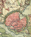
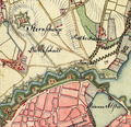
Die Karten wurden aufgenommen in den Jahren 1789 bis 1796 unter der Direktion des Majors Gustav Adolf von Varendorf durch Offiziere des Schleswigschen Infanterieregiments.
Media in category "Maps by Gustav Adolf von Varendorf"
The following 38 files are in this category, out of 38 total.
-
Hamburg 1790 große karte varendorf.jpg 7,040 × 3,530; 24.56 MB
-
Karte hamburg 1790 varendorf kl.jpg 2,000 × 1,003; 1.28 MB
-
Varendorf(62)Altona Hamburg Harburg.jpg 3,565 × 3,602; 15.77 MB
-
Tollerort-map-varendorf.jpg 1,652 × 1,184; 2.52 MB
-
Hamburg 1790 Elbinseln Varendorf.jpg 3,785 × 2,836; 9.89 MB
-
Schulterblatt um 1790.jpg 646 × 605; 531 KB
-
Karte harvestehude vahrendorf.jpg 565 × 754; 568 KB
-
Wallanlagen varendorf(62)Altona Hamburg Harburg.png 1,505 × 1,777; 6.2 MB
-
Grasbrook johnsche ecke.jpg 607 × 555; 457 KB
-
Reiherstieg-vor-1800.jpg 1,178 × 1,378; 2.06 MB
-
Sternschanze aus varendorf(62)Altona Hamburg Harburg.png 989 × 955; 2.19 MB
-
Pincerno - Wandsbek 1790.gif 1,280 × 882; 814 KB
-
Varendorf(63)Bergedorf Reinbek Ausschnitt Reit.jpg 1,535 × 1,167; 801 KB
-
Varendorf(63)Bergedorf Reinbek.jpg 3,608 × 3,619; 12.93 MB
-
Varendorf(63)Billstedt(schifbeck öjendorff steinbeck).jpg 1,925 × 1,925; 2.58 MB
-
Vahrendorf63a.JPG 3,504 × 2,496; 3.81 MB
-
Vahrendorf63b.JPG 3,506 × 2,507; 3.93 MB
-
Varendorf(63)-ausschnitt-eilbek-hamm.jpg 1,406 × 908; 559 KB
-
Vahrendorf63c.JPG 1,648 × 1,312; 1.01 MB
-
Varendorf(63)Ausschnitt Wandsbeck.jpg 3,273 × 1,917; 5.1 MB
-
Varendorf(64)Glinde Schwarzenbek.jpg 3,595 × 3,577; 13.44 MB
-
Varendorf(68)Vierlande Winsen.jpg 3,597 × 3,588; 13.66 MB
-
Varendorf(68)Ausschnitt Winsen.jpg 2,747 × 2,082; 5.86 MB
-
Reiherstiegwerft-karte1790-1910.jpg 1,051 × 1,361; 1.65 MB
-
Varendorf(63)ausschnitt Rahlstedt.jpg 3,346 × 1,534; 4.48 MB
-
Varendorf(64)ausschnitt schwarze Au.jpg 2,188 × 1,478; 3.22 MB
-
Karte Mühlen der Wandse.png 3,388 × 912; 6.67 MB
-
Kartenausschnitt Altona Hamburg 1789.PNG 1,269 × 720; 2.72 MB
-
Kartenausschnitt aus der Varendorfschen Karte.jpg 630 × 354; 405 KB
-
Meimersdorfer Moor Vahrendorf.jpeg 1,000 × 500; 660 KB
-
Varendorf(10)Ausschnitt-a.jpg 1,751 × 1,260; 1.77 MB
-
Varendorf(10)Ausschnitt-b.jpg 1,749 × 1,271; 1.46 MB
-
Varendorf(11)Ausschnitt-a.jpg 1,748 × 1,274; 1.83 MB
-
Varendorf(11)Ausschnitt-b.jpg 1,752 × 1,275; 1.58 MB
-
Varendorf(21)Ausschnitt-a.jpg 1,752 × 1,274; 1.98 MB
-
Varendorf(21)Ausschnitt-b.jpg 1,752 × 1,275; 1.68 MB
-
Varendorf(22)Ausschnitt-a.jpg 1,752 × 1,275; 2.19 MB
-
Varendorf(22)Ausschnitt-b.jpg 1,752 × 1,274; 2.08 MB


