Category:Maps by Girolamo Porro
Jump to navigation
Jump to search
Subcategories
This category has only the following subcategory.
1
- 1600 world map by Girolamo Porro (14 F)
Media in category "Maps by Girolamo Porro"
The following 50 files are in this category, out of 50 total.
-
 *eastern Asia (1598) the western part of eastern Asia.jpg 795 × 1,100; 659 KB
-
 *the World, in Ptolemaic style.jpg 1,600 × 1,200; 316 KB
-

-

-
 Africa I northwest Africa.jpg 1,600 × 1,200; 382 KB
-
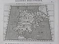
 Africa II northcentral Africa.jpg 1,600 × 1,200; 388 KB
-
 Africa III northeast Africa.jpg 1,600 × 1,200; 372 KB
-
 AfricaIV north Africa.jpg 1,600 × 1,200; 375 KB
-
 Asia (1598)* western and southern Asia.jpg 734 × 1,100; 656 KB
-
 Asia (1600) northeast.jpg 800 × 600; 141 KB
-
 Asia (1600) northwest.jpg 800 × 600; 152 KB
-
 Asia (1600) southeast.jpg 800 × 600; 147 KB
-
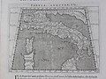
 Asia I Turkey.jpg 1,600 × 1,200; 373 KB
-
 Asia III armenia.jpg 1,600 × 1,200; 342 KB
-
 Asia IV The Holyland.jpg 1,600 × 1,200; 334 KB
-
 Asia IX pakistan.jpg 1,600 × 1,200; 312 KB
-
 Asia V persia.jpg 1,600 × 1,200; 341 KB
-
 Asia VI arabia.jpg 1,600 × 1,200; 407 KB
-
 Asia VII afghanistan.jpg 1,600 × 1,200; 365 KB
-
 Asia VIII central.jpg 1,600 × 1,200; 301 KB
-
 Asia X india.jpg 1,600 × 1,200; 361 KB
-
 Asia XI southeastasia.jpg 1,600 × 1,200; 400 KB
-
 Asia XII ceylon.jpg 1,600 × 1,200; 387 KB
-
 Eastern Asia (1598).jpg 1,100 × 821; 558 KB
-
 Europe I britain.jpg 1,600 × 1,200; 373 KB
-
 Europe II spain.jpg 1,600 × 1,200; 361 KB
-
 Europe III france.jpg 1,600 × 1,200; 318 KB
-
 Europe IV germany.jpg 1,600 × 1,200; 327 KB
-
 Europe IX northgreece.jpg 1,600 × 1,200; 368 KB
-
 Europe VI italy.jpg 1,600 × 1,200; 386 KB
-
 Europe VII sicily.jpg 1,600 × 1,200; 400 KB
-
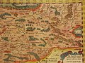
 Europe VIII sarmatia.jpg 1,600 × 1,200; 317 KB
-
 Europe X greece.jpg 1,600 × 1,200; 407 KB
-
 Jamaica 1572 (Tomaso Porcacchi).jpg 1,881 × 1,588; 191 KB
-

-
 Page 23 from Tomaso Porcacchi Castilione's 'L'Isole piu Famose del Mondo', Venice 1572.jpg 3,024 × 4,032; 3.16 MB
-
 Porro map.png 696 × 545; 566 KB
-
 Ptolemaic map Balkans 1598.jpg 1,600 × 1,200; 344 KB
-
 Ptolemaic map Scythia 1598.jpg 1,504 × 1,128; 310 KB
-
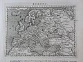 Ptolemic Europe.jpg 1,600 × 1,200; 392 KB
-
 Si0099x1024.jpg 1,024 × 1,639; 481 KB
-
 The americas 1600.jpg 800 × 600; 152 KB
-
 The asia 1598.jpg 1,100 × 801; 656 KB
-
 The asia 1600.jpg 800 × 600; 144 KB
-
 The Moscovian empire (1600) northeast.jpg 800 × 600; 146 KB
-
 The Moscovian empire (1600) northwest.jpg 800 × 600; 148 KB
-
 The Moscovian empire (1600) southeast.jpg 800 × 600; 143 KB
-
 The Moscovian empire (1600) southwest.jpg 800 × 600; 142 KB
-
 The Moscovian empire (1600).jpg 800 × 1,067; 187 KB
-
 The World depicted.jpg 1,600 × 1,200; 344 KB
_the_western_part_of_eastern_Asia.jpg)

_and_Ukraine_-_Geographicus_-_Moschovia-porcacchi-1572.jpg)


*_western_and_southern_Asia.jpg)
_northeast.jpg)
_northwest.jpg)
_southeast.jpg)


.jpg)


.jpg)
_(CBL_Rare_Books_-_AF697,_pp._12-13).jpg)


_northeast.jpg)
_northwest.jpg)
_southeast.jpg)
_southwest.jpg)
.jpg)
