Category:Maps by Daniel Specklin
Jump to navigation
Jump to search
Media in category "Maps by Daniel Specklin"
The following 10 files are in this category, out of 10 total.
-
 Alsace (Specklin, 1576).jpg 13,791 × 4,544; 15.02 MB
-
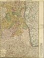
 Alsatia inferior.jpg 3,270 × 2,373; 2.81 MB
-
 Argentina bei Specklin.jpg 1,842 × 878; 417 KB
-
 Carte Alsatia inferior.jpg 5,062 × 6,698; 10.89 MB
-
 Carte Alsatia superior.jpg 5,017 × 6,727; 11.17 MB
-
 Jülich Zitadelle Specklin 1589.jpg 731 × 342; 51 KB
-
 Plan der Stadt Straßburg (1576).jpg 6,787 × 4,763; 6.04 MB
-
 Specklin-Reuelin.jpg 1,294 × 888; 184 KB
-
 UBBasel Map 1576 Kartenslg AA 52 Elsass.tiff 22,739 × 9,876, 2 pages; 642.52 MB
-
 Wolf-Dietrich-Klebeband Städtebilder G 026 III.jpg 2,000 × 931; 751 KB


.jpg)


.jpg)