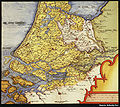
Category:Maps by Christian Sgrothen
Jump to navigation
Jump to search
Media in category "Maps by Christian Sgrothen"
The following 47 files are in this category, out of 47 total.
-
10 Zelandicarum 1573 Sgrooten (Borrendamme en Zierikzee).jpg 241 × 143; 85 KB
-
10 Zelandicarum 1573 Sgrooten (cropped (Beveland)).jpg 1,129 × 657; 511 KB
-
10 Zelandicarum 1573 Sgrooten (cropped Walcheren).jpg 653 × 679; 350 KB
-
10 Zelandicarum 1573 Sgrooten (Hongersdijk).jpg 233 × 179; 90 KB
-
10 Zelandicarum 1573 Sgrooten.jpg 3,114 × 2,968; 3.98 MB
-
11 1570 Schouwen + Sgroten(13a&b).jpg 5,500 × 2,842; 3.19 MB
-
1573 18 sgrooten bruessler atlas.jpg 1,235 × 1,160; 250 KB
-
1573 wickrath.jpg 654 × 603; 109 KB
-
5 1570 Noord Holland Sgroten4g38.JPG 4,893 × 5,339; 17.68 MB
-
7 Sup Hol 1573 Sgrooten.jpg 1,971 × 1,758; 2.94 MB
-
C Sgrothen Atlas 1557.jpg 1,274 × 1,071; 250 KB
-
Continent Hemisphaerium Meridionale 1592 Sgrooten.jpg 2,001 × 1,537; 1.25 MB
-
Detail Kaart Gelderland ca. 1565 Enghuizen Hummelo (2).pdf 822 × 658; 605 KB
-
Detail Kaart Gelderland ca. 1565 Enghuizen Hummelo.pdf 656 × 506; 444 KB
-
Detail kaart Gelderland en Kleef 1573.jpg 2,338 × 1,654; 1.06 MB
-
England and the Low Countries, old map by Christiaan Sgroten.jpg 1,546 × 670; 1.4 MB
-
Erkelant.jpg 970 × 640; 272 KB
-
Erkelenz Atlas 1575.jpg 753 × 581; 133 KB
-
ErkelenzKarte.jpg 766 × 597; 115 KB
-
Garzweiler Atlas 1575.jpg 607 × 498; 93 KB
-
Hinkelenoord, Agger en Oud-Bath op de kaart van Sgrooten (1573).jpg 664 × 495; 313 KB
-
Iersekeroord, Zelandicarum 1573 Sgrooten (uitsnede).jpg 326 × 224; 110 KB
-
Kaart van Zuid-Hollandse en Zeeuwse eilanden - Dordrecht - 20060112 - RCE.jpg 4,200 × 2,183; 6.46 MB
-
Kaster Atlas 1557.jpg 754 × 703; 99 KB
-
Körrenzigkarte.jpg 466 × 295; 41 KB
-
Ostium Scaldis 1573 Sgrooten (cropped Noord-Beveland).jpg 1,167 × 727; 788 KB
-
Ostium Scaldis 1573 Sgrooten (Hoedekenskerke en Vinninghen).jpg 244 × 197; 83 KB
-
Ostium Scaldis 1573 Sgrooten (Wolphaartsdijk).jpg 703 × 319; 251 KB
-
Ostium Scaldis 1573 Sgrooten.jpg 4,245 × 2,222; 7.1 MB
-
Sgroten - Groningen - kleur.png 5,319 × 4,148; 56.23 MB
-
Sgroten - Groningen en Oost-Friesland.jpg 7,101 × 6,699; 34.98 MB
-
Sgroten - Groningen.png 3,736 × 3,521; 22.51 MB
-
Sgrothen 1573inde.jpg 793 × 753; 110 KB
-
Sgrothen Atlas 1557.jpg 1,208 × 1,022; 311 KB
-
Sgrothen Limburg Jülich.jpg 1,100 × 1,800; 846 KB
-
Sogrothen 1573JL.jpg 1,140 × 1,814; 362 KB
-
Sogrothen 1573rur.jpg 644 × 714; 82 KB
-
Sogrothen 1573wurm.jpg 517 × 1,026; 95 KB
-
UBBasel Map 1572 Kartenslg AA 119-120 Peregrinatio filiorum Dei.tiff 28,739 × 8,534, 2 pages; 1.38 GB
-
UBBasel Map 1578 Kartenslg AA 57 Tractus Danubii prima.tiff 11,953 × 9,800, 2 pages; 666.34 MB
-
UBBasel Map Deutschland Mitteleuropa 1570 Kartenslg AA 24.tif 12,047 × 9,870, 2 pages; 340.21 MB
-
Veluwe Christian Sgrooten 1573.jpg 5,540 × 6,878; 5.12 MB
-
Verdronken Noord-Beveland, Zelandicarum 1573 Sgrooten.jpg 395 × 269; 132 KB
-
Voorne-Putten1573 Sgrooten.jpg 1,423 × 924; 474 KB
-
Zelandia Res000266222 & 23.jpg 2,000 × 1,287; 1.25 MB


