Category:Maps by Brockhaus
Jump to navigation
Jump to search
Subcategories
This category has the following 2 subcategories, out of 2 total.
B
Media in category "Maps by Brockhaus"
The following 46 files are in this category, out of 46 total.
-
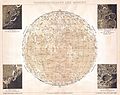 1898 Brockhaus Map of the Moon - Geographicus - Moon-brockhaus-1898.jpg 3,000 × 2,385; 1.48 MB
-

-
 Africa's places in Brockhaus.jpg 1,569 × 1,304; 1.63 MB
-
 Amsterdam Zeeheldenbuurt Brockhaus Konversations Lexikon 1901.jpg 1,668 × 1,452; 481 KB
-
 Asian places in Brockhaus 1937.jpg 1,600 × 2,601; 2.4 MB
-
 Berlin in Brockhaus 1937.jpg 2,788 × 1,670; 2.77 MB
-
 Britz-nach-Brockhaus 14doit.png 1,438 × 1,272; 1.43 MB
-
 Brockhaus 14 Karte Berlin Stadtbahn.jpg 1,618 × 1,111; 585 KB
-
 Brockhaus 14 Karte Berlin und Umgebung (rectified).jpg 3,516 × 3,000; 4.61 MB
-
 Brockhaus 14 Karte-Rudow.jpg 1,878 × 1,199; 1.66 MB
-
 Brockhaus-Afrika-1887.jpg 1,020 × 1,360; 1.65 MB
-
 Brockhaus-Blankenburg1894.jpg 1,000 × 707; 218 KB
-
 Brockhaus14Karte-BerlinUndUmgebung-Rosenthal.jpg 922 × 621; 398 KB
-
 Bukarest 1911.PNG 546 × 561; 573 KB
-
 Cairo in Brockhaus.jpg 1,563 × 1,310; 1.46 MB
-
 Central Europe (economy).jpg 2,306 × 1,450; 3.28 MB
-
 Central Europe (ethnic).JPG 2,230 × 1,436; 2.81 MB
-
 Central Europe Economy.jpg 2,320 × 1,456; 1.06 MB
-
 Deutsch Ostafrika.PNG 701 × 764; 1.32 MB
-
 Karte der deutschen Mundarten (Brockhaus).jpg 6,638 × 5,057; 21.36 MB
-
 Deutsches Reich Historische Karten 1.jpg 2,317 × 1,816; 1.81 MB
-
 Freiburg in Brockhaus 1937.jpg 1,579 × 2,672; 2.44 MB
-
 Karte der Villenkolonien Nikolassee, Schlachtensee und Wannsee 1911.jpg 1,535 × 801; 864 KB
-
 Karte Reinhardshagen 1905.png 709 × 694; 1.29 MB
-
 London in Brockhaus 1937.jpg 2,242 × 1,683; 2.15 MB
-
 Map Baden Hohenzollern Wuerttemberg 1892 Part Black Forest.jpg 4,529 × 6,370; 9.4 MB
-
 Map Grand Duchy of Hesse.png 1,256 × 1,548; 1.56 MB
-
 Map-Bremen-Brockhaus-1837 II.jpg 1,163 × 754; 298 KB
-
 Map-Bremen-Brockhaus-1837.png 1,163 × 754; 763 KB
-
 Map-Deutsch-Afrika.png 2,294 × 1,456; 2.06 MB
-
 Map-Kaiser-Wilhelms-Land-und-Bismarck-Archipel-2.png 1,284 × 810; 701 KB
-
 Map-Kaiser-Wilhelms-Land-und-Bismarck-Archipel.png 2,314 × 1,456; 2.14 MB
-
 Old Historical map of Russia from Brockhaus.jpg 2,048 × 1,586; 691 KB
-
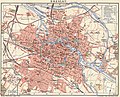
 Paris in Brockhaus 1937 cropped.jpg 2,619 × 1,577; 3.27 MB
-
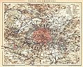
 Paris in Brockhaus 1937.jpg 2,624 × 1,680; 2.61 MB
-
 Paris Petite Ceinture 1898.jpg 2,524 × 2,041; 1.27 MB
-
 Pendulum Islands.png 437 × 339; 288 KB
-
 Plan of Leipzig 18 century.jpg 4,492 × 4,613; 7.81 MB
-
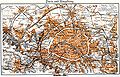
 Plan von Paris und seinen Festungswerken - btv1b8445691m.jpg 5,796 × 4,171; 4.27 MB
-
 Rheinisch Westfaelisches Kohlengebiet 1896.jpg 902 × 596; 198 KB
-
 Smyrna-German-map-1895.jpg 927 × 1,434; 1.23 MB
-
 Stadtplan Breslau 1904.jpg 3,370 × 2,722; 9.94 MB
-
 Stadtplan Hannover 1895 Meyers Konversations-Lexikon Jakobistrasse.jpg 264 × 208; 106 KB
-
 Stadtplan Hannover Brockhaus 14. Auflage 1893-1895 Straßennamen.jpg 3,936 × 3,037; 8.06 MB
-
 Stadtplan1895.png 694 × 466; 906 KB
-
 Wien in Brockhaus 1937.jpg 2,784 × 1,776; 3.02 MB

.jpg)


.jpg)


.jpg)
.JPG)


.jpg)


