Category:Maps by Ailura
Jump to navigation
Jump to search
Media in category "Maps by Ailura"
The following 22 files are in this category, out of 22 total.
-
20230929 WikiCon Photowalk.jpg 559 × 793; 243 KB
-
A49 OSM.jpg 945 × 1,417; 582 KB
-
Alpen Karpaten Korridor.jpg 1,249 × 1,750; 1.45 MB
-
Gemeindeau.png 3,397 × 2,362; 2.78 MB
-
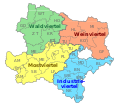
Karte NOE Viertel beschriftet Bezirke.svg 1,067 × 960; 1.55 MB
-
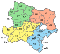
Karte NOE Viertel Bezirke 2017.svg 1,067 × 960; 1.54 MB
-
Karte NOE Viertel Bezirke bis 2016.svg 1,000 × 900; 63 KB
-
Karte NOE Viertel Bezirke.svg 1,000 × 900; 82 KB
-
Kernbruch.png 945 × 945; 34 KB
-
München Bahnhofsplatz1.jpg 496 × 726; 193 KB
-
NOe Viertel Ausschnitt Mannhartsberg.png 1,084 × 759; 847 KB
-
NÖ NSchK Grenzen.png 2,362 × 2,362; 4.89 MB
-
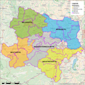
NÖ NSchK Hauptregionen.png 2,362 × 2,362; 4.91 MB
-
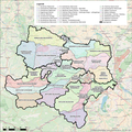
Regionen NÖ NSchK.png 2,362 × 2,362; 4.77 MB
-
Routen Schwerin 1.png 3,390 × 2,379; 7.82 MB
-
Routen Schwerin 2.png 3,390 × 2,379; 5.79 MB
-
Routen Schwerin 3.png 3,390 × 2,379; 9.69 MB
-
Routen Schwerin.png 3,390 × 2,379; 7.4 MB
-
Routen.png 2,366 × 3,387; 6.67 MB
-
Vierteleinteilung in Niederösterreich.png 2,362 × 2,362; 4.95 MB
-
Wiki Takes Innviertel Arbeitskarte 001.jpg 13,942 × 8,220; 40.69 MB
-
WP20Symbols CAMERA Ailura.svg 512 × 402; 86 KB


