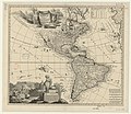
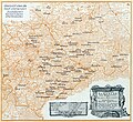
Category:Maps by Adam Friedrich Zürner
Jump to navigation
Jump to search
Subcategories
This category has the following 2 subcategories, out of 2 total.
Media in category "Maps by Adam Friedrich Zürner"
The following 16 files are in this category, out of 16 total.
-
2019-08-15 Staatliches Museum für Archäologie Chemnitz 36.jpg 3,648 × 2,736; 1.97 MB
-
2019-08-15 Staatliches Museum für Archäologie Chemnitz 37.jpg 3,648 × 2,736; 2.32 MB
-
Bornhöck Karte 2.png 947 × 593; 948 KB
-
Die kursächsischen Postmeilensäulen beim zweihundertjährigen Bestehen 161.jpg 3,011 × 2,771; 2.01 MB
-
Karte Meissnischer Kreis Homannsche Erben 1757 (cropped).jpg 1,547 × 1,184; 827 KB
-
Karte Thüringer Kreis Homannsche Erben 1757 (cropped).jpg 2,130 × 1,211; 1.16 MB
-
Kreisamt Leipzig 1758.jpg 6,589 × 6,200; 10.19 MB
-
Map - Special Collections University of Amsterdam - OTM- HB-KZL 31-01-29.tif 8,000 × 6,723; 153.88 MB
-
Map - Special Collections University of Amsterdam - OTM- HB-KZL 33.11.65.tif 7,736 × 6,519; 144.28 MB


