Category:Maps and plans of Tiryns
Jump to navigation
Jump to search
Maps and plans of Tiryns
Media in category "Maps and plans of Tiryns"
The following 11 files are in this category, out of 11 total.
-
 BurchtTiryns2.JPG 1,004 × 2,610; 240 KB
-
 BurchtTiryns21.jpg 2,610 × 1,004; 255 KB
-
 EB1911 Tiryns - Plan of the Palace.jpg 767 × 978; 395 KB
-

-
 Plan acropole supérieure de Tirynthe Dörpfeld 1884.jpg 5,471 × 3,739; 2.81 MB
-
 Plan citadelle Tirynthe d'après fouilles de Schliemann en 1884.jpg 4,365 × 2,680; 2.11 MB
-
 Plan en coupe de Tirynthe.jpg 4,503 × 2,552; 1.96 MB
-
 Plan of the ancient walls of Tiryns - Du Moncel Théodore - 1843.jpg 800 × 403; 78 KB
-
 The Upper Citadel of Tiryns. Drawn By Dr. W. Dorpfeld (11247017766).jpg 4,251 × 2,638; 2.89 MB
-
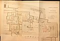
 Tiryns Tafel I.jpg 1,689 × 984; 531 KB
-
 Tiryns, map of the palace and the surrounding fortifications.png 872 × 524; 663 KB

_(14760118581).jpg)


.jpg)

