Category:Maps and plans of Mycenae
Jump to navigation
Jump to search
Maps and plans of Mycenae
Subcategories
This category has the following 2 subcategories, out of 2 total.
Media in category "Maps and plans of Mycenae"
The following 19 files are in this category, out of 19 total.
-
-
 559 of 'Travels in the Morea' (11007892176).jpg 2,565 × 2,359; 940 KB
-
 Argolis during Mycenaean Ages – Tsountas.png 1,100 × 1,644; 1.99 MB
-
 EB1911 Mycenae - plan of the citadel.jpg 1,590 × 993; 483 KB
-
 Greece-0416 - Mycenae (2215129203).jpg 3,264 × 2,448; 11.28 MB
-
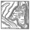
 Karte Mykene MKL1888.png 538 × 539; 144 KB
-
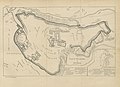
 Map of Mycenae.jpg 2,597 × 3,187; 4.62 MB
-
 Meyers b11 s0950 b1.png 384 × 384; 82 KB
-
 Mycenae 008.jpg 4,000 × 3,000; 4.33 MB
-
 Mycenae 009.jpg 4,000 × 3,000; 4.22 MB
-
 Mycenae 010.jpg 4,000 × 3,000; 4.28 MB
-
 Mycenae 3D Plan IMG 7410.jpg 2,048 × 1,152; 1.11 MB
-
 Mycenae fortifications 1st enceinte.svg 2,672 × 1,646; 243 KB
-
 Mycenae fortifications 2nd enceinte.svg 2,843 × 1,974; 246 KB
-
 Mycenae fortifications 3rd enceinte.svg 2,843 × 1,974; 248 KB
-
 Mycenae plan-A.jpg 1,037 × 602; 112 KB
-
 Mycenae plan3-he.jpg 1,051 × 737; 524 KB
-
 Plan of grave circle A.jpg 767 × 1,023; 91 KB
-
 Denkmaler antiker Kunst 1907 (150330417).jpg 6,544 × 4,659; 18.92 MB
.jpg)


.jpg)


.jpg)
.jpg)