Category:Maps and Charts of Plauen
Jump to navigation
Jump to search
Subcategories
This category has the following 2 subcategories, out of 2 total.
M
- Maps of districts of Plauen (70 F)
P
Media in category "Maps and Charts of Plauen"
The following 28 files are in this category, out of 28 total.
-
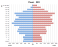 Bevoelkerungspyramide Plauen 2011.png 772 × 624; 15 KB
-
 Einwohnerentwicklung von Plauen - ab 1871.svg 800 × 400; 70 KB
-
 Einwohnerentwicklung von Plauen.svg 800 × 400; 72 KB
-
 Grundriss Plauen 1795.jpg 7,710 × 7,640; 18.17 MB
-
 Karte Friedhof I Plauen.png 2,234 × 2,205; 441 KB
-
 Karte Plauen in Deutschland.png 188 × 235; 3 KB
-
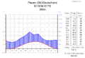 Klimadiagramm-deutsch-Plauen (SN)-Deutschland.png 1,024 × 710; 126 KB
-
 Lage der kreisfreien Stadt Plauen in Deutschland.png 176 × 234; 4 KB
-
 Meilenblatt B 125 Neundorf.jpg 9,020 × 9,010; 30.09 MB
-
 Meilenblatt B 126 Jößnitz.jpg 9,030 × 9,220; 29.28 MB
-
 Meilenblatt B 143 Taltitz.jpg 9,000 × 9,070; 30.38 MB
-
 Meilenblatt B 144 Plauen.jpg 9,000 × 9,050; 28.27 MB
-
 Plauen Bombenschadensgebiet 1945.JPG 1,200 × 1,600; 876 KB
-
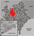
 Plauen in German Democratic Republic.svg 618 × 789; 3 MB
-
 Plauen in V.svg 1,178 × 1,254; 337 KB
-
 Plauen Karte Geologie.svg 965 × 970; 233 KB
-
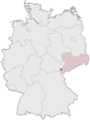
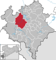
 Plauen Lage im Vogtlandkreis.png 1,315 × 1,355; 218 KB
-
 Plauen Land in German Democratic Republic.svg 618 × 789; 3 MB
-
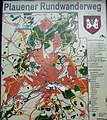 Plauen map.jpg 2,144 × 2,412; 3.12 MB
-
 Plauen Sitzverteilung im Stadtrat 2004.png 1,081 × 771; 77 KB
-
 Population development of Plauen 1458-2014.svg 1,750 × 906; 117 KB
-
 Population Statistics Plauen.png 910 × 562; 66 KB
-
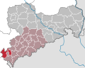
 Sachsen Große Kreisstädte Plauen.PNG 970 × 755; 120 KB
-
 Saxony 1993 Plauen-Land.svg 2,268 × 1,814; 441 KB
-
 Saxony 1993 Plauen.svg 2,268 × 1,814; 441 KB
-
 Sitzverteilung Stadt Plauen 2009.png 1,279 × 842; 140 KB
-
 Sitzverteilung Stadt Plauen 2014.png 1,279 × 842; 136 KB
-
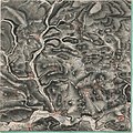
 Umgegend von Plauen (1761).jpg 3,391 × 2,572; 2.76 MB


-Deutschland.png)


.jpg)