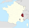
Category:Maps about the history of Savoie
Jump to navigation
Jump to search
Media in category "Maps about the history of Savoie"
The following 6 files are in this category, out of 6 total.
-
Carte des pierres à cupules de Billème.svg 750 × 750; 359 KB
-
Commune nouvelle Entrelacs.png 585 × 501; 597 KB
-
Savoie 1789.svg 2,000 × 1,922; 797 KB
-
Savoie 1814-de.svg 620 × 674; 1.69 MB
-
Savoie 1814-fr.svg 620 × 674; 1.69 MB
-
Savoie Campaign of 1793.png 500 × 692; 257 KB


