Category:Maps about the history of Rennes
Jump to navigation
Jump to search
Subcategories
This category has the following 2 subcategories, out of 2 total.
B
- Map of the Hôtel de Blossac (12 F)
M
- Maps of Tramway of Rennes (22 F)
Media in category "Maps about the history of Rennes"
The following 24 files are in this category, out of 24 total.
-
 Carte des limites de la ville antique de Condate.png 3,308 × 4,678; 1.81 MB
-
 Carte des opérations archéologiques à Rennes.png 3,308 × 4,678; 1.88 MB
-
 Diocèse Rennes 1789.svg 2,000 × 1,922; 801 KB
-
 Localisation des facultés à Rennes au XIXe.gif 647 × 585; 79 KB
-
 Localisation des facultés à Rennes au XIXe.svg 662 × 777; 101 KB
-
 Remparts de Rennes - fin XVe siècle.svg 1,200 × 743; 336 KB
-
 Rennes - Siège de 1356-1357.svg 379 × 311; 123 KB
-
 Rennes 1782.svg 477 × 384; 28 KB
-
 Rennes 1827.svg 477 × 384; 28 KB
-
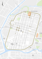
 Rennes 1877.svg 477 × 384; 37 KB
-
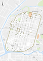
 Rennes 1919.svg 477 × 384; 36 KB
-
 Rennes 1942.svg 477 × 384; 37 KB
-
 Rennes 1962.svg 477 × 384; 39 KB
-
 Rennes 1983.svg 477 × 384; 39 KB
-
 Rennes 2008.svg 477 × 384; 40 KB
-
 Rennes at the 17th century Henri Carré's map-fr.svg 1,270 × 1,235; 118 KB
-
 Rennes at the early 17th century Henri Carré's map-fr.svg 2,000 × 1,275; 256 KB
-
 Rennes gallo-MA.svg 477 × 384; 29 KB
-
 Rennes gallo-romain.svg 477 × 384; 26 KB
-
 Rennes IVe.svg 477 × 384; 29 KB
-
 Rennes remparts.svg 477 × 384; 133 KB
-
 Rennes XVe.svg 477 × 384; 41 KB
-
 Rennes, lieux second procès Dreyfus.png 2,084 × 1,320; 242 KB
-
 Terrain des Halles de Rennes après l'incendie.jpg 3,376 × 1,936; 754 KB


