Category:Maps about the history of Indre-et-Loire
Jump to navigation
Jump to search
Subcategories
This category has the following 2 subcategories, out of 2 total.
Media in category "Maps about the history of Indre-et-Loire"
The following 9 files are in this category, out of 9 total.
-
Cité Turones.svg 766 × 808; 1.52 MB
-
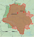
Indre-et-Loire-ligne demarcation.png 340 × 293; 69 KB
-
Prieuré Louroux emplacement OSM2.jpg 873 × 507; 61 KB
-
Ripault bruit explosion.svg 675 × 711; 1.51 MB
-
Ripault explosion bruit.svg 535 × 571; 143 KB
-
Ripault souffle explosion.svg 595 × 465; 25 KB
-
Tasciaca dans la cité Turones.svg 766 × 808; 1.52 MB
-
Vernou - localisation.svg 766 × 808; 1.52 MB
-
Yzeures dans la cité Turones.svg 766 × 808; 1.52 MB


