Category:Maps about the history of Hautes-Alpes
Jump to navigation
Jump to search
Media in category "Maps about the history of Hautes-Alpes"
The following 5 files are in this category, out of 5 total.
-
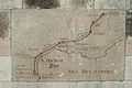
 Briancon NO detail - plan-relief 1736.jpg 3,776 × 2,520; 8.81 MB
-
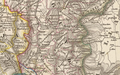
 Itinéraires Gap-Briançon Hannibal.jpg 832 × 654; 101 KB
-
 Pagi rhônalpins.png 904 × 564; 1.1 MB
-
 Peuples celtiques des Alpes du sud.jpg 867 × 519; 303 KB
-
 ViaDomitia2.jpg 4,256 × 2,832; 4.06 MB


