Category:Maps about the history of Eure-et-Loir
Jump to navigation
Jump to search
Subcategories
This category has the following 3 subcategories, out of 3 total.
O
Media in category "Maps about the history of Eure-et-Loir"
The following 2 files are in this category, out of 2 total.
-
 Cherisy, bombardement du 13 août 1944.svg 3,543 × 2,880; 20.52 MB
-
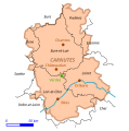 Verdes - Carnutes.svg 596 × 600; 31 KB

