Category:Maps about the COVID-19 pandemic in the Netherlands
Jump to navigation
Jump to search
Countries of Europe: Albania · Armenia‡ · Austria · Azerbaijan‡ · Belarus · Belgium · Bosnia and Herzegovina · Bulgaria · Croatia · Czech Republic · Denmark · Estonia · Finland · France‡ · Georgia‡ · Germany · Greece · Hungary · Iceland · Republic of Ireland · Italy · Kazakhstan‡ · Latvia · Liechtenstein · Lithuania · Luxembourg · Malta · Moldova · Monaco · Montenegro · Netherlands‡ · North Macedonia · Norway · Poland · Portugal‡ · Romania · Russia‡ · San Marino · Serbia · Slovakia · Slovenia · Spain‡ · Sweden · Switzerland · Turkey‡ · Ukraine · United Kingdom
Limited recognition: Abkhazia‡ · Kosovo
‡: partly located in Europe
Limited recognition: Abkhazia‡ · Kosovo
‡: partly located in Europe
Subcategories
This category has the following 2 subcategories, out of 2 total.
Media in category "Maps about the COVID-19 pandemic in the Netherlands"
The following 5 files are in this category, out of 5 total.
-
COVID-19 Netherlands - 7-day prevalence per capita (timeline).webm 1 min 46 s, 866 × 1,030; 3.22 MB
-

-
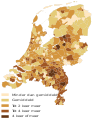
 COVID-19 outbreak the Netherlands per capita cases map.svg 512 × 603; 132 KB
-
 Sterfgevallen week 13 per gemeente.svg 382 × 490; 7.83 MB
-
 Sterfgevallen week 14 per gemeente.svg 3,285 × 4,213; 2.86 MB
.svg)


