Category:Maps about the COVID-19 pandemic in New Zealand
Jump to navigation
Jump to search
Media in category "Maps about the COVID-19 pandemic in New Zealand"
The following 8 files are in this category, out of 8 total.
-
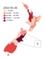 COVID-19 Outbreak Cases in New Zealand (DHB Totals).svg 650 × 846; 138 KB
-
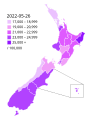 COVID-19 Outbreak Cases in New Zealand (DHB Totals, per capita).svg 650 × 846; 139 KB
-
 COVID-19 Outbreak Cases in New Zealand (Region Totals) v2.svg 1,380 × 1,746; 417 KB
-
 COVID-19 Outbreak Cases in New Zealand.png 256 × 335; 20 KB
-
 COVID-19 Outbreak Cases in New Zealand.svg 420 × 550; 292 KB
-
 COVID-19 Outbreak Deaths in New Zealand (DHB Totals).svg 650 × 846; 139 KB
-
 COVID-19 outbreak New Zealand per capita cases map.svg 650 × 846; 130 KB
-
 New Zealand Vaccine Rollout per DHB.png 550 × 795; 56 KB
.svg)
.svg)
_v2.svg)


.svg)

