Category:Maplehurst
Jump to navigation
Jump to search
Main Wikipedia article: Maplehurst, West Sussex.

village in United Kingdom .jpg) | |||||
| Upload media | |||||
| Instance of | |||||
|---|---|---|---|---|---|
| Location | Nuthurst, Horsham, West Sussex, South East England, England | ||||
 | |||||
English: Maplehurst is a hamlet in the civil parish of Nuthurst, and the Horsham District of West Sussex, England. It is on the Copsale to Nuthurst road, 4 miles (6km) south from Horsham town. There is one pub, The White Horse, which is on Park Lane just off Nuthurst Road.
Mobile device view makes it difficult to view Maplehurst's immediate and useful surrounding parish pictures. For this, click Nuthurst.
Desktop view links are at the bottom of the page.
Subcategories
This category has the following 2 subcategories, out of 2 total.
W
- Wassail at Maplehurst (11 F)
Media in category "Maplehurst"
The following 35 files are in this category, out of 35 total.
-
 Broken signpost, Maplehurst (geograph 4014406).jpg 640 × 430; 141 KB
-
 Brook Farmhouse (geograph 4528902).jpg 2,399 × 1,599; 817 KB
-
 Cottage on Nuthurst St (geograph 5146382).jpg 424 × 640; 69 KB
-
 Cottage, Maplehurst (geograph 4014409).jpg 640 × 430; 101 KB
-
 Deer fencing near Maplehurst Farm - geograph.org.uk - 1588508.jpg 640 × 480; 91 KB
-
 Entering Maplehurst (geograph 4010287).jpg 640 × 430; 118 KB
-
 Entering Maplehurst (geograph 4014432).jpg 640 × 430; 112 KB
-
 Ferncroft, Maplehurst (geograph 4010450).jpg 640 × 430; 71 KB
-
 Finger Post at road junction in Maplehurst - geograph.org.uk - 86055.jpg 467 × 640; 162 KB
-
 Flood in Park Lane - geograph.org.uk - 1152807.jpg 640 × 480; 78 KB
-
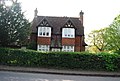 House in Maplehurst (geograph 4014422).jpg 640 × 430; 84 KB
-
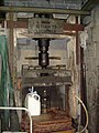 JB's Cider Press - geograph.org.uk - 102525.jpg 480 × 640; 77 KB
-
 Maplehurst Farm - geograph.org.uk - 4014465.jpg 640 × 430; 71 KB
-
 Maplehurst Farm - geograph.org.uk - 4014467.jpg 640 × 430; 69 KB
-
 Maplehurst Farm sign - geograph.org.uk - 4014440.jpg 640 × 430; 91 KB
-
 Maplehurst Road south to Conies Farm - geograph.org.uk - 1587401.jpg 640 × 480; 62 KB
-
 Maplehurst Village Sign (geograph 4014423).jpg 430 × 640; 100 KB
-

-

-

-
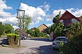
 Park Lane, Maplehurst (geograph 4010458).jpg 640 × 430; 75 KB
-
 Path junction south of Maplehurst Farm - geograph.org.uk - 1588531.jpg 640 × 480; 141 KB
-

-
 Pylon near Maplehurst Rd - geograph.org.uk - 4014718.jpg 430 × 640; 65 KB
-
 Race horse road sign - geograph.org.uk - 1588472.jpg 640 × 480; 139 KB
-

-
 Road sign, Maplehurst (geograph 4014426).jpg 430 × 640; 98 KB
-
 Row of houses, Nuthurst Rd (geograph 4010455).jpg 640 × 430; 98 KB
-

-
 The Way to the White Horse (geograph 5146370).jpg 640 × 424; 64 KB
-
 The White Horse Maplehurst (geograph 5146358).jpg 640 × 424; 77 KB
-
 The White Horse Maplehurst - geograph.org.uk - 1588430.jpg 640 × 480; 96 KB
-
 Timber bus shelter at Maplehurst - geograph.org.uk - 1588442.jpg 640 × 480; 104 KB
-
 Track to Maplehurst Farm - geograph.org.uk - 4014436.jpg 640 × 430; 84 KB
-

.jpg)
.jpg)
.jpg)
.jpg)

.jpg)
.jpg)
.jpg)


.jpg)


.jpg)


.jpg)


.jpg)
.jpg)
.jpg)
.jpg)


