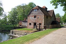
Category:Mapledurham Watermill
Jump to navigation
Jump to search
English: Mapledurham Watermill is an historic watermill in the civil parish of Mapledurham in the English county of Oxfordshire. The mill is driven by the head of water created by Mapledurham Lock and Weir and is preserved in an operational state. (→Mapledurham Watermill)
Polski: Mapledurham Watermill to historyczny młyn wodny na rzece Tamizie we wiosce Mapledurham w Oxfordshire w Anglii. (→Mapledurham Watermill)
mill in Mapledurham, South Oxfordshire, England, UK | |||||
| Upload media | |||||
| Instance of | |||||
|---|---|---|---|---|---|
| Location | Mapledurham, South Oxfordshire, Oxfordshire, South East England, England | ||||
| Heritage designation |
| ||||
 | |||||
Media in category "Mapledurham Watermill"
The following 13 files are in this category, out of 13 total.
-
Mapledurham Mill.jpg 640 × 480; 116 KB
-
Mapledurham Water Mill - geograph.org.uk - 767630.jpg 640 × 480; 96 KB
-
Mapledurham Water Mill - geograph.org.uk - 767631.jpg 640 × 480; 87 KB
-
Mapledurham Watermill 1.JPG 2,160 × 1,440; 1.18 MB
-
Mapledurham Watermill 2.JPG 2,160 × 1,440; 1,023 KB
-
Mapledurham Watermill 3.JPG 2,160 × 1,440; 1.16 MB
-
Mapledurham Watermill.jpg 3,034 × 4,000; 6.4 MB
-
Messing about on the river (geograph 3583648).jpg 800 × 600; 165 KB
-
Mill - geograph.org.uk - 1529474.jpg 640 × 480; 111 KB
-
Mill at Mapledurham - geograph.org.uk - 1529450.jpg 640 × 480; 110 KB
-
Mill, Mapledurham, Oxfordshire - geograph.org.uk - 1606403.jpg 640 × 401; 87 KB
-
The Eagle Has Landed - geograph.org.uk - 4243874.jpg 1,024 × 683; 244 KB
-
Water Power (geograph 4671084).jpg 1,024 × 683; 168 KB


