Category:Maple Canyon (Spanish Fork Peak)
Jump to navigation
Jump to search
canyon in the Wasatch Range in Utah County, Utah County, United States (Geonames ID 5777885) | |||||
| Upload media | |||||
| Instance of | |||||
|---|---|---|---|---|---|
| Located in protected area | |||||
| Location | Utah County, Utah | ||||
| Mountain range | |||||
| Elevation above sea level |
| ||||
 | |||||
English: Media related to Maple Canyon (Spanish Fork Peak), a canyon in the Unita National Forest in southern Wasatch Range on the north side of Spanish Fork Peak in southeastern Utah County, Utah, United States.
Media in category "Maple Canyon (Spanish Fork Peak)"
The following 9 files are in this category, out of 9 total.
-
 Bench along Left Fork Maple Canyon Trail, Utah, Jul 16.jpg 2,592 × 1,944; 2.23 MB
-
 Down lower Maple Canyon, Utah County, Utah, Jul 16.jpg 2,592 × 1,944; 2.39 MB
-
 Down upper Maple Canyon, Utah County, Utah, Jul 16.jpg 2,592 × 1,944; 2.29 MB
-
 Full moon from Maple Canyon, Jul 16.jpg 2,592 × 1,944; 2.3 MB
-
 Left Fork Maple Canyon, DyeClan.com - panoramio.jpg 1,836 × 3,264; 2.84 MB
-
 Right Fork Maple Canyon Trail, Jul 16.jpg 2,592 × 1,944; 2.35 MB
-
 South canoyn wall, Maple Canyon, Utah, Jul 16.jpg 2,592 × 1,944; 2.52 MB
-
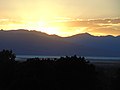 Sunset over Utah Lake, from Maple Canyon, Jul 16.jpg 2,592 × 1,944; 2.14 MB
-
 Whiting campground sign, Maple Canyon, Utah, Jul 16.jpg 2,592 × 1,944; 2.4 MB


