Category:Map with ETRS89-LAEA projection
Jump to navigation
Jump to search
English: This category groups maps which are using the ETRS89-LAEA projection (European Terrestrial Reference System 1989 - Lambert azimuthal equal-area projection), also called EPSG:3035.
This is the current European system which conserves surfaces (but not angles). See European grid for more details about this projection.
Français : Cette catégorie regroupe les cartes utilisant la projection ETRS89-LAEA (European Terrestrial Reference System 1989 - Projection azimutale équivalente de Lambert, dont l'abréviation vient de l'anglais "Lambert azimuthal equal-area"), également appelée EPSG:3035.
C'est le système européen actuel conservant les surfaces (mais pas les angles). Voir European grid pour plus de détails sur cette projection.
proposed, multipurpose Pan-European mapping standard | |||||
| Upload media | |||||
| Instance of | |||||
|---|---|---|---|---|---|
| |||||
See also
[edit]Subcategories
This category has only the following subcategory.
Media in category "Map with ETRS89-LAEA projection"
The following 24 files are in this category, out of 24 total.
-
 CEE member status map.png 3,507 × 2,456; 2.13 MB
-
 Europa - orografia.jpg 1,580 × 1,351; 1.71 MB
-
 Europe blank laea location map (variant).svg 1,401 × 1,198; 1.38 MB
-
 Europe blank laea location map before 1990.svg 1,401 × 1,198; 1.38 MB
-
 Europe blank laea location map no boundaries.svg 1,401 × 1,198; 1.72 MB
-
 Europe blank laea location map-1.svg 1,401 × 1,198; 1.54 MB
-
 Europe blank laea location map.svg 1,401 × 1,198; 1.42 MB
-
 Europe bluemarble laea location map.jpg 1,400 × 1,197; 926 KB
-
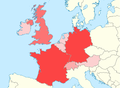
 Europe central west blank laea location map.png 1,000 × 890; 290 KB
-
 Europe central west blank laea location map.xcf 1,000 × 890; 329 KB
-
 Europe EU laea location map (configurable).svg 1,200 × 1,027; 1.39 MB
-
 Europe EU laea location map.svg 1,401 × 1,198; 1.43 MB
-
 Europe laea location map-es.svg 1,401 × 1,198; 2.06 MB
-
 Europe laea location map.svg 1,401 × 1,198; 2.21 MB
-
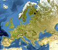
 Europe natural laea location map.jpg 1,580 × 1,351; 1.15 MB
-
 Europe relief laea location map BG.png 1,580 × 1,351; 3.07 MB
-
 Europe relief laea location map.jpg 1,580 × 1,351; 1.1 MB
-
 European long-distance paths.svg 1,000 × 900; 1.65 MB
-
 European Union relief laea location map.svg 1,401 × 1,198; 1,018 KB
-
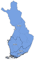 Finland-NUTS2013.png 520 × 894; 90 KB
-
 High Speed Railroad Map of Europe.svg 1,038 × 834; 1.68 MB
-
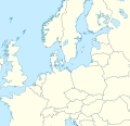 Northern and Central Europe 2 location map.svg 520 × 500; 1.84 MB
-
 Northern and Central Europe location map.svg 400 × 500; 1.84 MB
-
 Western Europe World Heritage Sites.png 1,130 × 832; 174 KB


.svg)


.svg)