Category:Map of India images that should use vector graphics
Jump to navigation
Jump to search
This is a subcategory of Category:Images that should use vector graphics. You can add images to this category using the template {{Convert to SVG|map of india}}.
Media in category "Map of India images that should use vector graphics"
The following 30 files are in this category, out of 30 total.
-
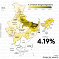
% of Native Bhojpuri Speakers.png 2,500 × 2,500; 1.27 MB
-
(Santragachi - Mangalore) Vivek Express Route map.jpg 1,519 × 1,773; 592 KB
-
(Santragachi - Tirupathi) Express Route map.jpg 1,519 × 1,773; 548 KB
-
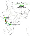
(Secunderabad - Gorakhpur) Express route map.jpg 1,519 × 1,773; 575 KB
-
(Secunderabad - Rajkot) Express Route map.jpg 1,519 × 1,773; 558 KB
-
(Secunderabad - Shalimar) AC Express and Super fast Express Route map.jpg 1,519 × 1,773; 580 KB
-
(TPJ - TEN) Intercity Express Route map.jpg 483 × 600; 173 KB
-
(Villupuram - Kharagpur) Express Route map.jpg 1,519 × 1,773; 568 KB
-
(Villupuram - Purulia) Express Route map.jpg 1,519 × 1,773; 565 KB
-
(Visakhapatnam - Bhagat Ki Kothi) Express Route map.jpg 1,519 × 1,773; 543 KB
-
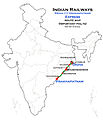
(Visakhapatnam - Digha) Express Route map.jpg 1,519 × 1,773; 497 KB
-
(Visakhapatnam - Kollam) Express Route map.jpg 1,519 × 1,773; 724 KB
-
(Visakhapatnam - Mumbai LTT) (via Secunderabad) Express Route map.jpg 1,519 × 1,773; 530 KB
-
(Visakhapatnam - Shalimar) Express Route map.jpg 1,519 × 1,773; 504 KB
-
1912 YB India Union Mission.jpg 773 × 802; 128 KB
-
2019 Political Map of India.jpg 9,213 × 10,392; 3.56 MB
-
5 регионов Индии.png 743 × 800; 29 KB
-
Garhani block map.png 699 × 1,076; 246 KB
-
Bhumij language.svg 1,500 × 1,615; 3.1 MB
-
CededConqueredProvincesDelhiTerritory.jpg 1,214 × 1,000; 344 KB
-
COVID-19 Death Cases in Punjab (2 april), India.png 1,084 × 1,200; 167 KB
-
Hayyal (B), Wadagera Map.jpg 3,264 × 3,264; 939 KB
-
India map.jpg 1,600 × 1,200; 154 KB
-
Kudmali language region.svg 1,500 × 1,615; 3.1 MB
-
Languages of Bharat.jpg 554 × 554; 164 KB
-
MAP OF SOUTH ASIA WITH RIVERS.png 5,152 × 4,777; 3.68 MB
-
Map of south asian rivers.png 2,324 × 2,151; 740 KB
-
Medium-india-political-wall-map-vinyl-moi4781121786238-original-imaezawqex9x5dbb.jpg 1,080 × 1,212; 196 KB
-
South India.png 1,503 × 1,687; 390 KB
-
೧೫ ಆಕ್ಟೊರ್ಬ್, ತ್ರಿಪುರ, ಭಾರತದ ಅವಿಭಾಜ್ಯ ಅ೦ಗವಾಯಿತು.png 250 × 285; 21 KB


