Category:Map of Ghent by Jan Blaeu
Jump to navigation
Jump to search
Subcategories
This category has only the following subcategory.
M
Media in category "Map of Ghent by Jan Blaeu"
The following 16 files are in this category, out of 16 total.
-
 "(Gante)" (22231069536).jpg 3,444 × 2,933; 2.23 MB
-
 Antique map of Gent by Blaeu J. 1649.jpg 750 × 593; 207 KB
-
 Gandavum Map of Ghent by Jan Blaeu.jpg 601 × 480; 205 KB
-
 Ghent, Belgium ; Map 1649.jpg 5,500 × 4,450; 10.91 MB
-
 Sint-Lievenspoort en Keizerpoort, Ghent, Belgium ; Map 1649.jpg 811 × 671; 440 KB
-
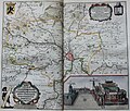
 Surroundings of Ghent with castle, Belgium ; Atlas Van Loon.jpg 5,500 × 4,672; 3.63 MB
-
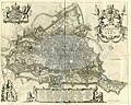 Ghent, Belgium, Gandauum vulgo Gent.jpg 5,604 × 4,472; 6.12 MB
-
 Ghent, map 1735.jpg 500 × 405; 100 KB
-
 Casselrij Oudenbrug, Neigbourhood Ghent, by Blau.jpg 2,124 × 1,828; 1.29 MB
-
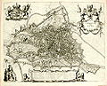
 Flandria illustrata; map of Ghent.jpg 4,897 × 3,602; 3.45 MB
-
 Gandavum-vulgo-gent-1698-de-wit.jpg 1,280 × 1,013; 533 KB
-
 Ghent from Steden-Boek van J. Blaeu.JPG 800 × 600; 92 KB
-
 Ghent from Steden-Boek van J. Janssonius.JPG 800 × 600; 97 KB
-
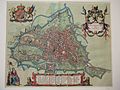
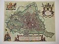
 Map of Ghent by Jan Blaeu.jpg 1,969 × 1,593; 5.63 MB
-
 Map of Ghent by Sanderus.jpg 3,359 × 2,711; 3.87 MB
-
 Stedenboeken van de wereld by Johannes Janssonius 1657 ; page 75.jpg 10,622 × 7,930; 21.95 MB
%22_(22231069536).jpg)


