Category:Map and directory displays in Paris
Jump to navigation
Jump to search
Subcategories
This category has only the following subcategory.
Media in category "Map and directory displays in Paris"
The following 14 files are in this category, out of 14 total.
-
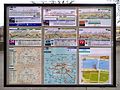 Affichage abri-bus Paris 2009.jpg 3,648 × 2,736; 3.68 MB
-
 Affichage abribus, bus RATP, Octobre 2010.jpg 3,110 × 2,445; 2.54 MB
-
 Arrêt Navette Autonome RATP Bois Vincennes Sabotier Paris 3.jpg 3,024 × 4,032; 4.67 MB
-
 Arrêt Navette Autonome RATP Bois Vincennes Tremblay Paris 3.jpg 3,024 × 4,032; 3.9 MB
-
 Panneau Plan Port Champs Élysées - Paris VIII (FR75) - 2021-08-09 - 1.jpg 3,024 × 4,032; 4.39 MB
-
 Panneau Plan Quartier Place Fêtes - Paris XIX (FR75) - 2024-05-20 - 1.jpg 3,024 × 4,032; 3.36 MB
-
 Panneau Plan Square Vitruve - Paris XX (FR75) - 2021-05-28 - 1.jpg 4,032 × 3,024; 3.48 MB
-
 Panneau Plan Square Vitruve - Paris XX (FR75) - 2021-05-28 - 2.jpg 3,286 × 2,821; 2.17 MB
-
 Panneau Plan Village Saint Paul Voie B4 - Paris IV (FR75) - 2023-05-24 - 1.jpg 4,032 × 3,024; 3.99 MB
-
 Paris 75006 Boulevard Raspail no 052 Street map display vandalized 2006.jpg 960 × 1,280; 123 KB
-
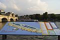 Paris Plage 2011. Plan de Paris plage.jpg 2,048 × 1,363; 516 KB
-
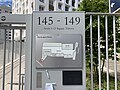
 Points d'accueil, Gare de Lyon, Paris 75.jpg 2,448 × 3,264; 2.03 MB
-
 Rue Jean-Jacques-Rousseau, Paris 1.jpg 1,990 × 1,810; 1.79 MB
-
 Vogueo - Escale Austerlitz 03.jpg 1,024 × 1,365; 242 KB


_-_2021-08-09_-_1.jpg)
_-_2024-05-20_-_1.jpg)
_-_2021-05-28_-_1.jpg)
_-_2021-05-28_-_2.jpg)
_-_2023-05-24_-_1.jpg)


