Category:Map Lab-ru
Jump to navigation
Jump to search
- English: Maps which are improved by the russian graphic Atelier
Media in category "Map Lab-ru"
The following 200 files are in this category, out of 235 total.
(previous page) (next page)-
 Administrative divisions of Madura Island - ru.svg 853 × 275; 32 KB
-
 Administrative divisions of North Kalimantan - ru.svg 1,017 × 984; 34 KB
-
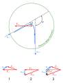
 Airship Italia flights (cropped).svg 150 × 200; 2.04 MB
-
 Airship Italia flights.svg 150 × 440; 1.41 MB
-
 Alaska administrative units - ru.svg 1,768 × 975; 179 KB
-
 Alexander Park - plan.svg 2,827 × 2,209; 1.73 MB
-
 Apollo 15 Traverses - ru.svg 3,003 × 5,161; 2.73 MB
-
 Apollo 16 Traverses - ru.svg 2,456 × 6,292; 1.94 MB
-
 Apollo 17 Traverses - ru.svg 6,001 × 3,219; 2.85 MB
-
 Archaeal viruses - ru.svg 1,276 × 858; 352 KB
-
 Archaeological map of human settlements in the Chavusy Raion.svg 2,373 × 2,145; 395 KB
-
 Aruba map ru.svg 350 × 350; 336 KB
-
 Aztec Empire - ru.svg 1,158 × 842; 958 KB
-
 Baltic states in the first half of the 16th century - ru.svg 1,256 × 1,745; 948 KB
-
 Barge T-36 drift and rescue - en.svg 1,770 × 925; 218 KB
-
 Barge T-36 drift and rescue - ru.svg 1,770 × 925; 232 KB
-
 Barge T-36 drift and rescue 2 - ru.svg 1,207 × 1,235; 444 KB
-
 Battle of Beaver Dam Creek. Lee's plan – ru.svg 1,016 × 1,151; 315 KB
-
 Battle of Chapultepec - ru.svg 955 × 987; 263 KB
-
 Battle of Gettysburg, July 1, 1863, Nightfall - ru.svg 1,519 × 1,155; 949 KB
-
 Battle of Gettysburg, July 1, Heth's attack - ru.svg 813 × 873; 599 KB
-
 Battle of Long Island, 1776 - ru.svg 919 × 1,041; 508 KB
-
 Battle of Marathon Greek Double Envelopment - az.svg 687 × 541; 30 KB
-
 Battle of Marathon Greek Double Envelopment - ru.svg 687 × 541; 30 KB
-
 Battle of Salem Church - ru.svg 2,128 × 2,184; 413 KB
-
 Benjamin of Tudela route - ru.svg 1,510 × 917; 518 KB
-
 Braddock Expedition - ru.svg 1,367 × 1,011; 2.13 MB
-
 Brazil Uzbekistan locator.svg 940 × 415; 1.44 MB
-
 Bulgarian ulus - ru.svg 1,201 × 859; 55 KB
-
 Burkina Faso Regions (ru).png 750 × 549; 75 KB
-
 Byzantine Constantinople - ru.svg 2,366 × 1,889; 335 KB
-
 Byzantium - ru.svg 1,710 × 888; 2.35 MB
-
 Byzantiumby650AD-ru.svg 924 × 423; 289 KB
-
 Caliphate 740-ru.svg 3,516 × 1,904; 662 KB
-
 Carl Linnaeus locations - ru.svg 800 × 702; 407 KB
-
 Catherine Park - plan.svg 3,099 × 1,931; 1.29 MB
-
 Ceewikigroupmap.svg 1,417 × 1,856; 410 KB
-
 China Historic Ming Empire.jpg 950 × 900; 787 KB
-
 Dhangethi administrative map - ru.svg 984 × 1,500; 414 KB
-
 East Prussian Campaign (17—23 Aug 1914) - ru.svg 2,591 × 1,671; 1.8 MB
-
 East Prussian Campaign (23—26 Aug 1914) - ru.svg 2,591 × 1,671; 1.79 MB
-
 East Prussian Campaign (27—30 Aug 1914) - ru.svg 2,591 × 1,671; 1.7 MB
-
 Eastern slavonia 91-92 map -ru.jpg 1,821 × 1,350; 627 KB
-
 Egypt–Israel Peace Treaty - ru.svg 1,060 × 1,766; 1.92 MB
-
 Estonia Harju location map.png 1,000 × 835; 142 KB
-
 Estonia Harju locator map.svg 1,668 × 1,393; 628 KB
-
 Estonia Hiiu location map.png 1,000 × 835; 142 KB
-
 Estonia Hiiu locator map.svg 1,668 × 1,393; 629 KB
-
 Estonia Ida-Viru location map.png 1,000 × 835; 142 KB
-
 Estonia Ida-Viru locator map.svg 1,668 × 1,393; 629 KB
-
 Estonia Järva location map.png 1,000 × 835; 142 KB
-
 Estonia Järva locator map.svg 1,668 × 1,393; 629 KB
-
 Estonia Jõgeva location map.png 1,000 × 835; 141 KB
-
 Estonia Jõgeva locator map.svg 1,668 × 1,393; 629 KB
-
 Estonia Lääne location map.png 1,000 × 835; 142 KB
-
 Estonia Lääne locator map.svg 1,668 × 1,393; 629 KB
-
 Estonia Lääne-Viru location map.png 1,000 × 835; 142 KB
-
 Estonia Lääne-Viru locator map.svg 1,668 × 1,393; 629 KB
-
 Estonia Pärnu location map.png 1,000 × 835; 142 KB
-
 Estonia Pärnu locator map.svg 1,668 × 1,393; 629 KB
-
 Estonia Põlva location map.png 1,000 × 835; 141 KB
-
 Estonia Põlva locator map.svg 1,668 × 1,393; 629 KB
-
 Estonia Rapla location map.png 1,000 × 835; 144 KB
-
 Estonia Rapla locator map.svg 1,668 × 1,393; 629 KB
-
 Estonia Saare location map.png 1,000 × 835; 142 KB
-
 Estonia Saare locator map.svg 1,668 × 1,393; 629 KB
-
 Estonia Tartu location map.png 1,000 × 835; 141 KB
-
 Estonia Tartu locator map.svg 1,668 × 1,393; 629 KB
-
 Estonia Valga location map.png 1,000 × 835; 143 KB
-
 Estonia Valga locator map.svg 1,668 × 1,393; 629 KB
-
 Estonia Viljandi location map.png 1,000 × 835; 142 KB
-
 Estonia Viljandi locator map.svg 1,668 × 1,393; 629 KB
-
 Estonia Võru location map.png 1,000 × 835; 143 KB
-
 Estonia Võru locator map.svg 1,668 × 1,393; 629 KB
-
 Ethnic Groups of Minahassa Peninsula - ru.svg 1,229 × 637; 101 KB
-
 First Russian Antarctic Expedition route - ru.svg 1,451 × 2,098; 1.67 MB
-
 First Russian circumnavigation route - ru.svg 1,851 × 1,031; 906 KB
-
 Florida war 1837 - en.svg 1,153 × 1,500; 369 KB
-
 Florida war 1837 - ru.svg 1,153 × 1,500; 375 KB
-
 Gepid kingdom 6th century - ru.svg 1,033 × 1,082; 161 KB
-
 Gordon's Attack (May 6, 1864) - ru.svg 964 × 840; 264 KB
-
 Gravity assist - ru.svg 668 × 869; 104 KB
-
 Greecemap.svg 983 × 751; 112 KB
-
 Hepatitis delta virus map - ru.svg 1,762 × 1,067; 988 KB
-
 Historical regions of Britanny ru.svg 765 × 570; 1.07 MB
-
 Indonesia Ethnic Groups Map - ru.svg 2,129 × 878; 2 MB
-
 Italy 1000 AD-ru.svg 565 × 811; 334 KB
-
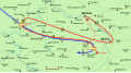 Ivan Ivanov's flight track - ru.svg 1,649 × 907; 365 KB
-
 Izium Eparchy.svg 1,120 × 1,401; 69 KB
-
 JNA offensive plan 1991 - ru.svg 869 × 798; 436 KB
-
 Kharkiv Eparchy.svg 1,376 × 1,366; 86 KB
-
 Kirovsky okrug, Omsk, locator map.svg 500 × 400; 288 KB
-
 Krasin and red tent.svg 72 × 59; 835 KB
-
 Lakes of Wannsee - ru.svg 1,163 × 735; 145 KB
-
 Leninsky okrug, Omsk, locator map.svg 500 × 400; 288 KB
-
 Les Francs en Belgique romaine-ru.svg 1,280 × 883; 62 KB
-
 Madura Island topographic map - ru.svg 2,401 × 806; 1.09 MB
-
 Manoeuvre of Tarutino - ru.svg 873 × 1,091; 1.02 MB
-
 Map 1-Don Okrug, Don Voisko Oblast, Russian Empire.svg 550 × 600; 450 KB
-
 Map 2-Don Okrug, Don Voisko Oblast, Russian Empire.svg 550 × 600; 450 KB
-
 Map Atkarsk uyezd, Saratov Governorate, Russian Empire.png 485 × 463; 27 KB
-
 Map Balashov uyezd, Saratov Governorate, Russian Empire.png 485 × 463; 26 KB
-
 Map Belarus, Gomelsk Oblast, Dobrushsky region.svg 1,062 × 1,517; 180 KB
-
 Map Cherkassk Okrug, Don Voisko Oblast, Russian Empire.svg 550 × 600; 450 KB
-
 Map concerning the Nazino affair-ru.svg 512 × 469; 171 KB
-
 Map Donetsk Okrug, Don Voisko Oblast, Russian Empire.svg 550 × 600; 450 KB
-
 Map Federal subjects of Russia (by number).svg 1,200 × 700; 1.06 MB
-
 Map Gulf of Finland-en.svg 1,400 × 800; 373 KB
-
 Map history Catalonian counties.svg 600 × 700; 324 KB
-
 Map Kamyshin uyezd, Saratov Governorate, Russian Empire.png 485 × 463; 27 KB
-
 Map Khopersk Okrug, Don Voisko Oblast, Russian Empire.svg 550 × 600; 450 KB
-
 Map Khvalynsk uyezd, Saratov Governorate, Russian Empire.png 485 × 463; 26 KB
-
 Map Kuznetsk uyezd, Saratov Governorate, Russian Empire.png 485 × 463; 25 KB
-
 Map Lands of Bernard of Septimania 835.svg 800 × 700; 314 KB
-
 Map Lands of Bernard of Septimania.svg 800 × 600; 311 KB
-
 Map of Meshchyora National Park - ru.svg 2,166 × 2,801; 949 KB
-
 Map of Meshchyorsky National Park - ru.svg 2,170 × 2,798; 892 KB
-
 Map of subdivisions of Russia.svg 5,065 × 2,718; 2.16 MB
-
 Map Petrovsk uyezd, Saratov Governorate, Russian Empire.png 485 × 463; 26 KB
-
 Map poz Russia Buriatia.png 663 × 463; 51 KB
-
 Map rajasthan dist 7 div - ru.svg 788 × 691; 532 KB
-
 Map Rostov Okrug, Don Voisko Oblast, Russian Empire.svg 550 × 600; 450 KB
-
 Map Russia Bryansk region.svg 500 × 500; 178 KB
-
 Map Russia Irkutsk oblast and Ust-Orda Buryatia.svg 500 × 500; 468 KB
-
 Map Russia Kaluga region.svg 501 × 501; 175 KB
-
 Map Salsky Okrug, Don Voisko Oblast, Russian Empire.svg 550 × 600; 450 KB
-
 Map Saratov Governorate, Russian Empire.svg 500 × 500; 355 KB
-
 Map Saratov uyezd, Saratov Governorate, Russian Empire.png 485 × 463; 27 KB
-
 Map Serdobsk uyezd, Saratov Governorate, Russian Empire.png 485 × 463; 26 KB
-
 Map Taganrog Okrug, Don Voisko Oblast, Russian Empire.svg 550 × 600; 450 KB
-
 Map Tsaritsyn uyezd, Saratov Governorate, Russian Empire.png 485 × 463; 26 KB
-
 Map Ust-Medveditsa Okrug, Don Voisko Oblast, Russian Empire.svg 550 × 600; 450 KB
-
 Map Volgsk uyezd, Saratov Governorate, Russian Empire.png 485 × 463; 27 KB
-
 Markakol map-de translit-DIN1460 96dpi.svg 1,278 × 1,949; 4.27 MB
-
 Markakol map-ru librsvg.png 1,278 × 1,949; 2.76 MB
-
 Markakol map-ru rendersvg.png 1,278 × 1,949; 3.65 MB
-
 Markakol map-ru.png 1,281 × 1,951; 3.37 MB
-
 Markakol map-ru.svg 1,278 × 1,949; 4.22 MB
-
 Maryland Campaign (September 10—13, 1862) - ru.svg 1,332 × 943; 593 KB
-
 Maryland Campaign (September 3—9, 1862) - ru.svg 1,111 × 1,003; 517 KB
-
 Mesopotamian campaign - ru.jpg 1,100 × 894; 292 KB
-
 Mexican–American War (without Scott's Campaign)-en.svg 1,433 × 1,230; 610 KB
-
 Mexican–American War(without Scott's Campaign)-ru.svg 1,430 × 1,230; 608 KB
-
 Mexican–American War-en.svg 1,571 × 1,230; 675 KB
-
 Mexican–American War-ru.svg 1,571 × 1,230; 674 KB
-
 Miklouho-Maclay's travels - ru.png 1,500 × 1,254; 3.08 MB
-
 Miklouho-Maclay's travels-ru.svg 1,500 × 1,254; 4.6 MB
-
 Minahassa Peninsula topographic map - ru.svg 2,731 × 1,440; 4.51 MB
-
 Mule Shoe (Battle of Spotsylvania) - ru.svg 1,422 × 1,080; 199 KB
-
 Musée Fort St-Eynard abc3.svg 2,282 × 1,712; 2.18 MB
-
 NE&NW Rhodesia (1899-1911) - ru.svg 1,181 × 1,022; 236 KB
-
 Nicaragua canal proposals - ru.svg 2,149 × 1,684; 713 KB
-
 North Kalimantan (Indonesia) topographic map - ru.svg 1,557 × 1,473; 2.28 MB
-
 Northern Virginia Campaign (as of August 22, 1862) - ru.svg 1,455 × 1,318; 499 KB
-
 Northwest Passage (ru).svg 1,052 × 744; 1.99 MB
-
 Norwegian Arctic Expedition (1898—1902) map-ru.svg 1,731 × 1,521; 787 KB
-
 Nusantara planned area - ru.svg 1,500 × 1,022; 177 KB
-
 NZNorthIsland-ru.svg 1,100 × 1,600; 108 KB
-
 Oktyabrsky okrug, Omsk, locator map.svg 500 × 400; 288 KB
-
 Old Courland - ru.png 1,679 × 2,629; 638 KB
-
 Old Courland - ru.svg 1,006 × 1,577; 452 KB
-
 Operation Epsom (July 1) - ru.svg 1,979 × 1,305; 804 KB
-
 Operation Epsom (June 26) - ru.svg 1,979 × 1,305; 724 KB
-
 Operation Epsom (June 27) - ru.svg 1,979 × 1,305; 937 KB
-
 Operation Epsom (June 28) - ru.svg 1,979 × 1,305; 746 KB
-
 Operation Epsom (June 29) - ru.svg 1,979 × 1,305; 782 KB
-
 Operation Epsom (June 30) - ru.svg 1,979 × 1,305; 739 KB
-
 Operation flash map - ru.jpg 896 × 697; 310 KB
-
 Oriental field week world map.svg 1,100 × 837; 694 KB
-
 Ottoman Istanbul - ru.svg 5,930 × 4,666; 2.86 MB
-
 Palestinian cities during the Byzantine period - ru.svg 794 × 1,337; 512 KB
-
 Panama Canal Map-ru.svg 1,361 × 1,406; 3.02 MB
-
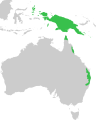 Paradisaeidae distribution map.svg 902 × 1,126; 49 KB
-
 Partition of the Livonian Order - ru.svg 930 × 1,245; 390 KB
-
 Pavlovsk park - plan.svg 2,719 × 2,175; 3.99 MB
-
 Peter and Paul Fortress - Plan (ru).svg 2,616 × 2,358; 1.26 MB
-
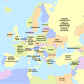 Philosophical map of Europe - ru.svg 1,401 × 1,398; 1.01 MB
-
 Progress of the Reconquista (718–1492) - ru.svg 1,207 × 1,100; 906 KB
-
 Ptolemaic Kingdom III-II century BC - ru.svg 2,191 × 1,679; 707 KB
-
 Raid at Cabanatuan (2D action) - ru.svg 1,826 × 1,235; 359 KB
-
 Raid on Chambersburg - ru.svg 1,473 × 1,549; 833 KB
-
 Rescue of airship Italia by icebreaker Krasin.svg 152 × 152; 1.92 MB
-

-
 Roeseliana roeselii distribution.svg 1,800 × 898; 278 KB
-
 Roman-Persian Frontier in Late Antiquity-ru.svg 2,718 × 1,743; 1.61 MB
-
 Route map of Raid at Cabanatuan - ru.svg 1,652 × 1,098; 267 KB
-
 Russia, Omsk administrative divisions.svg 500 × 400; 293 KB
-
 Samoa islands ru.svg 820 × 420; 479 KB
-
 Samoa mk.svg 820 × 420; 313 KB
-
 Sapudi Island topographic map - ru.svg 1,500 × 1,400; 473 KB
-
 SAZs & SAD of Myanmar - ru.svg 841 × 1,759; 178 KB
-
 Scott's campaign (Veracruz - Puebla) - ru.svg 1,917 × 818; 840 KB
-
 Scott's campaign-en.svg 1,411 × 541; 71 KB
-
 Scott's campaign-ru.svg 1,411 × 541; 72 KB
-
 Second Battle of Fredericksburg - ru.svg 1,952 × 1,796; 686 KB
-
 Second Punic War Battles -ru.svg 959 × 1,478; 120 KB
-
 Seleucid Empire 200-64 BC - ru.svg 2,148 × 1,057; 1.76 MB
-
 Serbia in the Yugoslav Wars - ru.png 1,285 × 892; 205 KB
-
 Siberian Military District in 2003 - ru.svg 1,361 × 960; 2.84 MB
-
 Sinai Peninsula - en.svg 1,060 × 1,766; 1.89 MB

.svg)


.png)


_-_ru.svg)
_-_ru.svg)
_-_ru.svg)


_-_ru.svg)


.svg)


_-_ru.svg)
_-_ru.svg)

-en.svg)
-ru.svg)


_-_ru.svg)

_-_ru.svg)

_topographic_map_-_ru.svg)
_-_ru.svg)
.svg)
_map-ru.svg)


_-_ru.svg)
_-_ru.svg)
_-_ru.svg)
_-_ru.svg)
_-_ru.svg)
_-_ru.svg)


.svg)

_-_ru.svg)

_-_ru.svg)


_-_ru.svg)


