Category:Manston, Kent
Jump to navigation
Jump to search
English: Manston is a village and civil parish in the Thanet district of Kent, England. The village is situated one mile north-west of Ramsgate. The parish includes four hamlets and Kent International Airport.
village and civil parish in Kent, UK  | |||||
| Upload media | |||||
| Instance of | |||||
|---|---|---|---|---|---|
| Location | Thanet, Kent, South East England, England | ||||
| Population |
| ||||
| Said to be the same as | Manston (Wikimedia duplicated page, civil parish) | ||||
 | |||||
Subcategories
This category has the following 5 subcategories, out of 5 total.
M
- Manston War Memorial (2 F)
Media in category "Manston, Kent"
The following 151 files are in this category, out of 151 total.
-
 Barn of Vincent Farm - geograph.org.uk - 2261310.jpg 3,072 × 2,304; 1.36 MB
-
 Bramble Lane junction on Manston Road - geograph.org.uk - 2261316.jpg 3,072 × 2,304; 1.73 MB
-
 Bridleway and footpath junction near Lydden Farm - geograph.org.uk - 2261509.jpg 3,072 × 2,304; 2.23 MB
-
 Bridleway and walkers to Manston Road - geograph.org.uk - 2261091.jpg 3,003 × 2,237; 1.36 MB
-
 Bridleway junction near Hengrove Farm - geograph.org.uk - 2261340.jpg 3,072 × 2,304; 1.94 MB
-
 Bridleway junction near Retreat Farm - geograph.org.uk - 2261207.jpg 3,072 × 2,304; 1.72 MB
-
 Bridleway near Retreat Farm - geograph.org.uk - 2261201.jpg 3,072 × 2,304; 1.61 MB
-
 Bridleway to A256 - geograph.org.uk - 6431129.jpg 3,264 × 2,448; 3.76 MB
-
 Bridleway to Haine Road (2) - geograph.org.uk - 2262458.jpg 3,072 × 2,304; 1.93 MB
-
 Bridleway to Haine Road - geograph.org.uk - 2262398.jpg 3,072 × 2,304; 1.84 MB
-
 Bridleway to Lydden - geograph.org.uk - 2261478.jpg 3,072 × 2,304; 2.01 MB
-
 Bridleway to Lydden Farm (2) - geograph.org.uk - 2261489.jpg 3,072 × 2,304; 2.06 MB
-
 Bridleway to Lydden Farm - geograph.org.uk - 2261486.jpg 3,072 × 2,304; 2.13 MB
-
 Bridleway to Manston Road - geograph.org.uk - 2261126.jpg 3,072 × 2,304; 1.96 MB
-
 Bridleway to Manston Road - geograph.org.uk - 2261336.jpg 3,072 × 2,304; 1.82 MB
-
 Bridleway to Nash Road - geograph.org.uk - 2261491.jpg 3,072 × 2,304; 2.28 MB
-
 Bridleway to Ozengell Grange - geograph.org.uk - 2262383.jpg 3,072 × 2,304; 1.96 MB
-
 Bridleway to Park Road (2) - geograph.org.uk - 2261137.jpg 3,072 × 2,304; 1.49 MB
-
 Bridleway to Park Road - geograph.org.uk - 2261125.jpg 3,072 × 2,304; 2.02 MB
-
 Bridleway to Park Road - geograph.org.uk - 2261134.jpg 3,072 × 2,304; 1.6 MB
-
 Bridleway to Retreat Farm - geograph.org.uk - 2261288.jpg 3,072 × 2,304; 1.62 MB
-
 Bridleway to Shottendane Road - geograph.org.uk - 2261191.jpg 3,072 × 2,304; 2.13 MB
-
 Bridleway to Shottendane Road - geograph.org.uk - 2261352.jpg 3,072 × 2,304; 2.27 MB
-
 Bridleway to Vincent Farm - geograph.org.uk - 2261214.jpg 3,072 × 2,304; 1.73 MB
-
 Bridleway to Woodchurch Road - geograph.org.uk - 2261361.jpg 3,072 × 2,304; 1.83 MB
-
 Bridleway to Woodchurch Road - geograph.org.uk - 2261376.jpg 3,072 × 2,304; 1.59 MB
-
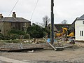
 Building site beside Haine Road (A256) - geograph.org.uk - 4236817.jpg 943 × 686; 139 KB
-
 Cemex, Margate Plant - geograph.org.uk - 2261433.jpg 3,072 × 2,304; 2.53 MB
-

-
 Crops at Flete Farm - geograph.org.uk - 5915162.jpg 5,184 × 3,456; 3.83 MB
-
 Cross Quays development - geograph.org.uk - 3720373.jpg 800 × 532; 106 KB
-

-
 Cross Quays Development, Westwood, Kent - geograph.org.uk - 3720376.jpg 529 × 800; 116 KB
-

-
 Daigor Lane - geograph.org.uk - 6434966.jpg 3,264 × 2,448; 2.34 MB
-
 Debenhams - geograph.org.uk - 2076992.jpg 640 × 427; 90 KB
-
 Dftdc-defence-fire-training-and-development-centre-manston.jpg 4,000 × 3,000; 6.24 MB
-
 Driving range at Manston golf course - geograph.org.uk - 723320.jpg 625 × 431; 177 KB
-
 Entrance to Quarry near Manston - geograph.org.uk - 2262422.jpg 3,072 × 2,304; 1.72 MB
-
 Entrance to recycling centre - geograph.org.uk - 6430350.jpg 3,264 × 2,448; 2.62 MB
-
 Farm road to Flete Farm - geograph.org.uk - 1003271.jpg 640 × 480; 187 KB
-
 Field off Woodchurch Road - geograph.org.uk - 2070430.jpg 640 × 480; 89 KB
-
 Field off Woodchurch Road - geograph.org.uk - 2070435.jpg 640 × 480; 80 KB
-
 Fields at Chalkhole Farm - geograph.org.uk - 5914867.jpg 5,184 × 3,456; 3.67 MB
-
 Flats on Haine Road, Newington - geograph.org.uk - 5832392.jpg 1,960 × 1,412; 1.28 MB
-
 Flete Farm Bungalow, Vincent Road - geograph.org.uk - 3663759.jpg 1,142 × 856; 186 KB
-
 Flete Farm from the end of Valley Road - geograph.org.uk - 1003268.jpg 640 × 480; 202 KB
-
 Flete Road - geograph.org.uk - 2070457.jpg 640 × 480; 66 KB
-
 Flint fronted building on Valley Road - geograph.org.uk - 1003351.jpg 640 × 480; 197 KB
-
 Footpath junction near Coldswood Farm - geograph.org.uk - 2261536.jpg 3,072 × 2,304; 1.88 MB
-
 Footpath to Chapel Bottom - geograph.org.uk - 2261501.jpg 3,072 × 2,304; 1.84 MB
-
 Footpath to Coldswood Farm - geograph.org.uk - 2261575.jpg 3,072 × 2,304; 1.49 MB
-
 Footpath to Manston - geograph.org.uk - 2261522.jpg 3,072 × 2,304; 2.19 MB
-
 Footpath to Manston Road (2) - geograph.org.uk - 2261594.jpg 3,072 × 2,304; 2.78 MB
-
 Footpath to Manston Road - geograph.org.uk - 2261410.jpg 3,072 × 2,304; 1.82 MB
-
 Footpath to Manston Road - geograph.org.uk - 2261588.jpg 3,072 × 2,304; 2.91 MB
-
 Footpath to Margate - geograph.org.uk - 2261385.jpg 3,072 × 2,304; 1.52 MB
-
 Footpath to Spratling Street - geograph.org.uk - 2261561.jpg 3,072 × 2,304; 1.86 MB
-
 Garage Nr Manston Airport - geograph.org.uk - 332047.jpg 640 × 480; 75 KB
-
 Grove Lodge - geograph.org.uk - 2261328.jpg 3,072 × 2,304; 2.04 MB
-
 Halfmile Ride - geograph.org.uk - 413662.jpg 640 × 480; 81 KB
-
 Halfmile Ride to Nash Court - geograph.org.uk - 2261444.jpg 3,072 × 2,304; 2.05 MB
-
 Harvested Field at Lydden - geograph.org.uk - 5920233.jpg 5,184 × 3,456; 3.79 MB
-
 High Street, Manston - geograph.org.uk - 3663706.jpg 913 × 684; 212 KB
-
 Houses on Manston Court Road - geograph.org.uk - 2070483.jpg 640 × 480; 85 KB
-
 Houses on Manston Road - geograph.org.uk - 5832423.jpg 2,048 × 1,536; 1.39 MB
-
 Houses on Shottendane Road - geograph.org.uk - 2070448.jpg 640 × 480; 83 KB
-
 Jolly Farmer, High Street - geograph.org.uk - 3663697.jpg 1,142 × 856; 177 KB
-
-
 Just a Post These Days - geograph.org.uk - 5914859.jpg 4,874 × 3,166; 2.99 MB
-
 Looking along Manston Road towards Chapel Bottom - geograph.org.uk - 3663780.jpg 1,142 × 856; 241 KB
-
 Looking NW along Preston Road - geograph.org.uk - 723339.jpg 640 × 480; 203 KB
-

-
 Manston Court Road - geograph.org.uk - 2077008.jpg 640 × 480; 93 KB
-
 Manston Court Road, Lydden - geograph.org.uk - 5920222.jpg 5,184 × 3,456; 3.95 MB
-
 Manston Court Road, Manston - geograph.org.uk - 4580878.jpg 2,272 × 1,704; 635 KB
-
 Manston Golf Centre, Driving Range - geograph.org.uk - 2262504.jpg 3,072 × 2,304; 1.32 MB
-
 Manston Methodist chapel - geograph.org.uk - 2070489.jpg 640 × 480; 98 KB
-
 Manston Methodist chapel - geograph.org.uk - 382738.jpg 640 × 480; 46 KB
-
 Manston R.O.C Post (8444932429).jpg 1,104 × 1,728; 334 KB
-
 Manston R.O.C Post (8444934405).jpg 3,068 × 4,601; 4.42 MB
-
 Manston R.O.C Post (8446022166).jpg 1,042 × 722; 151 KB
-
 Manston R.O.C Post (8446022254).jpg 5,184 × 3,456; 1.85 MB
-
 Manston R.O.C Post (8446025722).jpg 3,384 × 5,078; 2.82 MB
-
 Manston R.O.C Post (8446025794).jpg 1,646 × 1,885; 501 KB
-
 Manston R.O.C Post (8446029114).jpg 4,823 × 3,215; 3.4 MB
-
 Manston R.O.C Post (8446029920).jpg 5,184 × 3,456; 2.25 MB
-
 Manston R.O.C Post - 8446026256.jpg 3,400 × 2,368; 1.22 MB
-
 Manston R.O.C Post - 8446027484.jpg 5,184 × 3,456; 2.71 MB
-
 Manston Sports ^ Social Club, Daigor Lane, High Street - geograph.org.uk - 6433813.jpg 3,264 × 1,863; 1.67 MB
-
 Nash Road - geograph.org.uk - 2076997.jpg 640 × 480; 120 KB
-
 Nash Road and Star Lane Roundabout - geograph.org.uk - 5914247.jpg 4,717 × 3,299; 1.45 MB
-

-
 New building on Manston Business Park - geograph.org.uk - 737546.jpg 640 × 480; 157 KB
-
 New housing along Manston Court Road - geograph.org.uk - 4056492.jpg 1,142 × 856; 174 KB
-
 New Housing off Nash Road - geograph.org.uk - 2077001.jpg 640 × 427; 100 KB
-
 North Foreland and Pegwell Bay from the Air - geograph.org.uk - 2668467.jpg 1,024 × 731; 274 KB
-
 Open land beside Haine Road (A256) - geograph.org.uk - 4236828.jpg 1,072 × 856; 185 KB
-
 Ozengell Farmhouse - geograph.org.uk - 6431925.jpg 3,264 × 2,448; 3.76 MB
-
 Ozengell Farmhouse - geograph.org.uk - 6432769.jpg 3,264 × 2,448; 3.28 MB
-
 Path crosses Park Road - geograph.org.uk - 2261144.jpg 3,072 × 2,304; 1.7 MB
-
 Permissive bridleway beside Park Road - geograph.org.uk - 2261155.jpg 3,072 × 2,304; 2.17 MB
-
 Permissive bridleway beside Woodchurch Road - geograph.org.uk - 2261169.jpg 3,072 × 2,304; 1.77 MB
-
 Permissive bridleway beside Woodchurch Road - geograph.org.uk - 2261180.jpg 3,072 × 2,304; 2.22 MB
-
 Plane landing at Manston Airport - geograph.org.uk - 2262344.jpg 3,072 × 2,304; 1.71 MB
-
 Planes at Manston Airport - geograph.org.uk - 2070477.jpg 640 × 427; 76 KB
-
 Poppy Field - geograph.org.uk - 3034386.jpg 1,024 × 768; 219 KB
-
 Posts on Halfmile Ride - geograph.org.uk - 5914215.jpg 5,184 × 3,456; 4.39 MB
-
 Public Bridleway to Lydden - geograph.org.uk - 5914204.jpg 4,683 × 2,969; 2.47 MB
-
 Quarry near Manston Airport - geograph.org.uk - 2262413.jpg 3,072 × 2,304; 1.98 MB
-
 Queensdown Road - geograph.org.uk - 3034394.jpg 1,024 × 768; 163 KB
-
 Roller beside a field - geograph.org.uk - 5915169.jpg 5,184 × 3,456; 4.2 MB
-
 Roundabout on Manston Road - geograph.org.uk - 2262493.jpg 3,072 × 2,304; 1.29 MB
-
 Sign near Coldswood Farm - geograph.org.uk - 2261567.jpg 3,072 × 2,304; 1.42 MB
-
 Sign on fence of Manston Golf Centre - geograph.org.uk - 2262475.jpg 3,072 × 2,304; 1.91 MB
-
 Southern Winds Aircraft - geograph.org.uk - 2262371.jpg 3,006 × 2,304; 1.15 MB
-
 Star Lane, Westwood - geograph.org.uk - 4580890.jpg 2,272 × 1,704; 704 KB
-
 Stubble Field near Margate - geograph.org.uk - 5914846.jpg 5,184 × 3,456; 4.85 MB
-

-

-
 The Hooden Horse, Westwood - geograph.org.uk - 5500458.jpg 3,497 × 2,485; 1.55 MB
-
 The house at Bush Farm, High Street - geograph.org.uk - 3663722.jpg 913 × 684; 201 KB
-
 The junction of Flete Road with Manston Road - geograph.org.uk - 3663767.jpg 1,142 × 856; 235 KB
-
 The Lost Chicken - geograph.org.uk - 2261160.jpg 3,072 × 2,304; 2.29 MB
-
 The old A299 near Lord of the Manor - geograph.org.uk - 2587639.jpg 640 × 480; 160 KB
-

-
 The outbuildings of Flete Farm - geograph.org.uk - 3663740.jpg 913 × 684; 163 KB
-
 Track beside Nash Road - geograph.org.uk - 2261464.jpg 3,072 × 2,304; 2.15 MB
-
 Track junction near Hengrove Farm - geograph.org.uk - 2261348.jpg 3,072 × 2,304; 1.88 MB
-
 Track to Manston Road - geograph.org.uk - 2261148.jpg 3,072 × 2,304; 2.17 MB
-

-
 View along Preston Road - geograph.org.uk - 723335.jpg 640 × 480; 184 KB
-
 View along Preston Road - geograph.org.uk - 723344.jpg 640 × 480; 225 KB
-
 View along Preston Road, Manston - geograph.org.uk - 723329.jpg 640 × 480; 230 KB
-

-
 View along Vincent Road - geograph.org.uk - 736391.jpg 640 × 480; 188 KB
-
 View of Richborough Port from Manston Road - geograph.org.uk - 2027844.jpg 3,456 × 2,592; 2.57 MB
-
 View of Richborough Port from Manston Road ^2 - geograph.org.uk - 2027864.jpg 3,456 × 2,592; 2.77 MB
-
 View SW along Alland Grange Lane - geograph.org.uk - 739117.jpg 640 × 458; 61 KB
-
 Vincent Farm on Vincent Road - geograph.org.uk - 736431.jpg 640 × 480; 164 KB
-
 Vincent Farm undergoing some restoration - geograph.org.uk - 736444.jpg 640 × 480; 174 KB
-

-
 Vincent Road - geograph.org.uk - 3663733.jpg 913 × 684; 197 KB
-
 Wellington Road (track) - geograph.org.uk - 2261516.jpg 3,072 × 2,304; 1.63 MB
-
 Windsor Road, Cliffsend - geograph.org.uk - 4596725.jpg 2,272 × 1,704; 790 KB
-
 Wood Church Animal Centre - geograph.org.uk - 3034391.jpg 1,024 × 768; 177 KB
-
 Woodchurch Road - geograph.org.uk - 2070441.jpg 640 × 480; 74 KB
-
 Yard at Nash Farm - geograph.org.uk - 5914228.jpg 1,600 × 1,086; 513 KB
-

-

-
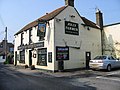 The Jolly Farmer at Manston - geograph.org.uk - 382733.jpg 640 × 480; 48 KB


_-_geograph.org.uk_-_2262458.jpg)


_-_geograph.org.uk_-_2261489.jpg)


_-_geograph.org.uk_-_2261137.jpg)


_-_geograph.org.uk_-_4236817.jpg)


_-_geograph.org.uk_-_2261594.jpg)


.jpg)
.jpg)
.jpg)
.jpg)
.jpg)
.jpg)
.jpg)
.jpg)


_-_geograph.org.uk_-_4236828.jpg)


_-_geograph.org.uk_-_2261516.jpg)


