Category:Manorbier
Jump to navigation
Jump to search
village and community in Pembrokeshire, United Kingdom  Maenorbŷr  | |||||
| Upload media | |||||
| Instance of | |||||
|---|---|---|---|---|---|
| Location | Pembrokeshire, Wales | ||||
| Population |
| ||||
| Area |
| ||||
| official website | |||||
 | |||||
Cymraeg: Pentref yn ne Sir Benfro yw Maenorbŷr. Cafodd Gerallt Gymro ei eni yng Nghastell Maenorbŷr.
Subcategories
This category has the following 8 subcategories, out of 8 total.
J
- St James' church, Manorbier (100 F)
- Jameston, Pembrokeshire (8 F)
L
M
- Manorbier Bay (13 F)
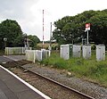
- Manorbier railway station (6 F)
S
- Skrinkle Haven, Pembrokeshire (27 F)
Media in category "Manorbier"
The following 200 files are in this category, out of 742 total.
(previous page) (next page)-
 2010 Wales Pembrokeshire Community Manorbier map.svg 512 × 393; 1,018 KB
-
 2024 Wales Pembrokeshire Community Manorbier map.svg 512 × 393; 1.19 MB
-
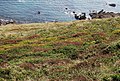
 A Geo, Manorbier Bay - geograph.org.uk - 3759304.jpg 640 × 430; 103 KB
-
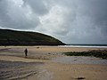
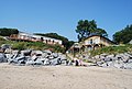
 A glimpse of the beach - geograph.org.uk - 3204357.jpg 3,240 × 3,712; 1.98 MB
-
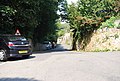
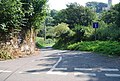
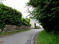
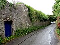
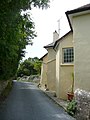
 A narrow Welsh lane - geograph.org.uk - 3753487.jpg 640 × 430; 82 KB
-
 A wall by the footpath - geograph.org.uk - 3753473.jpg 640 × 430; 131 KB
-
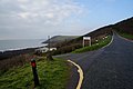
 A4139 approaching Wind Hill - geograph.org.uk - 3272042.jpg 640 × 480; 62 KB
-
 A4139 at Celtic Haven, Lydstep - geograph.org.uk - 3272040.jpg 640 × 481; 55 KB
-
 A4139 at Jameston village boundary - geograph.org.uk - 3272044.jpg 640 × 480; 62 KB
-
 A4139 destinations sign, Manorbier - geograph.org.uk - 5024897.jpg 800 × 653; 123 KB
-
 A4139 north of Calvesland - geograph.org.uk - 3272047.jpg 640 × 481; 55 KB
-
 A4139 road approaching Lydstep, Pembs - geograph.org.uk - 4546356.jpg 1,024 × 683; 240 KB
-
 A4139 west of Lydstep - geograph.org.uk - 4996246.jpg 800 × 653; 146 KB
-
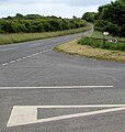
 A4139-B4585 junction - geograph.org.uk - 3272043.jpg 640 × 480; 49 KB
-
 Access road, Manorbier Camp - geograph.org.uk - 3747564.jpg 640 × 430; 74 KB
-
 Access road, Manorbier Camp - geograph.org.uk - 3747572.jpg 640 × 430; 56 KB
-
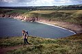
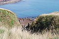
 Across Manorbier Bay - geograph.org.uk - 3518260.jpg 640 × 480; 91 KB
-
 Across Manorbier Bay - geograph.org.uk - 3519656.jpg 640 × 480; 75 KB
-
 ADRM - geograph.org.uk - 3747587.jpg 640 × 430; 31 KB
-
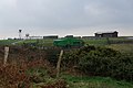 Air Defence Range Manorbier, Pembrokeshire - geograph.org.uk - 4322347.jpg 1,600 × 1,062; 644 KB
-
 Air Defence Range Manorbier, Pembrokeshire - geograph.org.uk - 4322350.jpg 1,600 × 1,062; 553 KB
-
 An avenue of boats - geograph.org.uk - 3738576.jpg 640 × 430; 75 KB
-
 At Norchard Beacon - geograph.org.uk - 3842179.jpg 640 × 480; 105 KB
-
 Atlantic View above Manorbier Bay - geograph.org.uk - 3759380.jpg 640 × 430; 55 KB
-
 B4585 - geograph.org.uk - 3753529.jpg 640 × 430; 101 KB
-

-
 B4585 passes the Manorbier boundary sign - geograph.org.uk - 5409451.jpg 800 × 721; 213 KB
-
 Bae Maenorbyr - Manorbier Bay - geograph.org.uk - 3527835.jpg 690 × 518; 145 KB
-
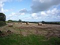 Bales off the Ridgeway - geograph.org.uk - 3842184.jpg 640 × 480; 110 KB
-
 Bare trees and scrubland - geograph.org.uk - 2064029.jpg 1,600 × 1,247; 767 KB
-
 Bay near Church Doors - geograph.org.uk - 3747475.jpg 640 × 430; 108 KB
-
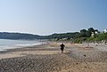
 Beach at Manorbier - geograph.org.uk - 3519652.jpg 640 × 480; 87 KB
-
 Beach Break Tea Room, Manorbier - geograph.org.uk - 5028591.jpg 800 × 630; 121 KB
-
 Beach, Lydstep Haven - geograph.org.uk - 3738541.jpg 640 × 430; 71 KB
-
 Beach, Lydstep Haven - geograph.org.uk - 3738546.jpg 640 × 430; 70 KB
-
 Beachbreak Tearoom - geograph.org.uk - 3753501.jpg 640 × 430; 70 KB
-
 Beavers Hill Crossing - geograph.org.uk - 5503342.jpg 4,896 × 3,672; 5.41 MB
-
 Beavers Retreat Glamping - geograph.org.uk - 6303216.jpg 800 × 568; 105 KB
-
 Bend in the A4139, Lydstep - geograph.org.uk - 4996691.jpg 800 × 600; 120 KB
-
 Bend in the road towards Lydstep - geograph.org.uk - 5145541.jpg 800 × 764; 130 KB
-

-

-
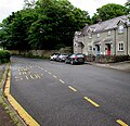
 Bier Cross junction, Manorbier - geograph.org.uk - 5028358.jpg 763 × 800; 143 KB
-

-
 Bier House, Manorbier - geograph.org.uk - 5000690.jpg 800 × 554; 128 KB
-
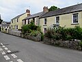
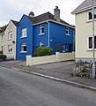 Blue house in Manor Crescent, Manorbier - geograph.org.uk - 4997720.jpg 726 × 800; 120 KB
-
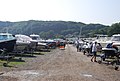
 Boats at Lydstep Haven - geograph.org.uk - 4321364.jpg 1,600 × 1,062; 638 KB
-
 BT phonebox on a Manorbier corner - geograph.org.uk - 4997718.jpg 800 × 694; 157 KB
-
 BT telecoms cabinet, Manorbier - geograph.org.uk - 5409550.jpg 800 × 600; 172 KB
-
 Bus shelter and postbox, Lydstep - geograph.org.uk - 4996624.jpg 800 × 512; 105 KB
-
 Bus shelter and tree, Manorbier - geograph.org.uk - 5048519.jpg 800 × 721; 155 KB
-

-
 Buttyland Bar, Manorbier - geograph.org.uk - 5024872.jpg 800 × 656; 102 KB
-
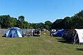 Camping site, Jameston, Pembrokeshire - geograph.org.uk - 5859737.jpg 1,024 × 683; 1.08 MB
-
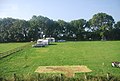 Campsite, Mead Farm - geograph.org.uk - 3689763.jpg 640 × 430; 79 KB
-
 Caravan Park, Lydstep Haven - geograph.org.uk - 3738615.jpg 640 × 430; 64 KB
-
 Castle Cottages, Manorbier - geograph.org.uk - 5048509.jpg 800 × 776; 196 KB
-
 Castle Inn - geograph.org.uk - 3753507.jpg 640 × 430; 62 KB
-
 Castle Inn, Manorbier - geograph.org.uk - 5048485.jpg 800 × 797; 135 KB
-
 Castle Inn, Manorbier - geograph.org.uk - 928772.jpg 640 × 469; 62 KB
-
 Cattle grazing - geograph.org.uk - 3747710.jpg 640 × 430; 128 KB
-
 Cattle grazing, West Moor Farm - geograph.org.uk - 3765802.jpg 640 × 430; 58 KB
-
 Cattle grazing, West Moor Farm - geograph.org.uk - 3765805.jpg 640 × 430; 54 KB
-
 Celtic Haven, Lydstep, Pembs - geograph.org.uk - 4546406.jpg 1,024 × 683; 192 KB
-
 Cerddwyr ar y A4139 - Walkers on the A4139 - geograph.org.uk - 6366458.jpg 1,024 × 768; 249 KB
-
 Children's play area in Manorbier - geograph.org.uk - 5048502.jpg 800 × 518; 136 KB
-
 Cliff top car park - geograph.org.uk - 3739852.jpg 640 × 430; 76 KB
-
 Cliff top chalet, Manorbier - geograph.org.uk - 5145340.jpg 2,000 × 1,333; 2.87 MB
-
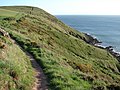
 Cliff top path - geograph.org.uk - 3765825.jpg 640 × 430; 75 KB
-
 Cliff top path - geograph.org.uk - 3765847.jpg 640 × 430; 55 KB
-
 Cliff top path - geograph.org.uk - 3765848.jpg 640 × 430; 55 KB
-
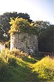
 Cliff top ruin - geograph.org.uk - 3738680.jpg 640 × 430; 42 KB
-
 Cliffed coastline - geograph.org.uk - 3738668.jpg 640 × 430; 74 KB
-
 Cliffs on Swanlake Bay - geograph.org.uk - 4275558.jpg 480 × 640; 88 KB
-
 Closed path at Manorbier Missile Range - geograph.org.uk - 4321923.jpg 1,600 × 1,062; 860 KB
-
 Coast at Lydstep National Trust Site - geograph.org.uk - 5503363.jpg 4,896 × 3,672; 6.41 MB
-
 Coast from Skrinkle - geograph.org.uk - 5679863.jpg 2,576 × 1,932; 1.27 MB
-
 Coast from Skrinkle - geograph.org.uk - 5679866.jpg 2,576 × 1,932; 1.28 MB
-
 Coast from Skrinkle - geograph.org.uk - 5679868.jpg 2,576 × 1,932; 1.26 MB
-
 Coast from Skrinkle - geograph.org.uk - 5679870.jpg 2,576 × 1,932; 1.26 MB
-
 Coast from Skrinkle - winter sunshine - geograph.org.uk - 5679874.jpg 2,576 × 1,932; 1.24 MB
-
 Coast path above Swanlake Bay - geograph.org.uk - 4796904.jpg 800 × 526; 116 KB
-
 Coastline near Manorbier - geograph.org.uk - 1821002.jpg 1,600 × 1,200; 650 KB
-
 Coastline near Skomar - geograph.org.uk - 3738655.jpg 640 × 430; 76 KB
-
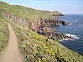
 Coastline south of Skrinkle Haven - geograph.org.uk - 3747451.jpg 640 × 430; 48 KB
-
 Cob Lane - geograph.org.uk - 6169803.jpg 1,024 × 768; 229 KB
-
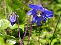 Common Columbine - geograph.org.uk - 3995803.jpg 640 × 480; 73 KB
-
 Concrete pillar on Lydstep Point - geograph.org.uk - 4321485.jpg 1,600 × 1,062; 701 KB
-
 Cottage on the path to Manorbier - geograph.org.uk - 3753477.jpg 640 × 430; 99 KB
-
 Croeso-Welcome sign, Maenorbŷr-Manorbier - geograph.org.uk - 5409447.jpg 800 × 785; 166 KB
-
 Cycling near Manorbier - geograph.org.uk - 5524906.jpg 1,280 × 851; 437 KB
-

-
 Dead end road - geograph.org.uk - 3753534.jpg 640 × 430; 112 KB
-
 Deep fissure - geograph.org.uk - 2622775.jpg 1,600 × 1,200; 781 KB
-
 Descending into Manorbier Bay - geograph.org.uk - 3759321.jpg 640 × 430; 106 KB
-
 Descending to Swanlake Bay - geograph.org.uk - 3765781.jpg 640 × 430; 96 KB
-
 Direction signs in a hedge, Manorbier - geograph.org.uk - 5028459.jpg 800 × 561; 114 KB
-

-
 Diverted Pembrokeshire Coastal Path - geograph.org.uk - 3765790.jpg 640 × 430; 76 KB
-
 Dovecote, Manorbier - geograph.org.uk - 68448.jpg 424 × 640; 118 KB
-
 Draught (bay) near Lydstep Head - geograph.org.uk - 4321547.jpg 1,600 × 1,062; 494 KB
-
 Driveway to The Dak - geograph.org.uk - 4322625.jpg 1,600 × 1,062; 538 KB
-
 East along the B4585 Manorbier - geograph.org.uk - 4997781.jpg 800 × 662; 109 KB
-
 East Moor Cliff - geograph.org.uk - 3765835.jpg 640 × 430; 36 KB
-
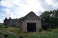 East Moor Farm - geograph.org.uk - 3147322.jpg 4,592 × 3,056; 5.16 MB
-
 East side of Manor Farm, Lydstep - geograph.org.uk - 4996521.jpg 800 × 436; 85 KB
-
 Edge of Manorbier Camp - geograph.org.uk - 3747507.jpg 640 × 430; 79 KB
-

-
 Emmanuel Gospel Church, Manorbier - geograph.org.uk - 4999285.jpg 800 × 518; 95 KB
-
-
 End of the 30 zone in Manorbier - geograph.org.uk - 5409430.jpg 800 × 603; 165 KB
-

-

-
 Entering Manorbier - geograph.org.uk - 3753491.jpg 640 × 430; 73 KB
-

-

-
 Entrance to Celtic Haven, Lydstep - geograph.org.uk - 4996672.jpg 800 × 747; 120 KB
-
 Entrance to Manorbier Camp - geograph.org.uk - 3747545.jpg 640 × 430; 56 KB
-
 Entrance to Manorbier Castle - geograph.org.uk - 5045098.jpg 2,576 × 1,932; 1.25 MB
-
 Entrance to Manorbier Country Park - geograph.org.uk - 5024862.jpg 800 × 600; 108 KB
-
 Entrance to Park Wall - geograph.org.uk - 2606899.jpg 1,024 × 680; 216 KB
-

-

-
 Exposed geology, Manorbier Bay - geograph.org.uk - 3753577.jpg 640 × 430; 121 KB
-
 Exposed sandstone, Swanlake Bay - geograph.org.uk - 4796900.jpg 800 × 525; 111 KB
-
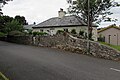
 Farmhouse B^B - geograph.org.uk - 3765801.jpg 640 × 430; 58 KB
-
 Farmhouse near Manorbier Camp - geograph.org.uk - 4322070.jpg 1,600 × 1,062; 487 KB
-
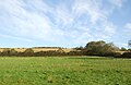
 Farmland by the railway - geograph.org.uk - 3689811.jpg 640 × 430; 46 KB
-
 Farmland by the railway - geograph.org.uk - 3689834.jpg 640 × 430; 43 KB
-

-
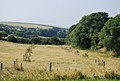
 Farmland near Manorbier - geograph.org.uk - 3689767.jpg 640 × 430; 70 KB
-
 Farmland near Manorbier - geograph.org.uk - 3689772.jpg 640 × 430; 46 KB
-
 Farmland near Manorbier - geograph.org.uk - 3689775.jpg 640 × 430; 51 KB
-
 Farmland near Manorbier Newton - geograph.org.uk - 3689739.jpg 640 × 430; 65 KB
-
 Farmland near Mead Farm - geograph.org.uk - 3689759.jpg 640 × 430; 59 KB
-
 Farmland near Swanlake Bay - geograph.org.uk - 3759353.jpg 640 × 430; 71 KB
-
 Farmland near Swanlake Bay - geograph.org.uk - 3759403.jpg 640 × 430; 82 KB
-
 Farmland view near Jameston, Pembrokeshire - geograph.org.uk - 5859694.jpg 1,024 × 768; 1.46 MB
-
 Fernley Lodge, B4585, Manorbier - geograph.org.uk - 928826.jpg 640 × 470; 64 KB
-

-
 Field behind Swanlake Bay - geograph.org.uk - 3765791.jpg 640 × 430; 60 KB
-
 Field behind Swanlake Bay - geograph.org.uk - 3765792.jpg 640 × 430; 62 KB
-
 Field by the railway line - geograph.org.uk - 3689765.jpg 640 × 430; 65 KB
-
 Field gate and side road in Manorbier - geograph.org.uk - 5028560.jpg 800 × 491; 119 KB
-
 Field gate, Lydstep - geograph.org.uk - 5145520.jpg 800 × 540; 112 KB
-
 Fields near Norchard Farm - geograph.org.uk - 6311375.jpg 640 × 418; 38 KB
-
 Fingerpost at The Dak - geograph.org.uk - 4322727.jpg 1,600 × 1,062; 537 KB
-
 Fingerpost to Manorbier Youth Hostel - geograph.org.uk - 4321887.jpg 1,600 × 1,062; 713 KB
-
-
 Flags flying, Swanlake Bay - geograph.org.uk - 3765795.jpg 640 × 430; 52 KB
-
 Flowering heather - geograph.org.uk - 3759393.jpg 640 × 430; 120 KB
-
 Footbridge at Manorbier Bay, Pembrokeshire - geograph.org.uk - 4322618.jpg 1,600 × 1,062; 782 KB
-
 Footpath junction - geograph.org.uk - 3753472.jpg 640 × 430; 143 KB
-
 Footpath on East Moor Cliff - geograph.org.uk - 2384670.jpg 1,280 × 960; 569 KB
-
 Footpath to Manorbier - geograph.org.uk - 3747576.jpg 640 × 430; 61 KB
-
 Footpath to Manorbier - geograph.org.uk - 3747593.jpg 640 × 430; 72 KB
-
 Footpath to Manorbier - geograph.org.uk - 3747702.jpg 640 × 430; 132 KB
-
 Footpath to Manorbier - geograph.org.uk - 3747708.jpg 640 × 430; 153 KB
-
 Footpath to Manorbier - geograph.org.uk - 3747712.jpg 640 × 430; 129 KB
-
 Footpath to Manorbier - geograph.org.uk - 3753480.jpg 640 × 430; 113 KB
-
 Footpath to Manorbier - geograph.org.uk - 3753481.jpg 640 × 430; 130 KB
-
 Footpath to Swanlake Bay - geograph.org.uk - 2488758.jpg 4,000 × 3,000; 4.95 MB
-
 Footpath towards Manorbier Camp - geograph.org.uk - 4321879.jpg 1,600 × 1,062; 432 KB
-

-
-
 Gadael Maenorbyr - Exiting Manorbier - geograph.org.uk - 6366459.jpg 1,024 × 768; 264 KB
-
 Gadael pentre Lydstep - Exiting Lydstep village - geograph.org.uk - 6366457.jpg 1,024 × 790; 274 KB
-
 Gate at Entrance to Lydstep Headland - geograph.org.uk - 5503394.jpg 4,896 × 3,672; 6.39 MB
-
 Gate on Pembrokeshire Coast Path near Lydstep - geograph.org.uk - 5503379.jpg 4,896 × 3,672; 6.43 MB
-
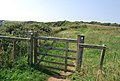
 Gate, Pembrokeshire Coast Path - geograph.org.uk - 3759327.jpg 640 × 430; 109 KB
-
 Gate, Pembrokeshire Coast Path - geograph.org.uk - 3765782.jpg 640 × 430; 116 KB
-
 Gate, Pembrokeshire Coast Path - geograph.org.uk - 3765822.jpg 640 × 430; 69 KB
-
 Gate, Pembrokeshire Coastal Path - geograph.org.uk - 3747482.jpg 640 × 430; 100 KB
-
 Gate, Pembrokeshire Coastal Path - geograph.org.uk - 3771321.jpg 640 × 430; 88 KB
-
 Geo, Manorbier Bay - geograph.org.uk - 3759342.jpg 640 × 430; 102 KB
-
 Ger - Near Skrinkle Haven - geograph.org.uk - 4492649.jpg 640 × 398; 61 KB
-
-
 Graham's of Manorbier - geograph.org.uk - 3753510.jpg 640 × 430; 51 KB
-
 Grasslands near Manorbier - geograph.org.uk - 3747581.jpg 640 × 430; 73 KB
-
 Grassy field above Swanlake Bay - geograph.org.uk - 3765796.jpg 640 × 430; 67 KB
-
 Grassy mound by the coastal path - geograph.org.uk - 3738645.jpg 640 × 430; 82 KB
-
 Grazing near Manorbier Station - geograph.org.uk - 6311378.jpg 800 × 500; 95 KB
-
 Grazing, Lords Mead - geograph.org.uk - 6311379.jpg 800 × 521; 89 KB
-
 Grazing, Manorbier Newton - geograph.org.uk - 6311381.jpg 800 × 410; 63 KB
-
 Gwersyll Maenor Byr - Manorbier Camp - geograph.org.uk - 4492685.jpg 640 × 459; 81 KB
-
 Happy Acre B^B, Lydstep - geograph.org.uk - 4996270.jpg 800 × 544; 85 KB
-
 Heading south - geograph.org.uk - 2384681.jpg 1,280 × 960; 602 KB
-
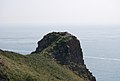 Headland, Church Doors - geograph.org.uk - 3739850.jpg 640 × 430; 46 KB
-
 Heather and broom - geograph.org.uk - 3759351.jpg 640 × 430; 144 KB
-
 High stone wall, Manorbier - geograph.org.uk - 5409546.jpg 800 × 600; 174 KB
-
 Holiday Park, Lydstep Haven - geograph.org.uk - 3738556.jpg 640 × 430; 79 KB
-
 Home Watch sign on a lamppost, Manorbier - geograph.org.uk - 5409535.jpg 800 × 600; 180 KB
-
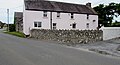
 House corners, B4585, Manorbier - geograph.org.uk - 928802.jpg 480 × 640; 69 KB
-
 Houses east of Warlows Meadow, Manorbier - geograph.org.uk - 5000637.jpg 800 × 600; 118 KB
-
 Houses in The Green, Lydstep - geograph.org.uk - 4996514.jpg 800 × 449; 83 KB
-
 Housing ADRM - geograph.org.uk - 3747511.jpg 640 × 430; 74 KB
-
 Housing ADRM - geograph.org.uk - 3747514.jpg 640 × 430; 76 KB
-
 Housing ADRM - geograph.org.uk - 3747578.jpg 640 × 430; 60 KB
-
 Indistinct footpath across a field - geograph.org.uk - 3747585.jpg 640 × 430; 64 KB
-
 Information Board at Skrinkle - geograph.org.uk - 5503387.jpg 4,896 × 3,672; 6.44 MB


_near_Lydstep_Head_-_geograph.org.uk_-_4321547.jpg)


