Category:Manor complex in Kopciowice
Jump to navigation
Jump to search
| Object location | | View all coordinates using: OpenStreetMap |
|---|
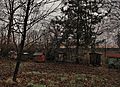
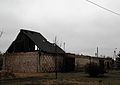
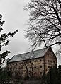
Polski: zespół dworski z poł. XIX wieku: dworek, stodoła, spichrz, obora, park
Media in category "Manor complex in Kopciowice"
The following 26 files are in this category, out of 26 total.
-
 Dworek in Kopciowice.jpg 4,064 × 2,704; 12.7 MB
-
 Dworek w Kopciowicach.jpg 4,009 × 2,667; 7.17 MB
-
 Kopciowice - dworek - elewacja frontowa.jpg 3,239 × 4,493; 1.6 MB
-
 Kopciowice - dworek - elewacja tylna.jpg 3,156 × 4,364; 1.83 MB
-
 Kopciowice - dworek - front.jpg 3,456 × 4,776; 3.24 MB
-
 Kopciowice - dworek.jpg 4,369 × 2,978; 1.62 MB
-
 Kopciowice - obora - fragement elewacji frontowej.jpg 3,412 × 4,721; 7.27 MB
-
 Kopciowice - obora - wejście.jpg 3,456 × 4,776; 7.19 MB
-
 Kopciowice - obora - wnętrze.jpg 3,456 × 5,184; 7.73 MB
-
 Kopciowice - obora.jpg 5,184 × 3,456; 6.57 MB
-
 Kopciowice - park - ule 2.jpg 5,184 × 3,456; 2.41 MB
-
 Kopciowice - park - ule.JPG 3,693 × 2,667; 4.45 MB
-
 Kopciowice - park 2.jpg 3,456 × 5,184; 5.05 MB
-
 Kopciowice - park.JPG 3,456 × 5,184; 5.38 MB
-
 Kopciowice - stodoła.jpg 4,782 × 3,402; 1.94 MB
-
 Kopciowice Zespół dworski - dworek i spichlerz.JPG 5,152 × 3,408; 3.11 MB
-
 Kopciowice Zespół dworski - dworek, spichlerz i stodoła.jpg 5,090 × 3,310; 5.07 MB
-
 Kopciowice Zespół dworski - spichlerz i stodoła.jpg 5,122 × 3,362; 7.07 MB
-
 Spichlerz - stolarka drzwiowa wewnętrzna.jpg 3,262 × 4,514; 3 MB
-
 Spichlerz - wejście.jpg 3,396 × 5,144; 6.96 MB
-
 Spichlerz - widok frontu.jpg 5,184 × 3,456; 3.68 MB
-
 Spichlerz - widok od strony parku 2.jpg 3,019 × 4,185; 3.28 MB
-
 Spichlerz - widok od strony parku.jpg 3,396 × 5,144; 3.44 MB
-
 Spichlerz - wnętrze - schody.jpg 3,362 × 5,122; 4.38 MB
-
 Spichlerz - wnętrze.jpg 3,957 × 2,865; 1.63 MB
-
 Stodoła - drzwi.JPG 4,785 × 3,455; 2.86 MB


