Category:Malayalam-language SVG maps
Appearance
Subcategories
This category has the following 3 subcategories, out of 3 total.
Media in category "Malayalam-language SVG maps"
The following 43 files are in this category, out of 43 total.
-
Anaximander world map-ml.svg 1,063 × 1,063; 14 KB
-
Assam-districts-2001 ml.svg 631 × 530; 214 KB
-
Central Asia - political map - 2000-ml.svg 995 × 790; 157 KB
-
Central Asia - political map 2008-ml.svg 996 × 790; 156 KB
-
Chalakkudy-Assembly-Segments-ml.svg 1,020 × 741; 24 KB
-
Course Channeltunnel ml.svg 472 × 387; 103 KB
-
Delhi Municipalities ml.svg 600 × 600; 13 KB
-
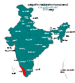
India Union Territories ml.svg 557 × 600; 209 KB
-
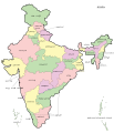
India-map ml.svg 1,620 × 1,891; 285 KB
-
India-map-en-2022-march 02.svg 1,519 × 1,773; 285 KB
-
India-map-ml-political-parties-2017.svg 1,521 × 1,697; 620 KB
-
India-map-ml.svg 1,519 × 1,773; 621 KB
-
Kannur-district-map-ml.svg 2,105 × 1,488; 1.46 MB
-
Karnataka 1956 Reorg ml.svg 740 × 798; 729 KB
-
Kerala Flood Relief States ml.svg 1,594 × 1,772; 390 KB
-
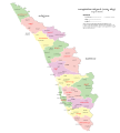
Kerala-administrative-divisions-map-ml.svg 2,700 × 3,000; 514 KB
-
Kerala-map-ml.svg 1,429 × 2,500; 254 KB
-
Kerala-road-map-ml.svg 2,000 × 2,556; 104 KB
-
Kozhikode-district-map-ml.svg 2,010 × 2,968; 4.32 MB
-
Lincoln Sea map ml.svg 1,000 × 913; 201 KB
-
Maharashtra Divisions ml.svg 3,313 × 2,617; 249 KB
-
Malappuram-district-map-ml.svg 1,541 × 2,188; 1.23 MB
-
MANIPUR district map ml.svg 640 × 715; 239 KB
-
Map Gulf of Finland ml.svg 1,400 × 800; 528 KB
-
Map of Sealand with territorial waters ml.svg 600 × 613; 109 KB
-
Meghalaya 2012 ml.svg 807 × 434; 166 KB
-
Nagaland district map ml.svg 768 × 680; 629 KB
-
Naval bases of India ml.svg 1,486 × 1,734; 459 KB
-
Orissa State map ml.svg 2,184 × 1,769; 1.82 MB
-
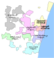
Puducherry District - Local bodies ml.svg 979 × 1,057; 48 KB
-
Punjab 1951-66-ml.svg 1,055 × 427; 76 KB
-
Punjab 2012 administrativ-ml.svg 900 × 600; 281 KB
-
Sustainable Development ml.svg 512 × 326; 16 KB
-
Tamil Nadu district map-ml.svg 1,640 × 2,032; 153 KB
-
Thinai-തിണകൾ.svg 649 × 535; 13 KB
-
TokyoSpecialWardsMap.ml.svg 438 × 388; 326 KB
-
Trichur-Assembly-Segments-ml-svg.svg 1,500 × 1,069; 146 KB
-
Up-subregions2 ml.svg 2,400 × 2,515; 244 KB
-
Uttar Pradesh administrative divisions ml.svg 1,600 × 1,600; 109 KB
-
Wayanad-district-map-ml.svg 2,658 × 1,780; 442 KB
-
WestBengalDistricts numbered ml.svg 576 × 601; 146 KB
-
Zonal Councils ml.svg 1,700 × 1,993; 236 KB


