Category:Maker-with-Rame
Jump to navigation
Jump to search
civil parish in Cornwall, England | |||||
| Upload media | |||||
| Instance of | |||||
|---|---|---|---|---|---|
| Named after | |||||
| Location | Cornwall, South West England, England | ||||
| Population |
| ||||
 | |||||
Subcategories
This category has the following 16 subcategories, out of 16 total.
C
K
- Kingsand Beach (9 F)
M
- Maker Lodge (3 F)
P
- Penlee Battery (4 F)
- Penlee Point, Maker-with-Rame (35 F)
- Picklecombe Fort (20 F)
- Polhawn Fort (2 F)
Q
- Queener Point, Cornwall (8 F)
R
S
- Sandway Beach (3 F)
Media in category "Maker-with-Rame"
The following 200 files are in this category, out of 1,206 total.
(previous page) (next page)-
 A corner of Kingsand - geograph.org.uk - 4608076.jpg 1,920 × 3,082; 727 KB
-
 A Cornish Barn - geograph.org.uk - 794581.jpg 640 × 427; 124 KB
-

-
 A Private Driveway - geograph.org.uk - 794546.jpg 640 × 427; 162 KB
-
 A small geo next to Cavehole Cellars - geograph.org.uk - 3831987.jpg 1,333 × 1,000; 1.13 MB
-
 A wave has just arrived - geograph.org.uk - 349903.jpg 640 × 480; 61 KB
-
 A wave is a coming - geograph.org.uk - 349899.jpg 640 × 480; 62 KB
-
 Above Lilley's Cove - geograph.org.uk - 2363153.jpg 1,024 × 768; 257 KB
-
 Above Penlee Point - geograph.org.uk - 2363172.jpg 1,024 × 768; 235 KB
-
 Above Polhawn Fort, Rame Head, Cornwall - geograph.org.uk - 3877337.jpg 2,560 × 1,920; 2.3 MB
-
 Above Queener Point - geograph.org.uk - 2370226.jpg 1,024 × 768; 229 KB
-
 Above Whitesand Bay - geograph.org.uk - 5075167.jpg 3,000 × 2,250; 3.66 MB
-
 After the flood Kingsand - geograph.org.uk - 3935945.jpg 683 × 1,024; 311 KB
-
 Air raid shelter, Mount Edgcumbe - geograph.org.uk - 6434479.jpg 1,024 × 681; 282 KB
-
 Amphitheatre Wood, Mount Edgcumbe - geograph.org.uk - 5317408.jpg 1,280 × 851; 678 KB
-
 Amphitheatre Wood, Mount Edgcumbe - geograph.org.uk - 5317787.jpg 1,280 × 851; 638 KB
-
 Amphitheatre Wood, Mount Edgcumbe - geograph.org.uk - 5317791.jpg 1,280 × 851; 676 KB
-
 Approaching Treninnow and Wiggle chalets - geograph.org.uk - 2634929.jpg 640 × 442; 102 KB
-
 Aquatic pursuits in Cawsand Bay - geograph.org.uk - 3834694.jpg 1,066 × 1,000; 752 KB
-
 Archway, Mount Edgcumbe Park - geograph.org.uk - 4920895.jpg 640 × 426; 108 KB
-
 Armada Road, Cawsand - geograph.org.uk - 2637318.jpg 480 × 640; 61 KB
-
 Armada Road, Cawsand - geograph.org.uk - 2637366.jpg 480 × 640; 98 KB
-
 Armada Road, Cawsand - geograph.org.uk - 2920193.jpg 1,000 × 1,333; 1.63 MB
-
 Armada Road, Cawsand - geograph.org.uk - 6022077.jpg 1,280 × 851; 368 KB
-
 August Saturday at Cremyll - geograph.org.uk - 4606338.jpg 1,920 × 1,115; 449 KB
-
 Autumn scene in Amphitheatre Wood - geograph.org.uk - 5972417.jpg 480 × 640; 152 KB
-
 Autumnal colours - geograph.org.uk - 6434497.jpg 1,024 × 681; 255 KB
-
 B3247 - geograph.org.uk - 4921284.jpg 640 × 426; 66 KB
-
 B3247 - geograph.org.uk - 4921286.jpg 640 × 426; 96 KB
-
 B3247 - geograph.org.uk - 4926962.jpg 640 × 426; 97 KB
-
 B3247 approaching Millbrook - geograph.org.uk - 6151939.jpg 3,933 × 2,205; 1.8 MB
-
 B3247 near Maker - geograph.org.uk - 6233421.jpg 1,000 × 1,333; 1.24 MB
-
 B3247 past Millbrook Burial Ground - geograph.org.uk - 6151944.jpg 4,285 × 2,435; 2.09 MB
-
 Barn in Rame - geograph.org.uk - 5621649.jpg 640 × 426; 96 KB
-
 Barn Pool - geograph.org.uk - 4913871.jpg 640 × 426; 53 KB
-
 Barn Pool - geograph.org.uk - 4913873.jpg 640 × 426; 48 KB
-
 Barn, Rame - geograph.org.uk - 5618119.jpg 640 × 426; 72 KB
-
 Barrow Park Flats, Mount Edgcumbe - geograph.org.uk - 6434441.jpg 1,024 × 681; 169 KB
-
 Base of the cliffs above Whitsand Beach - geograph.org.uk - 5183956.jpg 1,524 × 1,142; 366 KB
-
 Bay, Mount Edgcumbe - geograph.org.uk - 4913846.jpg 640 × 426; 56 KB
-
 Beach at Cawsand (0075).jpg 4,288 × 2,848; 6.66 MB
-
 Beach at Cawsand (0076).jpg 4,288 × 2,848; 6.62 MB
-
 Beach at Cawsand (0080).jpg 4,288 × 2,848; 6.37 MB
-
 Beach at Cawsand - geograph.org.uk - 2374237.jpg 1,024 × 768; 201 KB
-
 Beach at Cawsand - geograph.org.uk - 2374271.jpg 1,024 × 768; 241 KB
-
 Beach at Cremyll - geograph.org.uk - 5101760.jpg 640 × 480; 67 KB
-
 Beach at Eastern Gear (0059).jpg 4,288 × 2,848; 6.19 MB
-
 Beach at Kingsand - geograph.org.uk - 1978680.jpg 640 × 480; 58 KB
-
 Beach at Wiggle Sandway - geograph.org.uk - 2635104.jpg 640 × 447; 91 KB
-
 Beach at Wiggle Sandway - geograph.org.uk - 2635151.jpg 640 × 480; 78 KB
-
 Beach below Wiggle Cliff - geograph.org.uk - 2635035.jpg 640 × 434; 81 KB
-
 Beacon, Hooe Lake Point - geograph.org.uk - 5605459.jpg 640 × 425; 49 KB
-
-
 Blockhouse and park, Mount Edgcumbe - geograph.org.uk - 3539977.jpg 1,024 × 768; 87 KB
-
 Blockhouse at Wilderness Point - geograph.org.uk - 4374259.jpg 1,600 × 1,062; 496 KB
-
 Boat on The Hamoaze - geograph.org.uk - 4913789.jpg 640 × 426; 38 KB
-
 Boat yard and reflections 2 - geograph.org.uk - 5764271.jpg 2,048 × 1,536; 559 KB
-
 Boats Moored on Millbrook Lake - geograph.org.uk - 794456.jpg 497 × 640; 138 KB
-
 Boats on the Tamar - geograph.org.uk - 4606425.jpg 1,559 × 899; 300 KB
-
 Boatyard and reflections - geograph.org.uk - 5763924.jpg 640 × 480; 55 KB
-
 Boatyard at Cremyll on the River Tamar - geograph.org.uk - 4388395.jpg 1,600 × 1,062; 522 KB
-
 Boulders at the foot of the cliffs - geograph.org.uk - 5183961.jpg 1,306 × 979; 549 KB
-
 Britanny Ferry - geograph.org.uk - 5634481.jpg 640 × 426; 48 KB
-
 Britanny Ferry - geograph.org.uk - 5634482.jpg 640 × 426; 46 KB
-
 Building above Captain Blake's Point - geograph.org.uk - 2635186.jpg 640 × 480; 86 KB
-

-
 Building in Cremyll - geograph.org.uk - 5634533.jpg 640 × 426; 70 KB
-
 Building near The Cremyll Ferry - geograph.org.uk - 4905200.jpg 640 × 405; 47 KB
-
 Building north of Kingsand (0089).jpg 4,288 × 2,848; 6.29 MB
-
 Building on the beach - geograph.org.uk - 5626797.jpg 640 × 426; 103 KB
-
 Buildings at Maker Farm - geograph.org.uk - 4610587.jpg 1,920 × 1,275; 717 KB
-
 Bullock by the Earl's Drive - geograph.org.uk - 4609501.jpg 1,062 × 873; 224 KB
-
 Bus stop, Cremyll - geograph.org.uk - 4926993.jpg 640 × 426; 53 KB
-
 Butterfly near Homebarton Hill - geograph.org.uk - 2636809.jpg 640 × 485; 77 KB
-
 Camellia - Mount Edgcumbe - geograph.org.uk - 5317239.jpg 1,280 × 851; 279 KB
-
 Camellia - Mount Edgcumbe - geograph.org.uk - 5317266.jpg 1,280 × 851; 321 KB
-
 Camellias on the wall - geograph.org.uk - 3832024.jpg 1,000 × 1,333; 1.33 MB
-
 Captain Blake's Point - geograph.org.uk - 5347194.jpg 1,066 × 1,600; 378 KB
-
 Captain Blake's Point - geograph.org.uk - 5874413.jpg 1,600 × 900; 582 KB
-
 Carriage drive through Orchard Plantation - geograph.org.uk - 5347470.jpg 1,600 × 1,067; 757 KB
-
 Cattle at Sollack - geograph.org.uk - 6151837.jpg 3,980 × 2,540; 1.95 MB
-
 Cattle by the Earl's Drive - geograph.org.uk - 4609456.jpg 1,920 × 1,199; 799 KB
-
 Cattle by the Earl's Drive - geograph.org.uk - 4609470.jpg 1,920 × 1,259; 844 KB
-
 Cattle on the horizon, Earl's Drive - geograph.org.uk - 4609414.jpg 3,604 × 2,146; 1.58 MB
-
 Cavehole Cellar on Cavehole Point - geograph.org.uk - 3831583.jpg 1,333 × 1,000; 1.16 MB
-
 Cawsand - Armada Road - geograph.org.uk - 3830450.jpg 1,333 × 1,000; 1.1 MB
-
 Cawsand - geograph.org.uk - 2637194.jpg 640 × 480; 71 KB
-
 Cawsand - geograph.org.uk - 6645828.jpg 640 × 439; 69 KB
-
 Cawsand - St. Andrew's Street - geograph.org.uk - 3831227.jpg 1,000 × 1,240; 991 KB
-
 Cawsand - The Square - geograph.org.uk - 2918823.jpg 1,000 × 1,125; 1.39 MB
-
 Cawsand Bay - geograph.org.uk - 5101738.jpg 640 × 480; 39 KB
-
 Cawsand Bay - geograph.org.uk - 5621813.jpg 640 × 425; 76 KB
-
 Cawsand Bay - geograph.org.uk - 6262791.jpg 5,472 × 3,648; 6.38 MB
-
 Cawsand Bay - geograph.org.uk - 6262797.jpg 5,472 × 3,648; 2.92 MB
-
 Cawsand Bay with boats from The Cleave, Kingsand - geograph.org.uk - 6233393.jpg 1,333 × 1,000; 1 MB
-
 Cawsand Beach - geograph.org.uk - 2014160.jpg 681 × 1,024; 262 KB
-
 Cawsand beach - geograph.org.uk - 2751552.jpg 3,888 × 2,592; 2.12 MB
-
 Cawsand Beach - geograph.org.uk - 6022459.jpg 1,280 × 863; 265 KB
-
 Cawsand beach - geograph.org.uk - 6246817.jpg 640 × 480; 89 KB
-
 Cawsand Beach and houses on Garrett Street - geograph.org.uk - 3830661.jpg 1,135 × 1,000; 839 KB
-
 Cawsand beach from Earl's Drive - geograph.org.uk - 2380269.jpg 1,000 × 1,333; 1.42 MB
-
 Cawsand beach on Plymouth Sound - geograph.org.uk - 3935494.jpg 1,024 × 683; 244 KB
-
 Cawsand beach on Plymouth Sound - geograph.org.uk - 3935505.jpg 1,024 × 683; 310 KB
-
 Cawsand Cornwall - geograph.org.uk - 6246800.jpg 640 × 480; 80 KB
-

-

-
 Cawsand Fort (0074).jpg 4,288 × 2,848; 6.04 MB
-
 Cawsand Fort - geograph.org.uk - 2374228.jpg 1,024 × 768; 256 KB
-
 Cawsand Fort - geograph.org.uk - 2637214.jpg 640 × 433; 73 KB
-
 Cawsand from Pier Lane - geograph.org.uk - 2637185.jpg 640 × 396; 56 KB
-
 Cawsand Regatta - geograph.org.uk - 6232281.jpg 1,517 × 1,000; 1.31 MB
-
 Cawsand Square - geograph.org.uk - 4376713.jpg 1,200 × 803; 788 KB
-
 Cawsand Village - geograph.org.uk - 2007013.jpg 640 × 480; 100 KB
-
 Cawsand, Cornwall - geograph.org.uk - 6238312.jpg 1,600 × 1,065; 689 KB
-
 Cawsand, The Shop in the Square - geograph.org.uk - 4376724.jpg 1,200 × 803; 738 KB
-
 Cawsands - geograph.org.uk - 5621809.jpg 640 × 426; 54 KB
-
 Cawsands - geograph.org.uk - 5621851.jpg 640 × 450; 91 KB
-
 Cawsands - geograph.org.uk - 5621868.jpg 640 × 426; 56 KB
-
 Cawsands - geograph.org.uk - 5621869.jpg 640 × 426; 75 KB
-
 Cawsands Battery - geograph.org.uk - 5605511.jpg 640 × 426; 54 KB
-
 Cawsands Battery - geograph.org.uk - 5605522.jpg 640 × 426; 50 KB
-
 Cawsands Battery - geograph.org.uk - 5605528.jpg 640 × 426; 62 KB
-
 Cawsands Battery - geograph.org.uk - 5605541.jpg 640 × 426; 59 KB
-
 Cawsands Battery - geograph.org.uk - 5605547.jpg 640 × 426; 83 KB
-
 Cawsands Beach - geograph.org.uk - 5605524.jpg 640 × 425; 67 KB
-
 Cawsands Congregational Church - geograph.org.uk - 5605520.jpg 640 × 426; 63 KB
-
 Cawsands Congregational Church - geograph.org.uk - 5605534.jpg 640 × 426; 79 KB
-
 Cawsands Congregational Church - geograph.org.uk - 5621861.jpg 640 × 426; 63 KB
-
 Cawsands Ferry - geograph.org.uk - 5605550.jpg 640 × 426; 48 KB
-
 Cawsands Ferry - geograph.org.uk - 5605551.jpg 640 × 426; 68 KB
-
 Cawsands Fort - geograph.org.uk - 5621775.jpg 640 × 426; 60 KB
-
 Chapel of St Michael, Rame Head - geograph.org.uk - 2636006.jpg 640 × 480; 95 KB
-
 Chapel on Rame Head - geograph.org.uk - 2006962.jpg 640 × 480; 95 KB
-
 Chapel on Rame Head - geograph.org.uk - 4532415.jpg 640 × 480; 86 KB
-
 Chapel on Rame Head - geograph.org.uk - 4901211.jpg 1,024 × 768; 297 KB
-
 Chapel on Rame Head - geograph.org.uk - 4901220.jpg 800 × 600; 156 KB
-
 Chapel, Rame Head - geograph.org.uk - 3250122.jpg 1,333 × 1,000; 1.63 MB
-
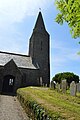
 Church of St Andrew - geograph.org.uk - 5611872.jpg 640 × 426; 82 KB
-
 Church of St Andrew - geograph.org.uk - 5621782.jpg 640 × 488; 108 KB
-
 Church of St Andrew - geograph.org.uk - 5621876.jpg 640 × 426; 85 KB
-
 Church of St Germanus - font - geograph.org.uk - 5618168.jpg 640 × 426; 68 KB
-
 Church of St Germanus - geograph.org.uk - 5618157.jpg 640 × 426; 57 KB
-
 Church of St Germanus - geograph.org.uk - 5618160.jpg 640 × 425; 62 KB
-
 Church of St Germanus - geograph.org.uk - 5618170.jpg 640 × 426; 74 KB
-
 Church of St Germanus - geograph.org.uk - 5618171.jpg 640 × 426; 78 KB
-
 Church of St Germanus - geograph.org.uk - 5618172.jpg 640 × 426; 82 KB
-
 Church of St Germanus - geograph.org.uk - 5618508.jpg 426 × 640; 78 KB
-
 Church of St Germanus - geograph.org.uk - 5621643.jpg 640 × 426; 84 KB
-
 Church of St Germanus - pulpit - geograph.org.uk - 5618162.jpg 640 × 426; 77 KB
-

-
 Church of St Germanus, Ramehead Lane, Rame - geograph.org.uk - 6215519.jpg 5,184 × 3,456; 6.35 MB
-
 Church of St Mary and St Julian - geograph.org.uk - 4921254.jpg 640 × 426; 72 KB
-
 Church of St Mary and St Julian - geograph.org.uk - 4921255.jpg 640 × 426; 76 KB
-
 Church of St Mary and St Julian - geograph.org.uk - 4921257.jpg 640 × 426; 41 KB
-
 Church of St Mary and St Julian - geograph.org.uk - 4921259.jpg 640 × 426; 61 KB
-
 Church of St Mary and St Julian - geograph.org.uk - 4921268.jpg 640 × 426; 97 KB
-
 Church of St Mary and St Julian - geograph.org.uk - 4921271.jpg 640 × 426; 100 KB
-
 Church of St Mary and St Julian - geograph.org.uk - 4921272.jpg 426 × 640; 70 KB
-
 Church of St Mary and St Julian - geograph.org.uk - 4921275.jpg 640 × 498; 83 KB
-
 Church of St Mary and St Julian - geograph.org.uk - 4921278.jpg 640 × 426; 57 KB
-
 Church tower - geograph.org.uk - 4535436.jpg 640 × 480; 75 KB
-
 Church tower, Maker - geograph.org.uk - 4610783.jpg 1,920 × 2,559; 1.13 MB
-
 Cliffs east of Rame Head (2741).jpg 4,288 × 2,848; 6.21 MB
-
 Cliffs west of Penlee Point (0060).jpg 4,288 × 2,848; 6.77 MB
-
 Cliffs west of Penlee Point (0061).jpg 4,288 × 2,848; 6.29 MB
-
 Cliffs west of Penlee Point (2767).jpg 4,288 × 2,848; 4.9 MB
-
 Cliffs west of Penlee Point (2768).jpg 4,288 × 2,848; 5.27 MB
-
 Cliffs west of Penlee Point (2769).jpg 4,288 × 2,848; 5.76 MB
-
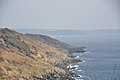
 Cliffs west of Rame Head (2744).jpg 4,288 × 2,848; 4.65 MB
-
 Cliffs west of Rame Head (2748).jpg 4,288 × 2,848; 4.49 MB
-
 Cliffs west of Rame Head (2750).jpg 4,288 × 2,848; 5.17 MB
-
 Cliffs west of Rame Head (2757).jpg 4,288 × 2,848; 5.48 MB
-
 Climb to St Michael's Chapel - geograph.org.uk - 3250124.jpg 1,000 × 1,333; 1.77 MB
-
 Clock near Cremyll Ferry landing - geograph.org.uk - 3251085.jpg 512 × 640; 446 KB
-
 Clock tower at Kingsand, Cornwall - geograph.org.uk - 3877293.jpg 1,920 × 2,560; 2.04 MB
-
 Clock Tower, Kingsand - geograph.org.uk - 2374289.jpg 768 × 1,024; 152 KB
-
 Clock Tower, Kingsand - geograph.org.uk - 5605530.jpg 640 × 425; 73 KB
-
 Clock tower, Kingsand - geograph.org.uk - 5621865.jpg 640 × 426; 83 KB
-

-
 Close up of Reef at low tide - geograph.org.uk - 343476.jpg 640 × 461; 95 KB
-
 Close up of rock Pool - geograph.org.uk - 343428.jpg 640 × 444; 84 KB
-

-
 Coach House, Mount Edgcumbe - geograph.org.uk - 6434477.jpg 1,024 × 681; 194 KB
-
 Coast Path - geograph.org.uk - 3634312.jpg 640 × 428; 121 KB
-
 Coast path above Fort Picklecombe - geograph.org.uk - 4606901.jpg 1,920 × 2,679; 1.67 MB
-
 Coast path above Middlebarton Brake - geograph.org.uk - 2636842.jpg 514 × 640; 123 KB
-
 Coast path above Middlebarton Brake - geograph.org.uk - 5347450.jpg 1,600 × 1,067; 846 KB
-
 Coast path above of Polhawn Cove - geograph.org.uk - 2370197.jpg 1,024 × 768; 333 KB
-
 Coast path above Picklecombe Fort - geograph.org.uk - 4902588.jpg 1,024 × 768; 408 KB
-
 Coast path above Picklecombe Point - geograph.org.uk - 2223032.jpg 1,024 × 681; 312 KB
-
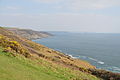
 Coast path approaching Rame Head - geograph.org.uk - 2363157.jpg 1,024 × 768; 247 KB
-
 Coast path at Wiggle Sandway - geograph.org.uk - 2635168.jpg 640 × 480; 116 KB
-
 Coast path near Fort Picklecombe - geograph.org.uk - 4606958.jpg 1,920 × 1,275; 904 KB
-
 Coast path near Fort Picklecombe - geograph.org.uk - 4606975.jpg 1,920 × 1,275; 1,001 KB
-
 Coast path south of Cawsand - geograph.org.uk - 2374187.jpg 1,024 × 768; 359 KB
-
 Coast path west of Penlee Point - geograph.org.uk - 2363165.jpg 1,024 × 768; 334 KB
-
 Coast path, Hooe Lake Valley - geograph.org.uk - 4607023.jpg 1,920 × 1,275; 886 KB
-
 Coastal Battery - geograph.org.uk - 5740656.jpg 640 × 426; 54 KB
-
 Coastal beacon - geograph.org.uk - 5626908.jpg 640 × 426; 66 KB
-
 Coastal beacon - geograph.org.uk - 5626910.jpg 640 × 426; 71 KB


.jpg)
.jpg)
.jpg)


.jpg)


.jpg)


.jpg)


.jpg)
.jpg)
.jpg)
.jpg)
.jpg)
.jpg)
.jpg)
.jpg)
.jpg)
.jpg)


