Category:Maisinger See
Jump to navigation
Jump to search
This is the category of the protected area listed at WDPA under the ID 555522102
|
This is the category of the protected area listed at WDPA under the ID 396093
|
| Object location | | View all coordinates using: OpenStreetMap |
|---|
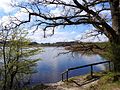
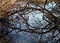
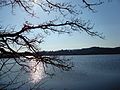
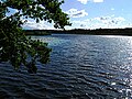
Deutsch: Der Maisinger See ist Teil des Naturschutzgebietes „Maisinger See“ (NSG-00313.01), des Landschaftsschutzgebietes „Westlicher Teil des Landkreises Starnberg“ (LSG-00542.01) und des FFH-Gebietes „NSG Maisinger See“ (8033-373) im Landkreis Starnberg, Oberbayern
lake in Bavaria, Germany  | |||||
| Upload media | |||||
| Instance of | |||||
|---|---|---|---|---|---|
| Named after | |||||
| Located in protected area | |||||
| Location | Pöcking, Starnberg, Upper Bavaria, Bavaria, Germany | ||||
| Width |
| ||||
| Length |
| ||||
| Area |
| ||||
| Elevation above sea level |
| ||||
| Outflows | |||||
| Drainage basin | |||||
 | |||||
Media in category "Maisinger See"
The following 31 files are in this category, out of 31 total.
-
 Fallbach im Naturschutzgebiet Maisinger See bei Starnberg.jpg 4,608 × 3,456; 7.47 MB
-
 Fallbach Naturschutzgebiet Maisinger See 01.jpg 4,608 × 3,456; 7.27 MB
-
 Maisinger See 0896-w025-picth025-q073.jpg 480 × 640; 96 KB
-
 Maisinger See im Winter.jpg 3,264 × 1,937; 2.84 MB
-
 Maisinger See Maising.jpg 5,472 × 3,648; 8.06 MB
-
 Maisinger See, Verlandungsmoor.jpg 3,872 × 2,592; 4.15 MB
-
 Maisinger See-HB.01.jpg 2,288 × 1,712; 1.42 MB
-
 Maisinger See-HB.02.jpg 3,097 × 2,073; 3.37 MB
-
 Maisinger See-HB.03.jpg 3,097 × 2,073; 2.92 MB
-
 Maisinger See-HB.04.jpg 3,097 × 2,073; 3.12 MB
-
 Maisinger See-HB.05.jpg 3,097 × 2,073; 4.6 MB
-
 Maisinger See-HB.06.jpg 2,288 × 1,712; 2.47 MB
-
 Maisinger See-HB.07.jpg 2,288 × 1,712; 1.87 MB
-
 Maisinger See-HB.08.jpg 2,973 × 1,933; 2.79 MB
-
 Maisinger See-HB.09.jpg 1,712 × 2,288; 2.4 MB
-
 Maisinger See-HB.10.jpg 4,608 × 3,456; 9.73 MB
-
 Maisinger See-HB.11.jpg 4,333 × 3,138; 6.14 MB
-
 Maisinger See-HB.12.jpg 4,452 × 3,214; 8.86 MB
-
 Maisinger See-HB.13.jpg 4,608 × 3,456; 10.89 MB
-
 Maisinger See-HB.14.jpg 4,548 × 3,410; 8.52 MB
-
 Maisinger See-ib01.jpg 1,536 × 1,914; 1.79 MB
-
 Maisinger See-ib02.jpg 2,577 × 1,851; 4.08 MB
-
 Maisinger See-ib03.jpg 2,935 × 2,129; 4.63 MB
-
 Maisinger See-ib04.jpg 2,997 × 2,258; 3.52 MB
-
 Maisinger See. Verlandungsmoor.1.jpg 3,015 × 1,873; 3 MB
-
 Maisinger See. Verlandungsmoor.2.jpg 3,097 × 2,073; 3.08 MB
-
 Maisinger See.jpg 640 × 480; 124 KB
-
 Maisinger See2.jpg 1,535 × 1,152; 229 KB
-
 Naturschutzgebiet Maisinger See.jpg 4,608 × 3,456; 4.28 MB
-
 Perchting. Postkarte 1935.jpg 1,074 × 694; 363 KB
-
 Tandem Blutrote Heidelibellen.png 3,504 × 1,971; 9.82 MB


